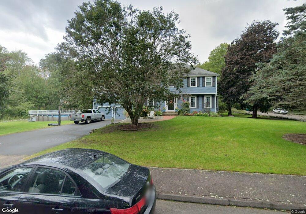
2 Vine Brook Rd Medfield, MA 02052
Estimated Value: $1,063,593 - $1,261,000
4
Beds
3
Baths
2,777
Sq Ft
$428/Sq Ft
Est. Value
About This Home
This home is located at 2 Vine Brook Rd, Medfield, MA 02052 and is currently estimated at $1,188,148, approximately $427 per square foot. 2 Vine Brook Rd is a home located in Norfolk County with nearby schools including Memorial School, Ralph Wheelock School, and Dale Street School.
Ownership History
Date
Name
Owned For
Owner Type
Purchase Details
Closed on
Nov 26, 2008
Sold by
Couture Paul A and Couture Ruth M
Bought by
Tolland Kathleen and Tolland Keith
Current Estimated Value
Home Financials for this Owner
Home Financials are based on the most recent Mortgage that was taken out on this home.
Original Mortgage
$270,000
Interest Rate
6.47%
Mortgage Type
Purchase Money Mortgage
Create a Home Valuation Report for This Property
The Home Valuation Report is an in-depth analysis detailing your home's value as well as a comparison with similar homes in the area
Home Values in the Area
Average Home Value in this Area
Purchase History
| Date | Buyer | Sale Price | Title Company |
|---|---|---|---|
| Tolland Kathleen | $530,000 | -- | |
| Tolland Kathleen | $530,000 | -- |
Source: Public Records
Mortgage History
| Date | Status | Borrower | Loan Amount |
|---|---|---|---|
| Open | Tolland Kathleen | $270,000 | |
| Closed | Tolland Kathleen | $140,000 | |
| Closed | Tolland Kathleen | $274,000 | |
| Closed | Tolland Kathleen | $270,000 |
Source: Public Records
Tax History
| Year | Tax Paid | Tax Assessment Tax Assessment Total Assessment is a certain percentage of the fair market value that is determined by local assessors to be the total taxable value of land and additions on the property. | Land | Improvement |
|---|---|---|---|---|
| 2025 | $12,448 | $902,000 | $468,300 | $433,700 |
| 2024 | $12,103 | $826,700 | $420,000 | $406,700 |
| 2023 | $11,998 | $777,600 | $402,500 | $375,100 |
| 2022 | $11,621 | $667,100 | $385,000 | $282,100 |
| 2021 | $11,585 | $652,300 | $381,500 | $270,800 |
| 2020 | $11,326 | $635,200 | $372,800 | $262,400 |
| 2019 | $11,221 | $627,900 | $362,300 | $265,600 |
| 2018 | $10,431 | $612,500 | $350,000 | $262,500 |
| 2017 | $10,286 | $609,000 | $346,500 | $262,500 |
| 2016 | $10,201 | $609,000 | $346,500 | $262,500 |
| 2015 | $9,255 | $577,000 | $315,800 | $261,200 |
| 2014 | $8,292 | $514,400 | $253,200 | $261,200 |
Source: Public Records
Map
Nearby Homes
- 37 Hatters Hill Rd
- 34 Hatters Hill Rd
- 29 Hatters Hill Rd
- 4 Vine Brook Rd
- 30 Hatters Hill Rd
- 41 Hatters Hill Rd
- 30 Cheney Pond Rd
- 8 Vine Brook Rd
- 25 Hatters Hill Rd
- 26 Hatters Hill Rd
- 26 Cheney Pond Rd
- 31 Cheney Pond Rd
- 10 Willow Cir
- 6 Willow Cir
- 2 Willow Cir
- 22 Hatters Hill Rd
- 27 Cheney Pond Rd
- 21 Hatters Hill Rd
- 22 Cheney Pond Rd
- 23 Cheney Pond Rd
Your Personal Tour Guide
Ask me questions while you tour the home.