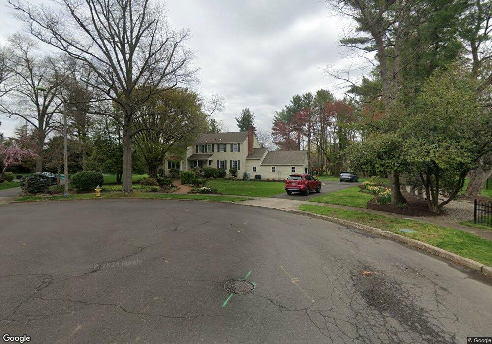
2 Walnut Ct Moorestown, NJ 08057
Estimated Value: $1,224,000 - $1,279,000
5
Beds
3
Baths
3,298
Sq Ft
$378/Sq Ft
Est. Value
About This Home
This home is located at 2 Walnut Ct, Moorestown, NJ 08057 and is currently estimated at $1,247,563, approximately $378 per square foot. 2 Walnut Ct is a home located in Burlington County with nearby schools including George C. Baker Elementary School, Moorestown Upper Elementary School, and William Allen Middle School.
Ownership History
Date
Name
Owned For
Owner Type
Purchase Details
Closed on
Jul 7, 2009
Sold by
Gerry Jean E
Bought by
Carey Timothy M and Carey Alison
Current Estimated Value
Home Financials for this Owner
Home Financials are based on the most recent Mortgage that was taken out on this home.
Original Mortgage
$580,000
Outstanding Balance
$383,705
Interest Rate
5.58%
Mortgage Type
New Conventional
Estimated Equity
$863,858
Create a Home Valuation Report for This Property
The Home Valuation Report is an in-depth analysis detailing your home's value as well as a comparison with similar homes in the area
Home Values in the Area
Average Home Value in this Area
Purchase History
| Date | Buyer | Sale Price | Title Company |
|---|---|---|---|
| Carey Timothy M | $725,000 | First American Title Ins Co |
Source: Public Records
Mortgage History
| Date | Status | Borrower | Loan Amount |
|---|---|---|---|
| Open | Carey Timothy M | $580,000 |
Source: Public Records
Tax History Compared to Growth
Tax History
| Year | Tax Paid | Tax Assessment Tax Assessment Total Assessment is a certain percentage of the fair market value that is determined by local assessors to be the total taxable value of land and additions on the property. | Land | Improvement |
|---|---|---|---|---|
| 2025 | $20,781 | $732,500 | $314,300 | $418,200 |
| 2024 | $19,257 | $732,500 | $314,300 | $418,200 |
| 2023 | $19,742 | $732,500 | $314,300 | $418,200 |
| 2022 | $19,742 | $725,000 | $314,300 | $410,700 |
| 2021 | $20,633 | $767,900 | $0 | $0 |
| 2020 | $20,503 | $767,900 | $0 | $0 |
| 2019 | $18,478 | $800,400 | $314,300 | $486,100 |
| 2018 | $18,256 | $759,100 | $314,300 | $444,800 |
| 2017 | $18,288 | $743,000 | $314,300 | $428,700 |
| 2016 | $18,224 | $743,000 | $314,300 | $428,700 |
| 2015 | $18,004 | $743,000 | $314,300 | $428,700 |
| 2014 | $17,877 | $714,500 | $314,300 | $400,200 |
Source: Public Records
Map
Nearby Homes
- 543 Bethel Ave
- 10 Longwood Ln
- 559 N Church St
- 493 N Church St
- 8 E Oak Ave
- 316 Farmdale Rd
- 803 Fernwood Rd
- 420 Park Blvd
- 739 Lippincott Ave
- 5 Collins Mill Ct
- 8 Collins Mill Ct
- 313 Fairview Ave
- 50 E 3rd St
- 15 E 2nd St
- 80 E 3rd St
- 205 E Central Ave
- 25 Oriole Way
- 133 Plum St Unit 6
- 129 S Church St
- 4 W Close
- 3 Walnut Ct
- 101 W Walnut Ave
- 704 Maple Leaf Ln
- 708 Maple Leaf Ln
- 105 W Walnut Ave
- 26 Middleton Rd
- 30 Middleton Rd
- 4 Walnut Ct
- 700 Maple Leaf Ln
- 712 Maple Leaf Ln
- 109 W Walnut Ave
- 34 Middleton Rd
- 45 W Walnut Ave
- 726 Maple Ct
- 709 Maple Leaf Ln
- 5 Walnut Ct
- 711 Maple Leaf Ln
- 38 Middleton Rd
- 27 Middleton Rd
- 98 W Walnut Ave