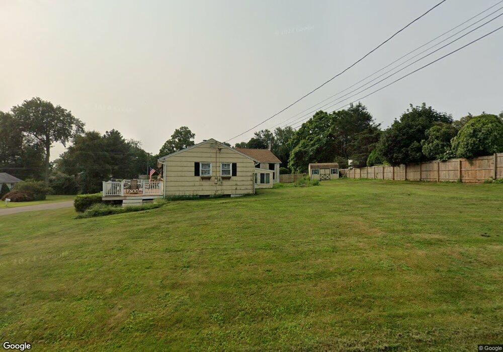
2 Whitewood Rd Clinton, CT 06413
Estimated Value: $375,341 - $504,000
3
Beds
1
Bath
1,456
Sq Ft
$303/Sq Ft
Est. Value
About This Home
This home is located at 2 Whitewood Rd, Clinton, CT 06413 and is currently estimated at $440,835, approximately $302 per square foot. 2 Whitewood Rd is a home located in Middlesex County with nearby schools including Lewin G. Joel Jr. School and The Morgan School.
Ownership History
Date
Name
Owned For
Owner Type
Purchase Details
Closed on
May 13, 2021
Sold by
Cochrane Cindy L
Bought by
Cochrane Matthew J
Current Estimated Value
Purchase Details
Closed on
Sep 1, 1993
Sold by
Mazzabufi Jeffrey M and Mazzabufi Elizabeth
Bought by
Cochrane Matthew J
Purchase Details
Closed on
May 31, 1988
Sold by
Olds William W
Bought by
Mazzabufi Jeffrey W
Create a Home Valuation Report for This Property
The Home Valuation Report is an in-depth analysis detailing your home's value as well as a comparison with similar homes in the area
Home Values in the Area
Average Home Value in this Area
Purchase History
| Date | Buyer | Sale Price | Title Company |
|---|---|---|---|
| Cochrane Matthew J | -- | None Available | |
| Cochrane Matthew J | -- | None Available | |
| Cochrane Matthew J | $120,000 | -- | |
| Cochrane Matthew J | $120,000 | -- | |
| Mazzabufi Jeffrey W | $140,000 | -- |
Source: Public Records
Mortgage History
| Date | Status | Borrower | Loan Amount |
|---|---|---|---|
| Previous Owner | Mazzabufi Jeffrey W | $26,000 | |
| Previous Owner | Mazzabufi Jeffrey W | $15,000 | |
| Previous Owner | Mazzabufi Jeffrey W | $127,900 |
Source: Public Records
Tax History
| Year | Tax Paid | Tax Assessment Tax Assessment Total Assessment is a certain percentage of the fair market value that is determined by local assessors to be the total taxable value of land and additions on the property. | Land | Improvement |
|---|---|---|---|---|
| 2025 | $4,839 | $155,400 | $52,500 | $102,900 |
| 2024 | $4,702 | $155,400 | $52,500 | $102,900 |
| 2023 | $4,636 | $155,400 | $52,500 | $102,900 |
| 2022 | $4,636 | $155,400 | $52,500 | $102,900 |
| 2021 | $4,567 | $153,100 | $57,500 | $95,600 |
| 2020 | $4,784 | $153,100 | $57,500 | $95,600 |
| 2019 | $4,784 | $153,100 | $57,500 | $95,600 |
| 2018 | $4,321 | $141,500 | $57,500 | $84,000 |
| 2017 | $4,232 | $141,500 | $57,500 | $84,000 |
| 2016 | $3,840 | $141,500 | $57,500 | $84,000 |
| 2015 | $3,858 | $144,100 | $60,000 | $84,100 |
| 2014 | $3,786 | $144,100 | $60,000 | $84,100 |
Source: Public Records
Map
Nearby Homes
- 19 Evergreen Dr
- 6 Evergreen Dr
- 50 Jefferson Cir
- 0 Fairy Dell Rd
- 106 Glenwood Rd
- 16 Silverbrook Ln
- 151 E Main St Unit 12
- 0 151 - 153 East Main St Unit 15
- 0 151 - 153 East Main St Unit 14
- 0 151 - 153 East Main St Unit 17
- 0 151 - 153 East Main St Unit 16
- 0 151 - 153 East Main St Unit 18
- 153 E Main St Unit 10
- 153 E Main St Unit 13
- 153 E Main St Unit 31
- 153 E Main St Unit 8
- 153 E Main St Unit 9
- 153 E Main St Unit 6
- 153 E Main St Unit 7
- 153 E Main St Unit 11
- 31 Evergreen Park
- 4 Whitewood Rd
- 10 Evergreen Dr
- 1 Whitewood Rd
- 6 Whitewood Rd
- 8 Evergreen Dr
- 3 Whitewood Rd
- 12 Evergreen Dr
- 21 Evergreen Dr
- 64 Evergreen Park
- 5 Whitewood Rd
- 8 Whitewood Rd
- 13 Evergreen Dr
- 7 Whitewood Rd
- 14 Evergreen Dr
- 9 Tamarack Dr
- 9 Whitewood Rd
- 74 Long Hill Rd
- 11 Tamarack Dr
- 12 Whitewood Rd
Your Personal Tour Guide
Ask me questions while you tour the home.