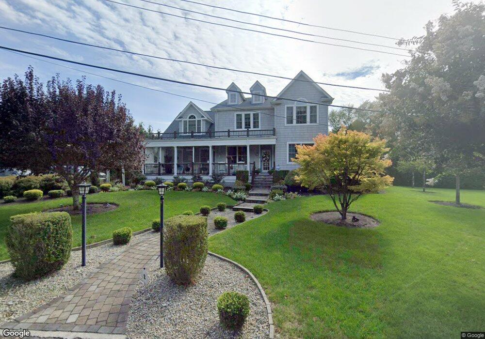
2 Wilson Cir Rumson, NJ 07760
Estimated Value: $2,387,175 - $3,021,000
4
Beds
1
Bath
3,156
Sq Ft
$842/Sq Ft
Est. Value
About This Home
This home is located at 2 Wilson Cir, Rumson, NJ 07760 and is currently estimated at $2,658,544, approximately $842 per square foot. 2 Wilson Cir is a home located in Monmouth County with nearby schools including Deane Porter School, Forrestdale School, and Rumson Fair Haven Regional High School.
Ownership History
Date
Name
Owned For
Owner Type
Purchase Details
Closed on
Oct 19, 2005
Sold by
Throndson Peter
Bought by
Watkins William and Watkins Marilyn
Current Estimated Value
Home Financials for this Owner
Home Financials are based on the most recent Mortgage that was taken out on this home.
Original Mortgage
$1,097,250
Outstanding Balance
$577,643
Interest Rate
5.5%
Mortgage Type
Adjustable Rate Mortgage/ARM
Estimated Equity
$2,080,901
Purchase Details
Closed on
Apr 27, 2004
Sold by
Adams Kimb Erly
Bought by
Throndson Peter and Throndson Kimberly
Home Financials for this Owner
Home Financials are based on the most recent Mortgage that was taken out on this home.
Original Mortgage
$940,500
Interest Rate
6.02%
Purchase Details
Closed on
Sep 11, 1997
Sold by
Shalders Donald
Bought by
Adams Kimberly
Home Financials for this Owner
Home Financials are based on the most recent Mortgage that was taken out on this home.
Original Mortgage
$206,000
Interest Rate
7.48%
Create a Home Valuation Report for This Property
The Home Valuation Report is an in-depth analysis detailing your home's value as well as a comparison with similar homes in the area
Home Values in the Area
Average Home Value in this Area
Purchase History
| Date | Buyer | Sale Price | Title Company |
|---|---|---|---|
| Watkins William | $1,567,500 | -- | |
| Throndson Peter | $710,000 | -- | |
| Adams Kimberly | $257,500 | -- |
Source: Public Records
Mortgage History
| Date | Status | Borrower | Loan Amount |
|---|---|---|---|
| Open | Watkins William | $1,097,250 | |
| Previous Owner | Throndson Peter | $940,500 | |
| Previous Owner | Adams Kimberly | $206,000 |
Source: Public Records
Tax History Compared to Growth
Tax History
| Year | Tax Paid | Tax Assessment Tax Assessment Total Assessment is a certain percentage of the fair market value that is determined by local assessors to be the total taxable value of land and additions on the property. | Land | Improvement |
|---|---|---|---|---|
| 2025 | $20,419 | $1,970,000 | $1,311,300 | $658,700 |
| 2024 | $19,044 | $1,856,300 | $1,243,500 | $612,800 |
| 2023 | $19,044 | $1,629,100 | $1,055,500 | $573,600 |
| 2022 | $18,562 | $1,478,700 | $928,500 | $550,200 |
| 2021 | $18,562 | $1,304,400 | $797,200 | $507,200 |
| 2020 | $17,465 | $1,218,800 | $724,800 | $494,000 |
| 2019 | $13,421 | $913,600 | $529,300 | $384,300 |
| 2018 | $13,363 | $901,700 | $529,300 | $372,400 |
| 2017 | $13,080 | $890,400 | $529,300 | $361,100 |
| 2016 | $13,036 | $909,700 | $529,300 | $380,400 |
| 2015 | $12,968 | $892,500 | $529,300 | $363,200 |
| 2014 | $12,689 | $870,900 | $512,300 | $358,600 |
Source: Public Records
Map
Nearby Homes
- 0 Wilson Cir
- 11 Maplewood Ave
- 41 Forrest Ave
- 33 Lennox Ave
- 84 Bingham Ave
- 17 Bingham Ave
- 24 Bingham Ct
- 11 Bingham Ct
- 26 Bingham Ct
- 5 Bingham Ct
- 22 Rosalie Ave
- 162 E River Rd
- 7 Allen St
- 5 Oakwood Ln
- 17 Bingham Ct
- 137 Bingham Ave
- 143 Bingham Ave
- 69 W River Rd
- 129 Avenue of Two Rivers
- 3 Black Point Horseshoe