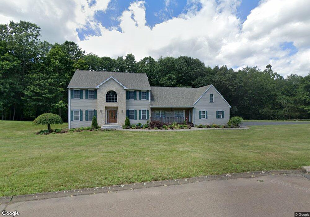
2 Windswept Hill Rd Wallingford, CT 06492
Estimated Value: $735,000 - $898,000
4
Beds
4
Baths
2,948
Sq Ft
$279/Sq Ft
Est. Value
About This Home
This home is located at 2 Windswept Hill Rd, Wallingford, CT 06492 and is currently estimated at $821,044, approximately $278 per square foot. 2 Windswept Hill Rd is a home located in New Haven County with nearby schools including Moses Y Beach Elementary School, Rock Hill Elementary School, and Dag Hammarskjold Middle School.
Ownership History
Date
Name
Owned For
Owner Type
Purchase Details
Closed on
May 9, 1997
Sold by
Bennett John J and Bennett Judith B
Bought by
Doherty Sean P and Doherty Theresa H
Current Estimated Value
Create a Home Valuation Report for This Property
The Home Valuation Report is an in-depth analysis detailing your home's value as well as a comparison with similar homes in the area
Home Values in the Area
Average Home Value in this Area
Purchase History
| Date | Buyer | Sale Price | Title Company |
|---|---|---|---|
| Doherty Sean P | $125,000 | -- | |
| Doherty Sean P | $125,000 | -- |
Source: Public Records
Mortgage History
| Date | Status | Borrower | Loan Amount |
|---|---|---|---|
| Closed | Doherty Sean P | $73,326 | |
| Closed | Doherty Sean P | $140,000 | |
| Closed | Doherty Sean P | $160,000 |
Source: Public Records
Tax History
| Year | Tax Paid | Tax Assessment Tax Assessment Total Assessment is a certain percentage of the fair market value that is determined by local assessors to be the total taxable value of land and additions on the property. | Land | Improvement |
|---|---|---|---|---|
| 2025 | $12,554 | $520,500 | $129,000 | $391,500 |
| 2024 | $10,418 | $339,800 | $107,300 | $232,500 |
| 2023 | $9,970 | $339,800 | $107,300 | $232,500 |
| 2022 | $9,868 | $339,800 | $107,300 | $232,500 |
| 2021 | $9,691 | $339,800 | $107,300 | $232,500 |
| 2020 | $10,438 | $357,600 | $130,500 | $227,100 |
| 2019 | $10,438 | $357,600 | $130,500 | $227,100 |
| 2018 | $10,242 | $357,600 | $130,500 | $227,100 |
| 2017 | $10,209 | $357,600 | $130,500 | $227,100 |
| 2016 | $9,973 | $357,600 | $130,500 | $227,100 |
| 2015 | $10,120 | $368,400 | $130,500 | $237,900 |
| 2014 | $9,906 | $368,400 | $130,500 | $237,900 |
Source: Public Records
Map
Nearby Homes
- 924 E Center St
- 4 Martin Trail
- 27 Tamarac Swamp Rd
- 126 Cooke Rd
- 19 Perkins Dr
- 134 E Main St
- 70 Putter Dr Unit 211
- 16 Putter Dr Unit 207S
- 21 Putter Dr Unit 303S
- 46 Walnut Ln
- 1 Dean Dr
- 229 Woodhouse Ave
- 24 Evergreen Rd
- 101 Grieb Rd
- 58 Grieb Rd
- 39 Farm Hill Rd
- 357 Long Hill Rd
- 16 Marie Ln
- 1877 Middletown Ave
- 2 Twin Pines Dr
- 7 Windswept Hill Rd
- 4 Windswept Hill Rd
- 6 Windswept Hill Rd
- 1260 Scard Rd
- 1270 Scard Rd
- 1282 Scard Rd
- 3 Windswept Hill Rd
- 8 Windswept Hill Rd
- 1286 Scard Rd
- 15 Windswept Hill Rd
- 1290 Scard Rd
- 12 Windswept Hill Rd
- 1287 Scard Rd
- 1238 Scard Rd
- 1308 Scard Rd
- 1307 Scard Rd
- 1285 Scard Rd
- 20 George Washington Trail
- 178 Williams Rd
- 182 Williams Rd
Your Personal Tour Guide
Ask me questions while you tour the home.