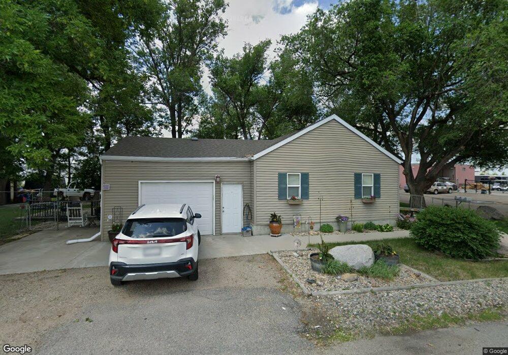
20 10th St E West Fargo, ND 58078
Sommerset NeighborhoodEstimated Value: $185,000
2
Beds
1
Bath
736
Sq Ft
$251/Sq Ft
Est. Value
About This Home
This home is located at 20 10th St E, West Fargo, ND 58078 and is currently estimated at $185,000, approximately $251 per square foot. 20 10th St E is a home located in Cass County with nearby schools including L.E. Berger Elementary School, Cheney Middle School, and West Fargo High School.
Ownership History
Date
Name
Owned For
Owner Type
Purchase Details
Closed on
May 30, 2019
Sold by
Kautzman Shane and Kautzman Elizabeth
Bought by
Haakenson Paulann
Current Estimated Value
Purchase Details
Closed on
Oct 29, 2018
Sold by
Sunde Jackie E and Klodt Dorothy Lucille
Bought by
Sunde Jackie E
Purchase Details
Closed on
Feb 9, 2012
Sold by
Berg Brady
Bought by
Kautzman Shane
Purchase Details
Closed on
Apr 1, 2011
Sold by
Klodt Dorothy
Bought by
Berg Brady
Purchase Details
Closed on
Mar 24, 2011
Sold by
Klodt Dorothy
Bought by
Sunde Jackie and Klodt Dorothy
Create a Home Valuation Report for This Property
The Home Valuation Report is an in-depth analysis detailing your home's value as well as a comparison with similar homes in the area
Home Values in the Area
Average Home Value in this Area
Purchase History
| Date | Buyer | Sale Price | Title Company |
|---|---|---|---|
| Haakenson Paulann | -- | None Available | |
| Kautzman Shane | $59,000 | None Available | |
| Sunde Jackie E | -- | None Available | |
| Kautzman Shane | -- | None Available | |
| Berg Brady | -- | -- | |
| Sunde Jackie | -- | -- |
Source: Public Records
Tax History Compared to Growth
Tax History
| Year | Tax Paid | Tax Assessment Tax Assessment Total Assessment is a certain percentage of the fair market value that is determined by local assessors to be the total taxable value of land and additions on the property. | Land | Improvement |
|---|---|---|---|---|
| 2024 | $1,731 | $60,350 | $14,300 | $46,050 |
| 2023 | $1,742 | $60,450 | $14,300 | $46,150 |
| 2022 | $1,710 | $56,850 | $14,300 | $42,550 |
| 2021 | $1,563 | $49,450 | $10,400 | $39,050 |
| 2020 | $1,542 | $49,350 | $10,400 | $38,950 |
| 2019 | $1,508 | $47,950 | $10,400 | $37,550 |
| 2018 | $1,466 | $47,950 | $10,400 | $37,550 |
| 2017 | $1,216 | $38,950 | $10,400 | $28,550 |
| 2016 | $1,096 | $37,900 | $10,400 | $27,500 |
| 2015 | $1,092 | $34,600 | $4,450 | $30,150 |
| 2014 | $1,036 | $30,800 | $4,450 | $26,350 |
| 2013 | $1,060 | $30,800 | $4,450 | $26,350 |
Source: Public Records
Map
Nearby Homes
- 1332 Sandstone Dr
- 1438 Suntree Dr
- 1059 Sommerset Place
- 426 3rd Ave E
- 1726 2nd Ave E
- 921 Homestead Ct
- 209 1st Ave E
- 78 Evergreen Cir
- 2120 4th Ave E
- 1511 11th Ave E
- 851 12th Ave E
- 2150 2nd Ave E
- 437 10th Ave E
- 924 10th Ave NE
- 52 Pinewood Blvd
- 432 22nd St E
- 670 13th Ave E
- 4836 9th Ave S
- 109 7th Ave E
- 109 5th Ave W