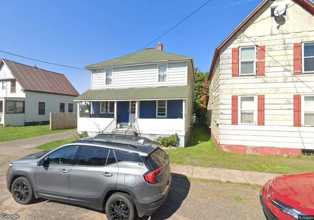
20 1st St South Range, MI 49963
Estimated Value: $93,631 - $166,000
5
Beds
1
Bath
1,680
Sq Ft
$78/Sq Ft
Est. Value
About This Home
This home is located at 20 1st St, South Range, MI 49963 and is currently estimated at $131,408, approximately $78 per square foot. 20 1st St is a home located in Houghton County with nearby schools including South Range Elementary School and Jeffers High School.
Ownership History
Date
Name
Owned For
Owner Type
Purchase Details
Closed on
Jun 2, 2021
Sold by
Melvig Thomas G
Bought by
Robins Teresa J
Current Estimated Value
Home Financials for this Owner
Home Financials are based on the most recent Mortgage that was taken out on this home.
Original Mortgage
$67,750
Outstanding Balance
$61,415
Interest Rate
2.98%
Mortgage Type
Construction
Estimated Equity
$69,993
Purchase Details
Closed on
Apr 29, 2015
Bought by
Melvig Thomas George
Create a Home Valuation Report for This Property
The Home Valuation Report is an in-depth analysis detailing your home's value as well as a comparison with similar homes in the area
Home Values in the Area
Average Home Value in this Area
Purchase History
| Date | Buyer | Sale Price | Title Company |
|---|---|---|---|
| Robins Teresa J | $69,000 | Simplifile Lc E-Recording | |
| Melvig Thomas George | $37,000 | -- |
Source: Public Records
Mortgage History
| Date | Status | Borrower | Loan Amount |
|---|---|---|---|
| Open | Robins Teresa J | $67,750 |
Source: Public Records
Tax History Compared to Growth
Tax History
| Year | Tax Paid | Tax Assessment Tax Assessment Total Assessment is a certain percentage of the fair market value that is determined by local assessors to be the total taxable value of land and additions on the property. | Land | Improvement |
|---|---|---|---|---|
| 2025 | $1,149 | $45,366 | $0 | $0 |
| 2024 | $1,497 | $38,640 | $0 | $0 |
| 2023 | $1,428 | $35,648 | $0 | $0 |
| 2022 | $1,531 | $31,965 | $0 | $0 |
| 2021 | $1,736 | $26,464 | $0 | $0 |
| 2020 | $1,721 | $25,928 | $0 | $0 |
| 2019 | $1,253 | $25,891 | $0 | $0 |
| 2018 | $1,288 | $27,884 | $0 | $0 |
| 2017 | $1,248 | $26,714 | $0 | $0 |
| 2016 | -- | $25,876 | $0 | $0 |
| 2015 | -- | $25,936 | $0 | $0 |
| 2014 | -- | $24,524 | $0 | $0 |
Source: Public Records
Map
Nearby Homes
- TBD Baltic-Onkalo's Corner Rd
- 43997 6th Ave Unit (Trimountain)
- TBD Huron St
- 42936 Superior Rd
- 47302 Janovosky Rd
- 46396 Maple St
- TBD-1 Green Acres Rd
- 2103 Balsam Ln
- TBD-undeveloped Oak Ridge Ln
- 1906 White Oak Ln
- 1905 Poplar Dr
- TBD Razorback Dr Unit Part of Lot 22, Enti
- 1506 Sugar Maple Ln
- 1504 Sugar Maple Ln
- 15710 Coles Creek Rd
- 47663 Main St
- TBD4 Upper Massie Rd
- TBD1 Upper Massie Rd
- 19586 Chassell Painesdale Rd
- 19336 W Edwards Ave