Estimated Value: $81,000 - $162,000
Studio
--
Bath
1,148
Sq Ft
$101/Sq Ft
Est. Value
About This Home
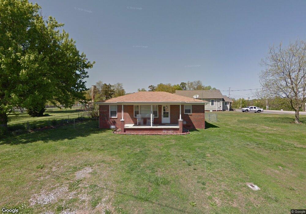
This home is located at 20 2nd St W, Grant, AL 35747 and is currently estimated at $116,455, approximately $101 per square foot. 20 2nd St W is a home located in Marshall County with nearby schools including Kate Duncan Smith DAR Elementary School, Kate Duncan Smith DAR Middle School, and Kate Duncan Smith DAR High School.
Ownership History
Date
Name
Owned For
Owner Type
Purchase Details
Closed on
Feb 15, 2024
Sold by
Scott Chelsea
Bought by
Brandon Maximus
Current Estimated Value
Home Financials for this Owner
Home Financials are based on the most recent Mortgage that was taken out on this home.
Original Mortgage
$103,479
Outstanding Balance
$96,273
Interest Rate
5.76%
Mortgage Type
New Conventional
Estimated Equity
$20,182
Purchase Details
Closed on
May 23, 2011
Sold by
Click William Randall
Bought by
Scott Chelsea
Home Financials for this Owner
Home Financials are based on the most recent Mortgage that was taken out on this home.
Original Mortgage
$53,885
Interest Rate
4.79%
Mortgage Type
New Conventional
Purchase Details
Closed on
Jul 5, 2005
Sold by
Starnes Bobby and Hebron Church Of Christ
Bought by
Click William Randall
Create a Home Valuation Report for This Property
The Home Valuation Report is an in-depth analysis detailing your home's value as well as a comparison with similar homes in the area
Purchase History
| Date | Buyer | Sale Price | Title Company |
|---|---|---|---|
| Brandon Maximus | $92,000 | None Listed On Document | |
| Brandon Maximus | $92,000 | None Listed On Document | |
| Scott Chelsea | $55,500 | None Available | |
| Click William Randall | $5,000 | None Available |
Source: Public Records
Mortgage History
| Date | Status | Borrower | Loan Amount |
|---|---|---|---|
| Open | Brandon Maximus | $103,479 | |
| Closed | Brandon Maximus | $103,479 | |
| Previous Owner | Scott Chelsea | $53,885 |
Source: Public Records
Tax History
| Year | Tax Paid | Tax Assessment Tax Assessment Total Assessment is a certain percentage of the fair market value that is determined by local assessors to be the total taxable value of land and additions on the property. | Land | Improvement |
|---|---|---|---|---|
| 2024 | $372 | $6,860 | $0 | $0 |
| 2023 | $299 | $6,760 | $960 | $5,800 |
| 2022 | $289 | $6,640 | $0 | $0 |
| 2021 | $275 | $6,300 | $0 | $0 |
| 2020 | $231 | $5,260 | $0 | $0 |
| 2017 | $155 | $4,900 | $0 | $0 |
| 2015 | -- | $4,340 | $0 | $0 |
| 2014 | -- | $4,340 | $0 | $0 |
Source: Public Records
Map
Nearby Homes
- 166 3rd Ave W
- 74 3rd Ave W
- 157 Olympia Ln Unit 1
- 157 Olympia Ln
- 28 Echota Ridge
- 145 Vail Dr
- 6 Keystone Trail
- 10 Chera Trail
- 230 Tin Top Rd
- 218 Tin Top Rd
- 210 McPeters Rd
- 247 Raulston Ln
- 172 Epic Way
- 760 Welcome Home Rd
- 52 Jewel Dr
- 733 Campbell Rd
- 4.51 Ester Rd
- 3.12 Ester Rd
- 8500 Simpson Point Rd
- 7905 Simpson Point Rd
- 8 Second St
- 41 1st Ave W
- 8 2nd St E
- 0 Swearengin Rd Unit 547617
- 0 Swearengin Rd Unit 1004333
- 0 Swearengin Rd Unit 1017272
- 0 Swearengin Rd Unit 1113634
- 12 3rd St
- 12 3rd St W
- 42 1st Ave E
- 32 3rd St W
- 400 Wright Ln
- 31 3rd St E
- 16 1st Ave E
- 5720 Main St
- 72 3rd St W
- 2.5 ac Cathedral Caverns Hwy
- 11 Pecan St
- 34 3rd St E
- 11 1st Ave E
Your Personal Tour Guide
Ask me questions while you tour the home.