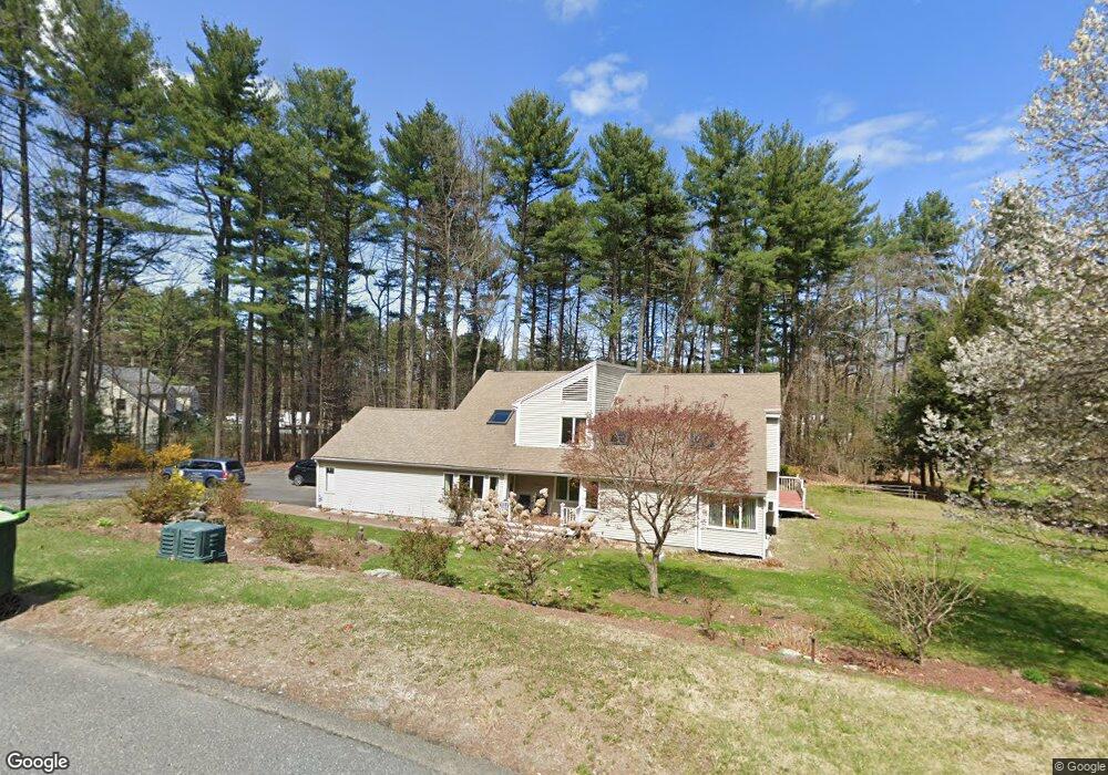
20 Adams Rd Sudbury, MA 01776
Estimated Value: $979,011 - $1,182,000
4
Beds
3
Baths
2,480
Sq Ft
$418/Sq Ft
Est. Value
About This Home
This home is located at 20 Adams Rd, Sudbury, MA 01776 and is currently estimated at $1,037,503, approximately $418 per square foot. 20 Adams Rd is a home located in Middlesex County with nearby schools including Israel Loring Elementary School, Ephraim Curtis Middle School, and Lincoln-Sudbury Regional High School.
Ownership History
Date
Name
Owned For
Owner Type
Purchase Details
Closed on
Jul 31, 2007
Sold by
Verma Surendra P and Verma Vimlesh
Bought by
Verma Surendra P and Verma Pallavi
Current Estimated Value
Home Financials for this Owner
Home Financials are based on the most recent Mortgage that was taken out on this home.
Original Mortgage
$584,000
Outstanding Balance
$368,616
Interest Rate
6.78%
Mortgage Type
Purchase Money Mortgage
Estimated Equity
$668,887
Purchase Details
Closed on
May 6, 2005
Sold by
Verma Surendra P
Bought by
Verma Surendra P and Verma Vimlesh
Create a Home Valuation Report for This Property
The Home Valuation Report is an in-depth analysis detailing your home's value as well as a comparison with similar homes in the area
Home Values in the Area
Average Home Value in this Area
Purchase History
| Date | Buyer | Sale Price | Title Company |
|---|---|---|---|
| Verma Surendra P | -- | -- | |
| Verma Surendra P | -- | -- |
Source: Public Records
Mortgage History
| Date | Status | Borrower | Loan Amount |
|---|---|---|---|
| Open | Verma Surendra P | $584,000 |
Source: Public Records
Tax History Compared to Growth
Tax History
| Year | Tax Paid | Tax Assessment Tax Assessment Total Assessment is a certain percentage of the fair market value that is determined by local assessors to be the total taxable value of land and additions on the property. | Land | Improvement |
|---|---|---|---|---|
| 2025 | $12,242 | $836,200 | $401,200 | $435,000 |
| 2024 | $11,805 | $808,000 | $389,700 | $418,300 |
| 2023 | $11,113 | $704,700 | $361,400 | $343,300 |
| 2022 | $10,971 | $607,800 | $332,200 | $275,600 |
| 2021 | $10,675 | $566,900 | $332,200 | $234,700 |
| 2020 | $10,459 | $566,900 | $332,200 | $234,700 |
| 2019 | $10,153 | $566,900 | $332,200 | $234,700 |
| 2018 | $10,028 | $559,300 | $349,200 | $210,100 |
| 2017 | $9,523 | $536,800 | $345,100 | $191,700 |
| 2016 | $9,217 | $517,800 | $332,200 | $185,600 |
| 2015 | $9,177 | $521,400 | $337,900 | $183,500 |
| 2014 | $9,152 | $507,600 | $328,200 | $179,400 |
Source: Public Records
Map
Nearby Homes
- 7 Adams Rd
- 24 Woodland Rd
- 0 Robbins Rd
- 128 Nobscot Rd
- 54 Stone Rd
- 12 Hickory Rd
- 1011 Boston Post Rd
- 30 Rolling Ln
- 0 Boston Post Rd
- 30 Nobscot Rd Unit 14
- 89 Bridle Path
- 32 Eaton Rd W
- 143 Peakham Rd
- 91 Eaton Rd W
- 19 Nob Hill Dr
- 36 Concord Rd
- 7 Saddle Ridge Rd
- 23 Massasoit Ave
- 270 Old Lancaster Rd
- 6 Mountain View Dr
- 4 Adams Rd
- 615 Boston Post Rd
- 32 Adams Rd
- 25 Adams Rd
- 587 Boston Post Rd
- 15 Adams Rd
- 598 Boston Post Rd
- 96 Dudley Rd
- 30 Adams Rd
- 610 Boston Post Rd
- 92 Dudley Rd
- 621 Boston Post Rd Unit B
- 621 Boston Post Rd
- 89 Dudley Rd
- 577 Boston Post Rd
- 625 Boston Post Rd
- 604 Boston Post Rd
- 616 Boston Post Rd Unit H
- 616 Boston Post Rd Unit E
- 616 Boston Post Rd