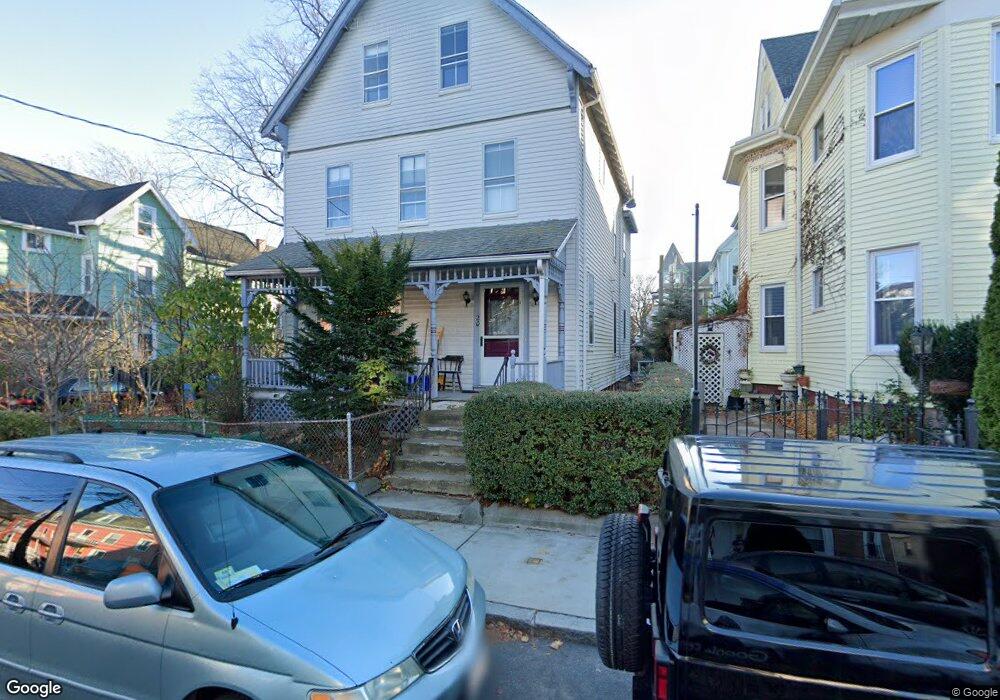
20 Albion St Somerville, MA 02143
Spring Hill NeighborhoodEstimated Value: $897,000 - $1,917,000
4
Beds
2
Baths
1,963
Sq Ft
$675/Sq Ft
Est. Value
About This Home
This home is located at 20 Albion St, Somerville, MA 02143 and is currently estimated at $1,324,751, approximately $674 per square foot. 20 Albion St is a home located in Middlesex County with nearby schools including Somerville High School, Saint Theresa School, and Bright Future Educare Center.
Ownership History
Date
Name
Owned For
Owner Type
Purchase Details
Closed on
Jun 6, 2022
Sold by
Forrest Geoffrey D and Provost Denise M
Bought by
Provost Denise M
Current Estimated Value
Purchase Details
Closed on
Jan 20, 1988
Sold by
Leo Edna
Bought by
Forrest Geoffrey D
Home Financials for this Owner
Home Financials are based on the most recent Mortgage that was taken out on this home.
Original Mortgage
$121,800
Interest Rate
10.64%
Mortgage Type
Purchase Money Mortgage
Create a Home Valuation Report for This Property
The Home Valuation Report is an in-depth analysis detailing your home's value as well as a comparison with similar homes in the area
Home Values in the Area
Average Home Value in this Area
Purchase History
| Date | Buyer | Sale Price | Title Company |
|---|---|---|---|
| Provost Denise M | -- | None Available | |
| Forrest Geoffrey D | $162,500 | -- |
Source: Public Records
Mortgage History
| Date | Status | Borrower | Loan Amount |
|---|---|---|---|
| Previous Owner | Forrest Geoffrey D | $121,800 |
Source: Public Records
Tax History Compared to Growth
Tax History
| Year | Tax Paid | Tax Assessment Tax Assessment Total Assessment is a certain percentage of the fair market value that is determined by local assessors to be the total taxable value of land and additions on the property. | Land | Improvement |
|---|---|---|---|---|
| 2025 | $11,244 | $1,030,600 | $528,200 | $502,400 |
| 2024 | $10,553 | $1,003,100 | $528,200 | $474,900 |
| 2023 | $10,296 | $995,700 | $528,200 | $467,500 |
| 2022 | $9,552 | $938,300 | $503,000 | $435,300 |
| 2021 | $8,994 | $882,600 | $479,000 | $403,600 |
| 2020 | $8,441 | $836,600 | $460,600 | $376,000 |
| 2019 | $8,285 | $770,000 | $400,500 | $369,500 |
| 2018 | $7,822 | $691,600 | $364,200 | $327,400 |
| 2017 | $7,357 | $630,400 | $343,500 | $286,900 |
| 2016 | $7,146 | $570,300 | $314,200 | $256,100 |
Source: Public Records
Map
Nearby Homes
- 15 Albion St
- 105 Central St
- 89 Central St
- 7 Woodbine St
- 144 Highland Ave Unit 1
- 80 Hudson St
- 124 Highland Ave Unit 204
- 124 Highland Ave Unit 404
- 15 Spring Hill Terrace
- 115 Highland Ave Unit 21
- 8 Albion Terrace
- 400 Possum Run
- 60 Avon St
- 125 Lowell St Unit 4C
- 125 Lowell St Unit 203
- 125 Lowell St Unit 5A
- 125 Lowell St Unit 301
- 125 Lowell St Unit 7B
- 125 Lowell St Unit 201
- 125 Lowell St Unit 503
- 22 Albion St
- 24 Albion St
- 17 Hudson St
- 17 Hudson St Unit 2
- 17 Hudson St Unit 2A
- 17 Hudson St Unit 2T
- 17 Hudson St Unit 1
- 14 Albion St
- 19 Hudson St Unit 1
- 19 Hudson St Unit 2
- 19 Hudson St
- 23 Hudson St
- 23 Hudson St Unit 23
- 21 Hudson St
- 26 Albion St
- 15 Hudson St
- 15 Hudson St Unit 3
- 15 Hudson St Unit 1
- 15 Hudson St Unit 2A
- 12 Albion St