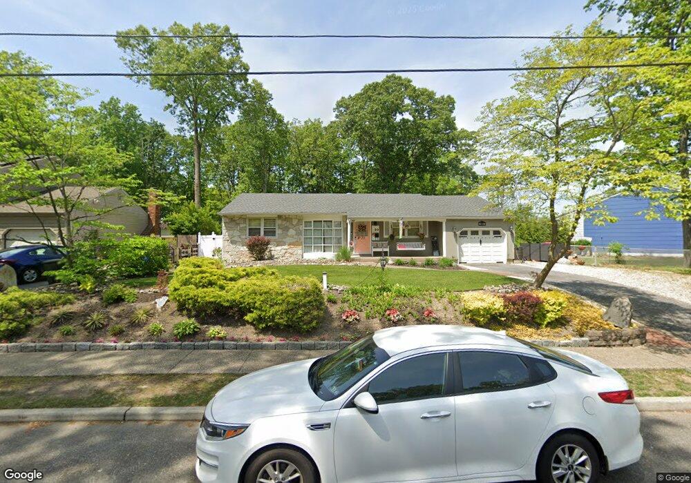
20 Amherst Ct Blackwood, NJ 08012
Washington Township NeighborhoodEstimated Value: $329,502 - $420,000
--
Bed
--
Bath
1,398
Sq Ft
$270/Sq Ft
Est. Value
About This Home
This home is located at 20 Amherst Ct, Blackwood, NJ 08012 and is currently estimated at $377,376, approximately $269 per square foot. 20 Amherst Ct is a home located in Gloucester County with nearby schools including Washington Township High School, Birches Elementary School, and Bunker Hill Middle School.
Ownership History
Date
Name
Owned For
Owner Type
Purchase Details
Closed on
Apr 25, 1994
Sold by
Berry Sharon L
Bought by
Romano Michael J and Romano Carrie A
Current Estimated Value
Home Financials for this Owner
Home Financials are based on the most recent Mortgage that was taken out on this home.
Original Mortgage
$63,000
Interest Rate
7.7%
Create a Home Valuation Report for This Property
The Home Valuation Report is an in-depth analysis detailing your home's value as well as a comparison with similar homes in the area
Home Values in the Area
Average Home Value in this Area
Purchase History
| Date | Buyer | Sale Price | Title Company |
|---|---|---|---|
| Romano Michael J | $103,000 | -- |
Source: Public Records
Mortgage History
| Date | Status | Borrower | Loan Amount |
|---|---|---|---|
| Closed | Romano Michael J | $63,000 |
Source: Public Records
Tax History Compared to Growth
Tax History
| Year | Tax Paid | Tax Assessment Tax Assessment Total Assessment is a certain percentage of the fair market value that is determined by local assessors to be the total taxable value of land and additions on the property. | Land | Improvement |
|---|---|---|---|---|
| 2025 | $8,123 | $219,600 | $61,300 | $158,300 |
| 2024 | $7,895 | $219,600 | $61,300 | $158,300 |
| 2023 | $7,895 | $219,600 | $61,300 | $158,300 |
| 2022 | $7,635 | $219,600 | $61,300 | $158,300 |
| 2021 | $5,309 | $219,600 | $61,300 | $158,300 |
| 2020 | $7,425 | $219,600 | $61,300 | $158,300 |
| 2019 | $6,652 | $182,500 | $37,900 | $144,600 |
| 2018 | $6,577 | $182,500 | $37,900 | $144,600 |
| 2017 | $6,495 | $182,500 | $37,900 | $144,600 |
| 2016 | $6,457 | $182,500 | $37,900 | $144,600 |
| 2015 | $6,366 | $182,500 | $37,900 | $144,600 |
| 2014 | $6,165 | $182,500 | $37,900 | $144,600 |
Source: Public Records
Map
Nearby Homes
- 29 Melony Ln
- 300 Westminster Blvd
- 4 River Birch Rd
- 241 Bells Lake Rd
- 29 Catawba Ave
- 122 Mckinley St
- 93 Claire Ct Unit 3
- 804 Saratoga Terrace
- 137 Alpha Ct
- 10 Birch Grove Ln
- 1706 Franklin Ct
- 8 George Wythe Bldg Unit 8
- 1 Matthew Thornton Bldg
- 22 Woodbrook Rd
- 824 Canal St
- 8 John Hancock Bldg Unit 8
- 7 John Hancock Bldg Unit 7
- 825 Lexington Ave
- 36 Bridge Dr
- 41 Bridge Dr
- 18 Amherst Ct
- 301 Georgetown Rd
- 305 Georgetown Rd
- 16 Amherst Ct
- 407 Westminster Blvd
- 307 Georgetown Rd
- 409 Westminster Blvd
- 207 Georgetown Rd
- 2 Amherst Ct
- 405 Westminster Blvd
- 4 Amherst Ct
- 14 Amherst Ct
- 411 Westminster Blvd
- 401 Georgetown Rd
- 300 Georgetown Rd
- 6 Amherst Ct
- 302 Georgetown Rd
- 403 Westminster Blvd
- 205 Georgetown Rd
- 413 Westminster Blvd