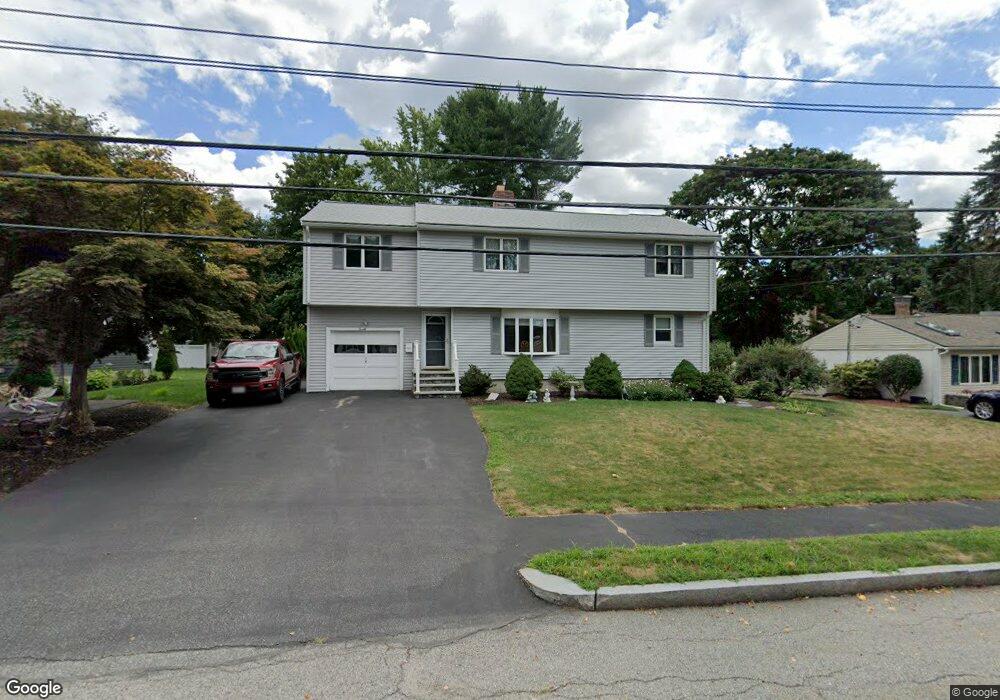
20 Arbor Ln Waltham, MA 02451
North Waltham NeighborhoodEstimated Value: $964,000 - $1,066,000
5
Beds
2
Baths
2,377
Sq Ft
$426/Sq Ft
Est. Value
About This Home
This home is located at 20 Arbor Ln, Waltham, MA 02451 and is currently estimated at $1,012,392, approximately $425 per square foot. 20 Arbor Ln is a home located in Middlesex County with nearby schools including Douglas Macarthur Elementary School, John F Kennedy Middle School, and Waltham Sr High School.
Ownership History
Date
Name
Owned For
Owner Type
Purchase Details
Closed on
Jul 16, 2024
Sold by
Arseneau Gerard J and Marcou-Arseneau Kathryn L
Bought by
20 Arbor Lane Waltham Rt and Arseneau
Current Estimated Value
Purchase Details
Closed on
Aug 1, 1985
Bought by
Arseneau Gerard Joseph and Marcou-Arseneau Kathryn L
Create a Home Valuation Report for This Property
The Home Valuation Report is an in-depth analysis detailing your home's value as well as a comparison with similar homes in the area
Home Values in the Area
Average Home Value in this Area
Purchase History
| Date | Buyer | Sale Price | Title Company |
|---|---|---|---|
| 20 Arbor Lane Waltham Rt | -- | None Available | |
| 20 Arbor Lane Waltham Rt | -- | None Available | |
| Arseneau Gerard Joseph | $110,000 | -- |
Source: Public Records
Mortgage History
| Date | Status | Borrower | Loan Amount |
|---|---|---|---|
| Previous Owner | Arseneau Gerard Joseph | $217,000 | |
| Previous Owner | Arseneau Gerard Joseph | $30,000 |
Source: Public Records
Tax History
| Year | Tax Paid | Tax Assessment Tax Assessment Total Assessment is a certain percentage of the fair market value that is determined by local assessors to be the total taxable value of land and additions on the property. | Land | Improvement |
|---|---|---|---|---|
| 2025 | $7,988 | $813,400 | $440,700 | $372,700 |
| 2024 | $7,623 | $790,800 | $421,200 | $369,600 |
| 2023 | $7,531 | $729,700 | $382,200 | $347,500 |
| 2022 | $7,508 | $674,000 | $343,200 | $330,800 |
| 2021 | $7,473 | $660,200 | $343,200 | $317,000 |
| 2020 | $194 | $611,800 | $319,800 | $292,000 |
| 2019 | $7,064 | $558,000 | $315,900 | $242,100 |
| 2018 | $6,427 | $509,700 | $292,500 | $217,200 |
| 2017 | $7,277 | $482,400 | $265,200 | $217,200 |
| 2016 | $5,714 | $466,800 | $249,600 | $217,200 |
| 2015 | $5,501 | $419,000 | $218,400 | $200,600 |
Source: Public Records
Map
Nearby Homes
- 7 Field Rd
- 542 Concord Ave
- 14 Benjamin Rd
- 89 Hardy Pond Rd
- 44 Lakeview Terrace
- 1105 Lexington St Unit 6-4
- 353 Concord Ave
- 9 April Ln Unit 9
- 86 Indian Rd
- 21 Lakeview Ave
- 203 College Farm Rd
- 28 Hillcrest St
- 22 Fairbanks Rd
- 11 Autumn Ln
- 8 Dobbins St
- 72 Grassland St
- 34 Allen St
- 170 Clocktower Dr Unit 103
- 8 Phinney Rd
- 12 Wellington Lane Ave
Your Personal Tour Guide
Ask me questions while you tour the home.