Estimated Value: $309,761 - $345,000
3
Beds
2
Baths
1,270
Sq Ft
$260/Sq Ft
Est. Value
About This Home
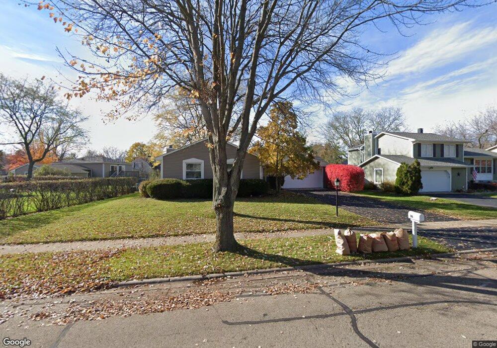
This home is located at 20 Asbury Ln, Cary, IL 60013 and is currently estimated at $330,190, approximately $259 per square foot. 20 Asbury Ln is a home located in McHenry County with nearby schools including Briargate Elementary School, Cary Jr High School, and Cary Grove High School.
Ownership History
Date
Name
Owned For
Owner Type
Purchase Details
Closed on
Apr 7, 2010
Sold by
Frits Jimmy R and Frits Patsy L
Bought by
Frits Patsy L and Frits Jimmy R
Current Estimated Value
Purchase Details
Closed on
Aug 12, 2008
Sold by
Vanerka Mary T
Bought by
Frits Jimmy R and Frits Patsy L
Purchase Details
Closed on
Nov 3, 2005
Sold by
Slack Robert J
Bought by
Vanerka Mary T
Purchase Details
Closed on
Apr 1, 1999
Sold by
Veath Andrew A and Veath Kathryn A
Bought by
Slack Robert J
Home Financials for this Owner
Home Financials are based on the most recent Mortgage that was taken out on this home.
Original Mortgage
$104,000
Interest Rate
6.89%
Purchase Details
Closed on
Oct 1, 1997
Sold by
Veath Andrew A and Veath Kathryn A
Bought by
Veath Andrew A and Veath Kathryn A
Create a Home Valuation Report for This Property
The Home Valuation Report is an in-depth analysis detailing your home's value as well as a comparison with similar homes in the area
Home Values in the Area
Average Home Value in this Area
Purchase History
| Date | Buyer | Sale Price | Title Company |
|---|---|---|---|
| Frits Patsy L | -- | None Available | |
| Frits Jimmy R | $189,000 | Lawyers Title | |
| Vanerka Mary T | $216,500 | Pntn | |
| Slack Robert J | $134,000 | Chicago Title | |
| Veath Andrew A | -- | -- |
Source: Public Records
Mortgage History
| Date | Status | Borrower | Loan Amount |
|---|---|---|---|
| Previous Owner | Slack Robert J | $104,000 |
Source: Public Records
Tax History Compared to Growth
Tax History
| Year | Tax Paid | Tax Assessment Tax Assessment Total Assessment is a certain percentage of the fair market value that is determined by local assessors to be the total taxable value of land and additions on the property. | Land | Improvement |
|---|---|---|---|---|
| 2024 | $6,911 | $82,063 | $22,164 | $59,899 |
| 2023 | $6,794 | $73,395 | $19,823 | $53,572 |
| 2022 | $6,046 | $64,573 | $20,749 | $43,824 |
| 2021 | $5,788 | $60,157 | $19,330 | $40,827 |
| 2020 | $5,630 | $58,028 | $18,646 | $39,382 |
| 2019 | $5,536 | $55,539 | $17,846 | $37,693 |
| 2018 | $5,325 | $52,041 | $16,486 | $35,555 |
| 2017 | $5,247 | $49,026 | $15,531 | $33,495 |
| 2016 | $5,235 | $45,982 | $14,567 | $31,415 |
| 2013 | -- | $35,960 | $13,589 | $22,371 |
Source: Public Records
Map
Nearby Homes
- 2 Daybreak Ridge Trail
- 780 Merrimac St
- 641 Alida Dr
- 368 Copper Canyon Trail
- 413 Haber Rd Unit 5
- 417 Haber Rd Unit 6
- 589 Arthur Dr
- 421 Haber Rd Unit 7
- 763 Blazing Star Trail
- 745 Harper Ave
- 204 Country Commons Rd
- 550 Norman Dr
- 226 Aberdeen Rd
- 888 Blazing Star Trail
- 411 Park Ave
- 60 S Seebert St
- 0 Kaper Dr
- Lots 2,3,4 Northwest Hwy
- 20 Oak Valley Dr Unit 2
- 1108 E Danbury Dr Unit 4D