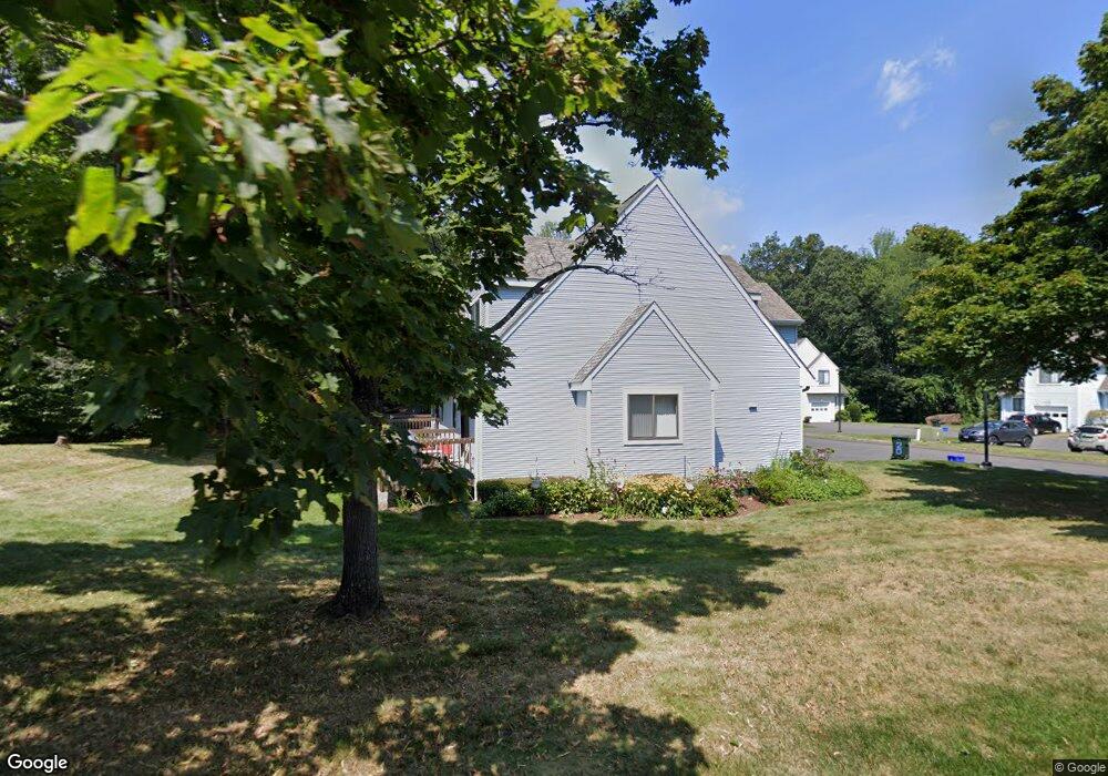
20 Ash Ct Farmington, CT 06032
Estimated Value: $352,000 - $388,000
2
Beds
3
Baths
1,468
Sq Ft
$249/Sq Ft
Est. Value
About This Home
This home is located at 20 Ash Ct, Farmington, CT 06032 and is currently estimated at $365,189, approximately $248 per square foot. 20 Ash Ct is a home located in Hartford County with nearby schools including West Woods Upper Elementary School, Irving A. Robbins Middle School, and Farmington High School.
Ownership History
Date
Name
Owned For
Owner Type
Purchase Details
Closed on
Apr 25, 2018
Sold by
Chung Cheng H and Wu Te C
Bought by
Stawski Frank J and Stawski Marilyn R
Current Estimated Value
Home Financials for this Owner
Home Financials are based on the most recent Mortgage that was taken out on this home.
Original Mortgage
$163,000
Outstanding Balance
$140,177
Interest Rate
4.44%
Mortgage Type
Purchase Money Mortgage
Estimated Equity
$225,012
Purchase Details
Closed on
Dec 16, 2014
Sold by
Kerr Ian and Kerr Rose
Bought by
Chung Cheng-Han and Wu Te-Chia
Purchase Details
Closed on
Dec 13, 2000
Sold by
Demikat Linda A
Bought by
Kerr Ian and Kerr Rose
Purchase Details
Closed on
Sep 29, 1989
Sold by
Murphy Edward J
Bought by
Demikat Linda A
Purchase Details
Closed on
Mar 2, 1987
Sold by
Rwr Meadow Farm Inc
Bought by
Murphy Edward J
Create a Home Valuation Report for This Property
The Home Valuation Report is an in-depth analysis detailing your home's value as well as a comparison with similar homes in the area
Home Values in the Area
Average Home Value in this Area
Purchase History
| Date | Buyer | Sale Price | Title Company |
|---|---|---|---|
| Stawski Frank J | $233,000 | -- | |
| Stawski Frank J | $233,000 | -- | |
| Chung Cheng-Han | $174,000 | -- | |
| Chung Cheng-Han | $174,000 | -- | |
| Kerr Ian | $125,000 | -- | |
| Kerr Ian | $125,000 | -- | |
| Demikat Linda A | $140,000 | -- | |
| Murphy Edward J | $146,120 | -- |
Source: Public Records
Mortgage History
| Date | Status | Borrower | Loan Amount |
|---|---|---|---|
| Open | Stawski Frank J | $163,000 | |
| Closed | Murphy Edward J | $163,000 | |
| Previous Owner | Murphy Edward J | $125,000 |
Source: Public Records
Tax History Compared to Growth
Tax History
| Year | Tax Paid | Tax Assessment Tax Assessment Total Assessment is a certain percentage of the fair market value that is determined by local assessors to be the total taxable value of land and additions on the property. | Land | Improvement |
|---|---|---|---|---|
| 2025 | $4,919 | $184,800 | $0 | $184,800 |
| 2024 | $4,703 | $184,800 | $0 | $184,800 |
| 2023 | $4,474 | $184,800 | $0 | $184,800 |
| 2022 | $4,463 | $152,220 | $0 | $152,220 |
| 2021 | $4,385 | $152,220 | $0 | $152,220 |
| 2020 | $4,258 | $152,220 | $0 | $152,220 |
| 2019 | $4,258 | $152,220 | $0 | $152,220 |
| 2018 | $4,137 | $152,220 | $0 | $152,220 |
| 2017 | $3,842 | $144,020 | $0 | $144,020 |
| 2016 | $3,713 | $144,020 | $0 | $144,020 |
| 2015 | $3,602 | $144,020 | $0 | $144,020 |
| 2014 | $3,463 | $141,680 | $0 | $141,680 |
Source: Public Records
Map
Nearby Homes
- 19 Village View Ln
- 487 Plainville Ave
- 24 Green Woods Ln
- 6 Chaffee Ln
- 61 Litchfield Rd
- 66 E Shore Blvd
- 277 New Britain Ave Unit 277
- 20 Briarwood Rd
- 220 Monce Rd Unit 17
- 171 New Britain Ave
- 55 Depot Place
- 94 Mallard Dr Unit 94
- 14 Inwood Ln
- 796 Plainville Ave
- 18 Greenbriar Dr Unit A
- 77 Vermont Dr
- 26 George Washington Turnpike
- 24 Worthington Dr
- 50 Woodhaven Dr
- 5 Crosswood Rd