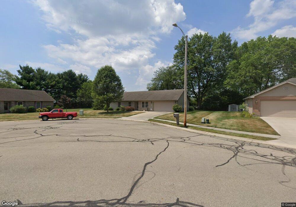
20 Ash Knoll Dr Pleasant Hill, OH 45359
Estimated Value: $184,000 - $279,000
3
Beds
2
Baths
1,572
Sq Ft
$146/Sq Ft
Est. Value
About This Home
This home is located at 20 Ash Knoll Dr, Pleasant Hill, OH 45359 and is currently estimated at $229,574, approximately $146 per square foot. 20 Ash Knoll Dr is a home located in Miami County with nearby schools including Newton Elementary School and Newton High School.
Ownership History
Date
Name
Owned For
Owner Type
Purchase Details
Closed on
May 30, 2023
Sold by
Snead Carol L
Bought by
Snead Family Irrevocable Trust and Griffin
Current Estimated Value
Purchase Details
Closed on
Sep 23, 2015
Sold by
Mcfadden Genevieve P
Bought by
Snead Carol L
Home Financials for this Owner
Home Financials are based on the most recent Mortgage that was taken out on this home.
Original Mortgage
$74,500
Interest Rate
3.93%
Mortgage Type
New Conventional
Purchase Details
Closed on
Jul 6, 2006
Sold by
D S Vance Properties Llc
Bought by
Mcfadden Genevieve P
Purchase Details
Closed on
Nov 30, 2005
Sold by
Vance Dean R and Vance Shirley Alice
Bought by
Ds Vance Properties
Purchase Details
Closed on
Mar 21, 2005
Sold by
The Blair Group Land Co Llc
Bought by
Vance Dean R and Vance Shirley Alice
Create a Home Valuation Report for This Property
The Home Valuation Report is an in-depth analysis detailing your home's value as well as a comparison with similar homes in the area
Home Values in the Area
Average Home Value in this Area
Purchase History
| Date | Buyer | Sale Price | Title Company |
|---|---|---|---|
| Snead Family Irrevocable Trust | -- | None Listed On Document | |
| Snead Carol L | $93,200 | Attorney | |
| Mcfadden Genevieve P | $24,000 | -- | |
| Ds Vance Properties | -- | -- | |
| Vance Dean R | -- | -- |
Source: Public Records
Mortgage History
| Date | Status | Borrower | Loan Amount |
|---|---|---|---|
| Previous Owner | Snead Carol L | $74,500 |
Source: Public Records
Tax History Compared to Growth
Tax History
| Year | Tax Paid | Tax Assessment Tax Assessment Total Assessment is a certain percentage of the fair market value that is determined by local assessors to be the total taxable value of land and additions on the property. | Land | Improvement |
|---|---|---|---|---|
| 2024 | $2,347 | $62,900 | $14,840 | $48,060 |
| 2023 | $2,347 | $62,900 | $14,840 | $48,060 |
| 2022 | $2,058 | $62,900 | $14,840 | $48,060 |
| 2021 | $1,776 | $52,400 | $12,360 | $40,040 |
| 2020 | $1,783 | $52,400 | $12,360 | $40,040 |
| 2019 | $1,671 | $52,400 | $12,360 | $40,040 |
| 2018 | $1,348 | $43,860 | $10,500 | $33,360 |
| 2017 | $1,689 | $43,860 | $10,500 | $33,360 |
| 2016 | $1,669 | $43,860 | $10,500 | $33,360 |
| 2015 | $1,471 | $43,860 | $10,500 | $33,360 |
| 2014 | $1,471 | $43,860 | $10,500 | $33,360 |
| 2013 | $1,485 | $43,860 | $10,500 | $33,360 |
Source: Public Records
Map
Nearby Homes
- 1 N Main St
- 106 W Hill St
- 115 W Hill St
- 120 Pipers Pine Dr
- 120 Piper's Pine Dr
- State Route 48
- 9980 Ohio 718
- 5920 Horseshoe Bend Rd
- 2222 Larkspur Dr
- 2791 Meadowpoint Dr
- 221 Henry Ct
- 219 Henry Ct
- 2620 S Rangeline Rd
- 201 Charles Ct
- 207 Charles Ct
- 200 Charles Ct
- 203 Charles Ct
- 205 Charles Ct
- 202 Charles Ct
- 212 Charles Ct
- 18 Ash Knoll Dr
- 5 Brethren Dr
- 7 Brethren Dr
- 22 Ash Knoll Dr
- 15 Brethren Dr
- 16 Ash Knoll Dr
- 24 Ash Knoll Dr
- 17 Ash Knoll Dr
- 4 Brethren Dr
- 19 Brethren Dr
- 1 Brethren Dr
- 408 E Monument St
- 14 Ash Knoll Dr
- 23 Ash Knoll Dr
- 6 Brethren Dr
- 2 Brethren Dr
- 15 Ash Knoll Dr
- 999 Ash Knoll Dr
- 16 Brethren Dr
- 601 E High St