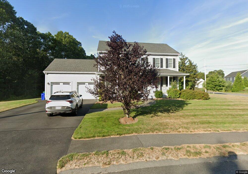
20 Avalon Dr Attleboro, MA 02703
Estimated Value: $762,000 - $824,000
3
Beds
4
Baths
2,184
Sq Ft
$366/Sq Ft
Est. Value
About This Home
This home is located at 20 Avalon Dr, Attleboro, MA 02703 and is currently estimated at $800,192, approximately $366 per square foot. 20 Avalon Dr is a home located in Bristol County with nearby schools including Hyman Fine Elementary School, Wamsutta Middle School, and Attleboro High School.
Ownership History
Date
Name
Owned For
Owner Type
Purchase Details
Closed on
Mar 31, 2016
Sold by
Prudential Builders In
Bought by
Mccreadie 3Rd Edgar B
Current Estimated Value
Home Financials for this Owner
Home Financials are based on the most recent Mortgage that was taken out on this home.
Original Mortgage
$356,000
Outstanding Balance
$282,542
Interest Rate
3.65%
Mortgage Type
New Conventional
Estimated Equity
$517,650
Create a Home Valuation Report for This Property
The Home Valuation Report is an in-depth analysis detailing your home's value as well as a comparison with similar homes in the area
Home Values in the Area
Average Home Value in this Area
Purchase History
| Date | Buyer | Sale Price | Title Company |
|---|---|---|---|
| Mccreadie 3Rd Edgar B | $445,000 | -- |
Source: Public Records
Mortgage History
| Date | Status | Borrower | Loan Amount |
|---|---|---|---|
| Open | Mccreadie 3Rd Edgar B | $356,000 |
Source: Public Records
Tax History Compared to Growth
Tax History
| Year | Tax Paid | Tax Assessment Tax Assessment Total Assessment is a certain percentage of the fair market value that is determined by local assessors to be the total taxable value of land and additions on the property. | Land | Improvement |
|---|---|---|---|---|
| 2025 | $9,144 | $728,600 | $145,300 | $583,300 |
| 2024 | $8,845 | $694,800 | $145,300 | $549,500 |
| 2023 | $7,927 | $579,000 | $132,100 | $446,900 |
| 2022 | $7,505 | $519,400 | $125,900 | $393,500 |
| 2021 | $7,274 | $491,500 | $121,100 | $370,400 |
| 2020 | $6,963 | $478,200 | $117,500 | $360,700 |
| 2019 | $6,793 | $479,700 | $115,300 | $364,400 |
| 2018 | $6,499 | $438,500 | $111,800 | $326,700 |
| 2017 | $6,337 | $435,500 | $111,800 | $323,700 |
| 2016 | $5,515 | $372,100 | $120,100 | $252,000 |
Source: Public Records
Map
Nearby Homes
- 99 Brigham Hill Rd
- 240 Smith St
- 8 Kasmira Way
- 2 Round Farm Rd
- 1 Round Farm Rd
- 48 Round Farm Rd
- 4 Colonial Dr Unit 4
- 14 Tremont St
- 58 Peck St
- 8 Preservation Way
- 730 Pike Ave
- 45 Spruce Ln
- 73 Butterworth Dr
- 127 John Scott Blvd
- 125 John Scott Blvd
- 3 Wilmarth St
- 48 Dean St
- 64 Ridgehill Rd
- 3 Gilberts Way
- 26 Dean St
- 0 Lot B Avalon Dr
- 24 Excalibur Way
- 88 Avalon Dr
- 81 Avalon Dr
- 84 Avalon Dr
- 25 Excalibur Way
- 25 Excalibur Way
- 28 Excalibur Way
- 80 Avalon Dr
- 79 Avalon Dr
- 29 Excalibur Way
- 32 Excalibur Way
- 32 Excalibur Way
- 76 Avalon Dr
- 23 Stockade Cir
- 16 Avalon Dr
- 71 Avalon Dr
- 33 Excalibur Way
- 72 Avalon Dr
- 36 Excalibur Way