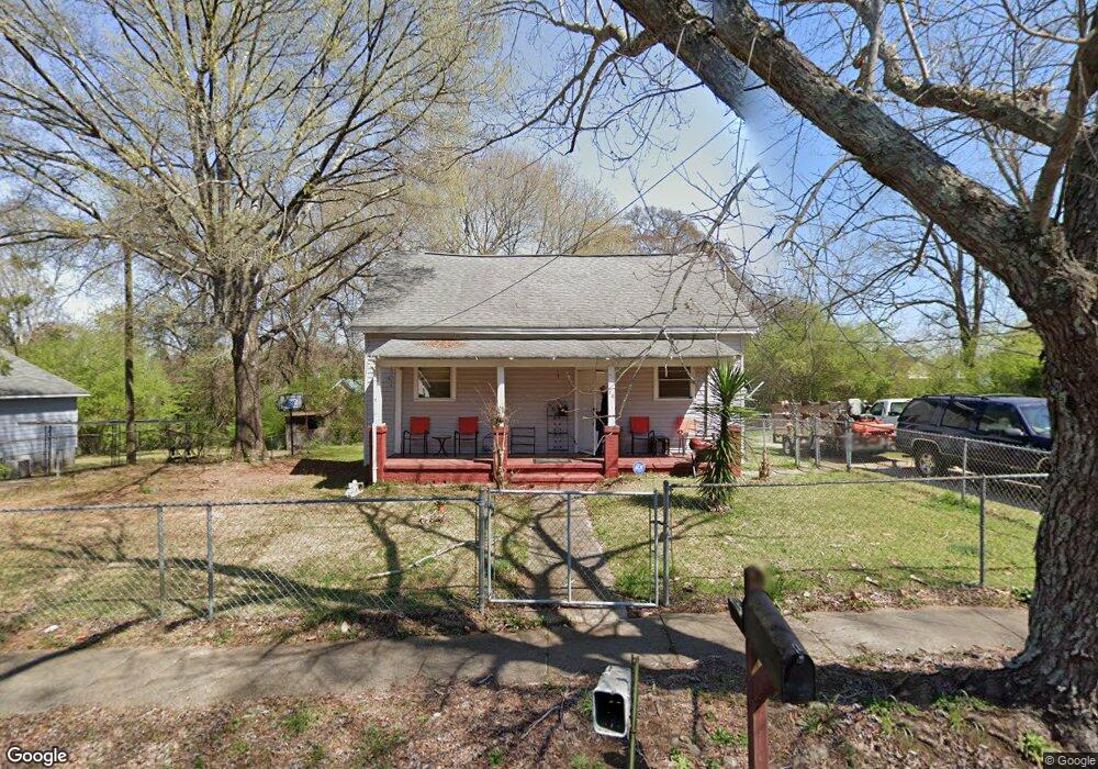
20 Barnard Ave Lagrange, GA 30241
Estimated Value: $115,000 - $184,000
2
Beds
2
Baths
1,408
Sq Ft
$94/Sq Ft
Est. Value
About This Home
This home is located at 20 Barnard Ave, Lagrange, GA 30241 and is currently estimated at $132,990, approximately $94 per square foot. 20 Barnard Ave is a home located in Troup County with nearby schools including Franklin Forest Elementary School, Hollis Hand Elementary School, and Ethel W. Kight Elementary School.
Ownership History
Date
Name
Owned For
Owner Type
Purchase Details
Closed on
May 11, 2004
Sold by
Marie Robert C and Marie Folds
Bought by
Hayes Sabrena D
Current Estimated Value
Purchase Details
Closed on
Apr 30, 1996
Sold by
Steven W Mezick
Bought by
Marie Robert C and Marie Folds
Purchase Details
Closed on
Sep 25, 1980
Sold by
Benny F Bennett
Bought by
Steven W Mezick
Purchase Details
Closed on
Jan 1, 1972
Sold by
Annie H Bennett
Bought by
Benny F Bennett
Purchase Details
Closed on
Sep 1, 1965
Sold by
Dunson Mills
Bought by
Annie H Bennett
Create a Home Valuation Report for This Property
The Home Valuation Report is an in-depth analysis detailing your home's value as well as a comparison with similar homes in the area
Purchase History
| Date | Buyer | Sale Price | Title Company |
|---|---|---|---|
| Hayes Sabrena D | $62,400 | -- | |
| Marie Robert C | $45,000 | -- | |
| Steven W Mezick | $20,000 | -- | |
| Benny F Bennett | $5,000 | -- | |
| Annie H Bennett | -- | -- |
Source: Public Records
Tax History
| Year | Tax Paid | Tax Assessment Tax Assessment Total Assessment is a certain percentage of the fair market value that is determined by local assessors to be the total taxable value of land and additions on the property. | Land | Improvement |
|---|---|---|---|---|
| 2025 | $926 | $37,040 | $5,200 | $31,840 |
| 2024 | $872 | $33,960 | $5,200 | $28,760 |
| 2023 | $255 | $29,240 | $5,200 | $24,040 |
| 2022 | $725 | $27,960 | $5,200 | $22,760 |
| 2021 | $594 | $21,680 | $2,960 | $18,720 |
| 2020 | $594 | $21,680 | $2,960 | $18,720 |
| 2019 | $538 | $19,840 | $2,960 | $16,880 |
| 2018 | $537 | $19,800 | $2,960 | $16,840 |
| 2017 | $537 | $19,800 | $2,960 | $16,840 |
| 2016 | $524 | $19,358 | $2,960 | $16,398 |
| 2015 | $525 | $19,358 | $2,960 | $16,398 |
| 2014 | $500 | $18,495 | $2,960 | $15,535 |
| 2013 | -- | $19,558 | $2,960 | $16,598 |
Source: Public Records
Map
Nearby Homes
- 5 Curran Ave
- 4 1/2 Barnard Ave
- 204 Cleveland Dr
- 212 Cleveland Dr
- 15 Fulton St
- 87 Youngs Mill Rd
- 115 Clara Jean Ct
- 2 Louise St
- 0 N Barnard Ave
- 3 Gulfstream Dr
- 5 Gulfstream Dr
- 110 Lenox Cir
- 107 N Barnard Ave
- 224 Rutland Cir
- 147 Shenandoah Ln
- 146 Shenandoah Ln
- 143 Shenandoah Ln
- 141 Shenandoah Ln
- 139 Shenandoah Ln
- 142 Shenandoah Ln
- 22 Barnard Ave
- 18 Barnard Ave
- 19 Barnard Ave
- 21 1/2 N Barnard Ave
- 21 Barnard Ave
- 24 Barnard Ave
- 16 Barnard Ave
- 23 Barnard Ave
- 17 Barnard Ave
- 17 Thornton St
- 19 Thornton St
- 15 Thornton St
- 15 Barnard Ave
- 26 Barnard Ave
- 21 Thornton St
- 13 Thornton St
- 14 Barnard Ave
- 23 Thornton St
- 28 Barnard Ave
- 14 Thornton St
Your Personal Tour Guide
Ask me questions while you tour the home.