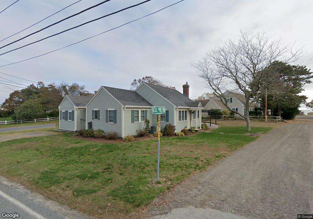
20 Beach Pine Rd Dennis Port, MA 02639
Dennis Port NeighborhoodEstimated Value: $861,777 - $1,033,000
4
Beds
2
Baths
1,302
Sq Ft
$742/Sq Ft
Est. Value
About This Home
This home is located at 20 Beach Pine Rd, Dennis Port, MA 02639 and is currently estimated at $965,944, approximately $741 per square foot. 20 Beach Pine Rd is a home located in Barnstable County with nearby schools including Dennis-Yarmouth Regional High School and St. Pius X. School.
Ownership History
Date
Name
Owned For
Owner Type
Purchase Details
Closed on
Apr 21, 2016
Sold by
Mackinlay Shirley R and Mackinlay William A
Bought by
Mackinlay Rt and Mackinlay
Current Estimated Value
Create a Home Valuation Report for This Property
The Home Valuation Report is an in-depth analysis detailing your home's value as well as a comparison with similar homes in the area
Home Values in the Area
Average Home Value in this Area
Purchase History
| Date | Buyer | Sale Price | Title Company |
|---|---|---|---|
| Mackinlay Rt | -- | -- |
Source: Public Records
Tax History Compared to Growth
Tax History
| Year | Tax Paid | Tax Assessment Tax Assessment Total Assessment is a certain percentage of the fair market value that is determined by local assessors to be the total taxable value of land and additions on the property. | Land | Improvement |
|---|---|---|---|---|
| 2025 | $3,908 | $902,500 | $509,900 | $392,600 |
| 2024 | $3,778 | $860,600 | $490,300 | $370,300 |
| 2023 | $3,446 | $737,900 | $401,200 | $336,700 |
| 2022 | $3,398 | $606,700 | $361,400 | $245,300 |
| 2021 | $3,377 | $560,000 | $354,300 | $205,700 |
| 2020 | $3,299 | $540,900 | $354,300 | $186,600 |
| 2019 | $3,166 | $513,100 | $347,400 | $165,700 |
| 2018 | $3,039 | $479,300 | $330,700 | $148,600 |
| 2017 | $2,901 | $471,700 | $330,700 | $141,000 |
| 2016 | $3,302 | $505,600 | $377,900 | $127,700 |
| 2015 | $3,236 | $505,600 | $377,900 | $127,700 |
| 2014 | $3,144 | $495,100 | $377,900 | $117,200 |
Source: Public Records
Map
Nearby Homes
- 402 Old Wharf Rd
- 402 Old Wharf Rd
- 405 Old Wharf Rd Unit B204
- 405 Old Wharf Rd Unit B204
- 102 Sea St
- 9 Chase Ave Unit 6
- 11 Ocean Park W
- 22 Ferncliff Rd
- 37-A Beach Hills Rd
- 37 Beach Hills Rd
- 262 Old Wharf Rd Unit 67
- 262 Old Wharf Rd Unit 5
- 262 Old Wharf Rd Unit 5
- 262 Old Wharf Rd Unit 20
- 262 Old Wharf Rd Unit 87
- 26 Manning Rd
- 12 Cross St
- 1 E Belmont Unit 630
- 241 Old Wharf Rd Unit 82
- 241 Old Wharf Rd Unit 127