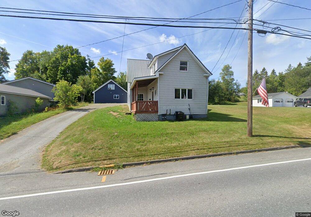
20 Benjamin St Mars Hill, ME 04758
Estimated Value: $80,000
3
Beds
2
Baths
1,700
Sq Ft
$47/Sq Ft
Est. Value
About This Home
This home is located at 20 Benjamin St, Mars Hill, ME 04758 and is currently estimated at $80,000, approximately $47 per square foot. 20 Benjamin St is a home with nearby schools including Fort Street School and Central Aroostook Junior/Senior High School.
Ownership History
Date
Name
Owned For
Owner Type
Purchase Details
Closed on
Sep 5, 2017
Sold by
Martin Michael J and Martin Jan M
Bought by
Blevins Margaret A and Blevins Michael A
Current Estimated Value
Purchase Details
Closed on
May 22, 2006
Sold by
Mckenney David
Bought by
Martin Michael J and Martin Jan M
Create a Home Valuation Report for This Property
The Home Valuation Report is an in-depth analysis detailing your home's value as well as a comparison with similar homes in the area
Purchase History
| Date | Buyer | Sale Price | Title Company |
|---|---|---|---|
| Blevins Margaret A | -- | -- | |
| Blevins Margaret A | -- | -- | |
| Martin Michael J | -- | -- | |
| Martin Michael J | -- | -- | |
| Martin Michael J | -- | -- |
Source: Public Records
Tax History
| Year | Tax Paid | Tax Assessment Tax Assessment Total Assessment is a certain percentage of the fair market value that is determined by local assessors to be the total taxable value of land and additions on the property. | Land | Improvement |
|---|---|---|---|---|
| 2022 | $1,447 | $84,900 | $6,800 | $78,100 |
| 2021 | $1,583 | $84,900 | $6,800 | $78,100 |
| 2020 | $1,571 | $84,900 | $6,800 | $78,100 |
| 2019 | $1,486 | $84,900 | $6,800 | $78,100 |
| 2018 | $1,465 | $84,900 | $6,800 | $78,100 |
| 2017 | $1,465 | $84,900 | $6,800 | $78,100 |
| 2016 | $1,401 | $84,900 | $6,800 | $78,100 |
| 2015 | $1,401 | $84,900 | $6,800 | $78,100 |
| 2014 | $1,102 | $39,700 | $3,600 | $36,100 |
| 2013 | $1,022 | $39,700 | $3,600 | $36,100 |
Source: Public Records
Map
Nearby Homes
- 8 Benjamin St
- 77 Main St
- 11 Gilman St
- 8 Robinson Rd
- 107 Robinson Rd
- 338 Kinney Rd
- 381 Bubar Rd
- Map11 Lot1 High St
- 227 Boundary Line Rd
- 0 Young Lake Rd Unit 1651788
- 676 Houlton Rd
- 296 W Ridge Rd
- 95 Boundary Line Rd
- 228 U S Route 1
- 234 Ladner Rd
- 130 Graham Rd
- 389 Houlton Rd
- 77 Perry Rd
- 83 Center Rd
- 33 Station Rd
Your Personal Tour Guide
Ask me questions while you tour the home.