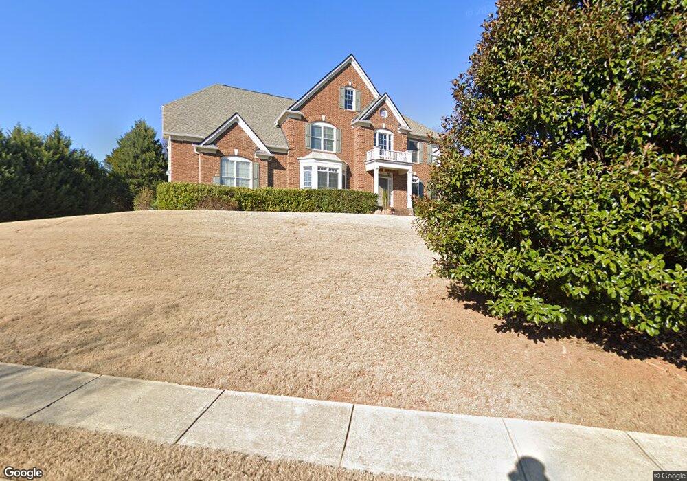
20 Bluestone Ct Acworth, GA 30101
Cedarcrest NeighborhoodEstimated Value: $550,915 - $681,000
5
Beds
5
Baths
3,467
Sq Ft
$183/Sq Ft
Est. Value
About This Home
This home is located at 20 Bluestone Ct, Acworth, GA 30101 and is currently estimated at $633,729, approximately $182 per square foot. 20 Bluestone Ct is a home located in Paulding County with nearby schools including Floyd L. Shelton Elementary School at Crossroad, Sammy Mcclure Sr. Middle School, and North Paulding High School.
Ownership History
Date
Name
Owned For
Owner Type
Purchase Details
Closed on
Sep 24, 2004
Sold by
Sharp Residential Builders & Dev
Bought by
Williams Gerald E and Williams Vicki
Current Estimated Value
Home Financials for this Owner
Home Financials are based on the most recent Mortgage that was taken out on this home.
Original Mortgage
$62,640
Outstanding Balance
$45,673
Interest Rate
5.73%
Mortgage Type
New Conventional
Estimated Equity
$588,056
Purchase Details
Closed on
Mar 25, 2004
Sold by
Temco Associates
Create a Home Valuation Report for This Property
The Home Valuation Report is an in-depth analysis detailing your home's value as well as a comparison with similar homes in the area
Home Values in the Area
Average Home Value in this Area
Purchase History
| Date | Buyer | Sale Price | Title Company |
|---|---|---|---|
| Williams Gerald E | $313,200 | -- | |
| -- | $61,000 | -- |
Source: Public Records
Mortgage History
| Date | Status | Borrower | Loan Amount |
|---|---|---|---|
| Open | Williams Gerald E | $62,640 | |
| Open | Williams Gerald E | $250,560 |
Source: Public Records
Tax History
| Year | Tax Paid | Tax Assessment Tax Assessment Total Assessment is a certain percentage of the fair market value that is determined by local assessors to be the total taxable value of land and additions on the property. | Land | Improvement |
|---|---|---|---|---|
| 2025 | $6,728 | $270,492 | $26,000 | $244,492 |
| 2024 | $5,419 | $217,836 | $26,000 | $191,836 |
| 2023 | $5,831 | $223,652 | $26,000 | $197,652 |
| 2022 | $5,162 | $197,988 | $26,000 | $171,988 |
| 2021 | $4,886 | $168,120 | $26,000 | $142,120 |
| 2020 | $4,620 | $155,564 | $26,000 | $129,564 |
| 2019 | $4,412 | $146,424 | $26,000 | $120,424 |
| 2018 | $4,794 | $159,116 | $26,000 | $133,116 |
| 2017 | $4,607 | $150,796 | $34,000 | $116,796 |
| 2016 | $4,215 | $139,396 | $34,000 | $105,396 |
| 2015 | $4,260 | $138,404 | $34,000 | $104,404 |
| 2014 | $3,492 | $110,632 | $34,000 | $76,632 |
| 2013 | -- | $116,480 | $34,000 | $82,480 |
Source: Public Records
Map
Nearby Homes
- 788 Highcrest Dr
- 123 Candler Loop
- 1022 Carl Sanders Dr
- 260 Carl Sanders Dr
- 300 Carl Sanders Dr
- 954 Carl Sanders Dr
- 341 Carl Sanders Dr
- 28 Vandiver Ct
- 138 Highcrest Dr
- 254 Broadstone Blvd
- 6335 Howell Cobb Ct
- 331 Brisbane Dr
- 39 Telfair Ct
- 202 Vandiver Ct
- 216 Brisbane Dr
- 6225 Arnall Ct NW
- 1276 Rutledge Rd
- 4559 Oglethorpe Loop NW
- 6186 Talmadge Run NW
- 6191 Talmadge Run NW
- 15 Bluestone Ct
- 591 Highcrest Dr
- 38 Bluestone Ct
- 607 Highcrest Dr
- 590 Highcrest Dr
- 554 Highcrest Dr
- 515 Highcrest Dr
- 536 Highcrest Dr
- 606 Highcrest Dr
- 62 Bluestone Ct
- 520 Highcrest Dr
- 53 Bluestone Ct
- 92 Bluestone Ct
- 65 Bluestone Ct
- 499 Highcrest Dr
- 29 Whitehall Ct
- 620 Highcrest Dr
- 11 Whitehall Ct
- 502 Highcrest Dr
- 85 Bluestone Ct