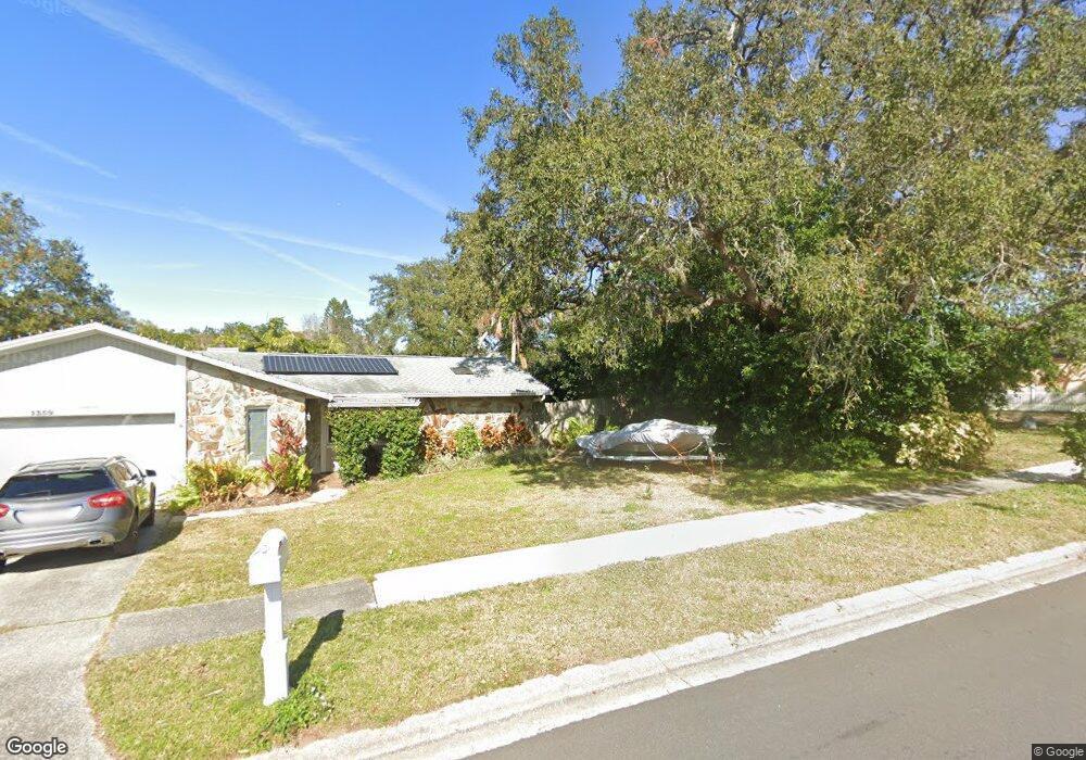
20 Bourne Cir Palm Harbor, FL 34683
Estimated Value: $422,417 - $495,000
Studio
2
Baths
1,728
Sq Ft
$269/Sq Ft
Est. Value
About This Home
This home is located at 20 Bourne Cir, Palm Harbor, FL 34683 and is currently estimated at $465,604, approximately $269 per square foot. 20 Bourne Cir is a home located in Pinellas County with nearby schools including Ozona Elementary School, Palm Harbor Middle School, and Palm Harbor University High.
Ownership History
Date
Name
Owned For
Owner Type
Purchase Details
Closed on
Jan 4, 2001
Sold by
Roy Douglas J
Bought by
Roy Linda E
Current Estimated Value
Home Financials for this Owner
Home Financials are based on the most recent Mortgage that was taken out on this home.
Original Mortgage
$65,780
Outstanding Balance
$23,477
Interest Rate
7.44%
Mortgage Type
New Conventional
Estimated Equity
$442,127
Create a Home Valuation Report for This Property
The Home Valuation Report is an in-depth analysis detailing your home's value as well as a comparison with similar homes in the area
Home Values in the Area
Average Home Value in this Area
Purchase History
| Date | Buyer | Sale Price | Title Company |
|---|---|---|---|
| Roy Linda E | -- | -- |
Source: Public Records
Mortgage History
| Date | Status | Borrower | Loan Amount |
|---|---|---|---|
| Open | Roy Linda E | $25,000 | |
| Open | Roy Linda E | $65,780 | |
| Closed | Roy Linda E | $0 | |
| Closed | Roy Linda E | $25,000 |
Source: Public Records
Tax History
| Year | Tax Paid | Tax Assessment Tax Assessment Total Assessment is a certain percentage of the fair market value that is determined by local assessors to be the total taxable value of land and additions on the property. | Land | Improvement |
|---|---|---|---|---|
| 2025 | $2,005 | $149,297 | -- | -- |
| 2024 | $1,962 | $145,089 | -- | -- |
| 2023 | $1,962 | $140,863 | $0 | $0 |
| 2022 | $1,892 | $136,760 | $0 | $0 |
| 2021 | $1,895 | $132,777 | $0 | $0 |
| 2020 | $1,886 | $130,944 | $0 | $0 |
| 2019 | $1,849 | $128,000 | $0 | $0 |
| 2018 | $1,817 | $125,613 | $0 | $0 |
| 2017 | $1,794 | $123,029 | $0 | $0 |
| 2016 | $1,772 | $120,499 | $0 | $0 |
| 2015 | $1,800 | $119,661 | $0 | $0 |
| 2014 | $1,791 | $118,711 | $0 | $0 |
Source: Public Records
Map
Nearby Homes
- 1412 Wexford Dr N
- 60 Durham Ct
- 1431 Noell Blvd
- 864 Franklin Cir
- 3301 U S 19 Alternate
- 3301 U S 19 Alternate Unit 815
- 3301 Alt 19 Unit 811
- 3301 Alt 19 Unit 266
- 3301 Alt 19 Unit 96
- 3301 Alt 19 Unit 314
- 3301 Alt 19 Unit 162
- 3301 Alt 19 Unit 254
- 3301 Alt 19 Unit 508
- 878 Franklin Square Cir
- 795 County Road 1
- 795 County Road 1 Unit Lot 4
- 795 County Road 1 Unit Lot 50
- 795 County Road 1 Unit Lot 175
- 795 County Road 1 Unit LOT 20
- 795 County Road 1 Unit 129
- 1373 Wexford Dr S
- 1356 Wexford Dr N
- 30 Bourne Cir
- 1387 Wexford Dr S
- 1342 Wexford Dr N
- 1359 Wexford Dr S
- 40 Bourne Cir
- 1417 Wexford Dr S
- 1341 Wexford Dr S Unit 1
- 1341 Wexford Dr S
- 1376 Wexford Dr N
- 70 Regis Cir
- 60 Regis Cir
- 1374 Wexford Dr S
- 100 Durham Ct
- 80 Regis Cir
- 1368 Wexford Dr S
- 1414 Wexford Dr S
- 1358 Wexford Dr S
- 50 Regis Cir
Your Personal Tour Guide
Ask me questions while you tour the home.