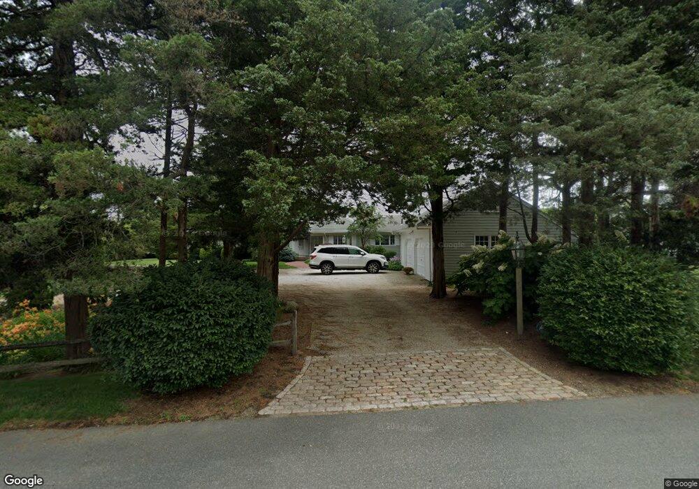
20 Bourne Place South Dartmouth, MA 02748
Cow Yard/Nonquitt NeighborhoodEstimated Value: $2,032,000 - $3,011,000
4
Beds
4
Baths
2,877
Sq Ft
$898/Sq Ft
Est. Value
About This Home
This home is located at 20 Bourne Place, South Dartmouth, MA 02748 and is currently estimated at $2,582,266, approximately $897 per square foot. 20 Bourne Place is a home located in Bristol County with nearby schools including Dartmouth High School.
Ownership History
Date
Name
Owned For
Owner Type
Purchase Details
Closed on
Mar 1, 1999
Sold by
Sullivan Paul D and Sullivan Ulla N
Bought by
Bourne Place Rt
Current Estimated Value
Purchase Details
Closed on
Aug 18, 1995
Sold by
Martin Scott B
Bought by
Sullivan Ulla N and Sullivan Paul D
Home Financials for this Owner
Home Financials are based on the most recent Mortgage that was taken out on this home.
Original Mortgage
$400,000
Interest Rate
7.61%
Mortgage Type
Purchase Money Mortgage
Create a Home Valuation Report for This Property
The Home Valuation Report is an in-depth analysis detailing your home's value as well as a comparison with similar homes in the area
Home Values in the Area
Average Home Value in this Area
Purchase History
| Date | Buyer | Sale Price | Title Company |
|---|---|---|---|
| Bourne Place Rt | $875,000 | -- | |
| Sullivan Ulla N | $675,000 | -- |
Source: Public Records
Mortgage History
| Date | Status | Borrower | Loan Amount |
|---|---|---|---|
| Previous Owner | Sullivan Ulla N | $400,000 |
Source: Public Records
Tax History Compared to Growth
Tax History
| Year | Tax Paid | Tax Assessment Tax Assessment Total Assessment is a certain percentage of the fair market value that is determined by local assessors to be the total taxable value of land and additions on the property. | Land | Improvement |
|---|---|---|---|---|
| 2025 | $17,914 | $2,080,600 | $1,303,000 | $777,600 |
| 2024 | $18,611 | $2,141,600 | $1,402,500 | $739,100 |
| 2023 | $15,328 | $1,671,500 | $989,900 | $681,600 |
| 2022 | $15,628 | $1,578,600 | $989,900 | $588,700 |
| 2021 | $2,036 | $1,594,400 | $1,011,100 | $583,300 |
| 2020 | $17,618 | $1,697,300 | $1,160,600 | $536,700 |
| 2019 | $2,147 | $1,690,700 | $1,160,600 | $530,100 |
| 2018 | $16,983 | $1,679,800 | $1,222,200 | $457,600 |
| 2017 | $15,953 | $1,592,100 | $1,152,100 | $440,000 |
| 2016 | $15,724 | $1,547,600 | $1,111,700 | $435,900 |
| 2015 | $15,075 | $1,486,700 | $1,045,300 | $441,400 |
| 2014 | $14,811 | $1,450,600 | $1,018,500 | $432,100 |
Source: Public Records
Map
Nearby Homes
- 40 School St
- 23 High St
- 738 Smith Neck Rd
- 76 Shipyard Ln
- 48 Wilson St
- 0 Stoneledge Rd
- 00 Prospect St
- 21 Avis St
- 75 Country Way Unit 75
- 105 Rock Odundee Rd
- 248 Bakerville Rd
- 44 Arrowhead Ln
- 212 Rockland St
- 34 Country Way
- 2 Spinnaker Ln
- 360 Russells Mills Rd
- 3 Mishawum Dr
- 5 Samosett Dr
- 59 Hidden Bay Dr
- 24 White Alder Way
- 24 Bourne Place
- 21 Bourne Place
- 21 Bourne Place
- 25 Bourne Place
- 28 Bourne Place
- 16 Bourne Place
- 29 W Smith Neck Rd
- 33 W Smith Neck Rd
- 17A W Smith Neck Rd
- 17 W Smith Neck Rd
- 15 Salt Creek Rd
- 16 Salt Creek Rd
- 50 W Smith Neck Rd
- 11 Salt Creek Rd
- 5 Salt Creek Rd
- 14 Salt Creek Rd
- 966 Smith Neck Rd
- 12 Salt Creek Rd
- 3 Salt Creek Rd
- 2 Salt Creek Rd