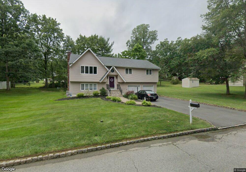
20 Boyd Ln Randolph, NJ 07869
Estimated Value: $601,096 - $820,000
Studio
--
Bath
2,040
Sq Ft
$344/Sq Ft
Est. Value
About This Home
This home is located at 20 Boyd Ln, Randolph, NJ 07869 and is currently estimated at $700,774, approximately $343 per square foot. 20 Boyd Ln is a home located in Morris County with nearby schools including Randolph High School, Randolph Middle School, and Apple Montessori Schools and Camps - Randolph.
Ownership History
Date
Name
Owned For
Owner Type
Purchase Details
Closed on
Nov 18, 1997
Sold by
Grenot Raymond and Grenot Edwina
Bought by
Bello Ruben and Bello Denise
Current Estimated Value
Home Financials for this Owner
Home Financials are based on the most recent Mortgage that was taken out on this home.
Original Mortgage
$208,800
Outstanding Balance
$31,541
Interest Rate
6.37%
Estimated Equity
$669,233
Purchase Details
Closed on
Aug 1, 1996
Sold by
Alaska Seaboard Partners Ltd Partnership
Bought by
Alaska Seaboard Investments Inc
Purchase Details
Closed on
May 23, 1996
Sold by
Ge Capital Asset Management Corp
Bought by
Alaska Seaboard Partners Ltd Partnership
Purchase Details
Closed on
Jan 19, 1995
Sold by
Nigro James and Nigro Susan S
Bought by
Ge Capital Asset Management Corp
Create a Home Valuation Report for This Property
The Home Valuation Report is an in-depth analysis detailing your home's value as well as a comparison with similar homes in the area
Home Values in the Area
Average Home Value in this Area
Purchase History
| Date | Buyer | Sale Price | Title Company |
|---|---|---|---|
| Bello Ruben | $232,000 | -- | |
| Alaska Seaboard Investments Inc | $165,000 | -- | |
| Alaska Seaboard Partners Ltd Partnership | $98,058 | -- | |
| Ge Capital Asset Management Corp | -- | -- |
Source: Public Records
Mortgage History
| Date | Status | Borrower | Loan Amount |
|---|---|---|---|
| Open | Bello Ruben | $208,800 |
Source: Public Records
Tax History
| Year | Tax Paid | Tax Assessment Tax Assessment Total Assessment is a certain percentage of the fair market value that is determined by local assessors to be the total taxable value of land and additions on the property. | Land | Improvement |
|---|---|---|---|---|
| 2025 | $10,577 | $373,600 | $155,600 | $218,000 |
| 2024 | $10,311 | $373,600 | $155,600 | $218,000 |
Source: Public Records
Map
Nearby Homes
- 3 Marble Ln
- 107 High St
- 37 Kearney St
- 10 Dalrymple St
- 19 South St
- 77B Highland Way
- 413 Boulder Ridge Dr Unit 413
- 60 Watson Dr
- 71 Washington Ave Unit 73
- 38 E Dickerson St
- 14 Jessica Ln
- 138 S Salem St
- 7 Jessica Ln
- 5 A&B Dewey St
- 142 W Blackwell St
- 384 Millbrook Ave
- 12 Birch St
- 181 Center Grove Rd
- 343 & 339 Quaker Church Rd
- 42 Everdale Rd
Your Personal Tour Guide
Ask me questions while you tour the home.