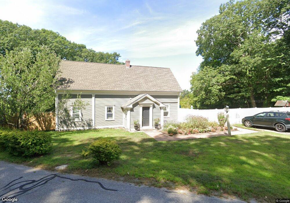
20 Branch Rd Harwinton, CT 06791
Estimated Value: $289,000 - $393,975
4
Beds
3
Baths
1,680
Sq Ft
$211/Sq Ft
Est. Value
About This Home
This home is located at 20 Branch Rd, Harwinton, CT 06791 and is currently estimated at $354,494, approximately $211 per square foot. 20 Branch Rd is a home located in Litchfield County with nearby schools including Harwinton Consolidated School, Har-Bur Middle School, and Lewis S. Mills High School.
Ownership History
Date
Name
Owned For
Owner Type
Purchase Details
Closed on
Jun 27, 2018
Sold by
Criss Nicole L
Bought by
Criss 2Nd Steven G
Current Estimated Value
Home Financials for this Owner
Home Financials are based on the most recent Mortgage that was taken out on this home.
Original Mortgage
$193,325
Outstanding Balance
$167,568
Interest Rate
4.6%
Mortgage Type
New Conventional
Estimated Equity
$186,926
Purchase Details
Closed on
Dec 7, 2000
Sold by
Pont Barbara
Bought by
Criss Steven G
Create a Home Valuation Report for This Property
The Home Valuation Report is an in-depth analysis detailing your home's value as well as a comparison with similar homes in the area
Home Values in the Area
Average Home Value in this Area
Purchase History
| Date | Buyer | Sale Price | Title Company |
|---|---|---|---|
| Criss 2Nd Steven G | -- | -- | |
| Criss 2Nd Steven G | -- | -- | |
| Criss Steven G | $85,000 | -- | |
| Criss Steven G | $85,000 | -- |
Source: Public Records
Mortgage History
| Date | Status | Borrower | Loan Amount |
|---|---|---|---|
| Open | Criss Steven G | $193,325 | |
| Previous Owner | Criss Steven G | $145,000 |
Source: Public Records
Tax History Compared to Growth
Tax History
| Year | Tax Paid | Tax Assessment Tax Assessment Total Assessment is a certain percentage of the fair market value that is determined by local assessors to be the total taxable value of land and additions on the property. | Land | Improvement |
|---|---|---|---|---|
| 2025 | $4,594 | $199,750 | $70,190 | $129,560 |
| 2024 | $4,574 | $199,750 | $70,190 | $129,560 |
| 2023 | $5,279 | $180,790 | $50,130 | $130,660 |
| 2022 | $5,153 | $180,790 | $50,130 | $130,660 |
| 2021 | $5,189 | $180,790 | $50,130 | $130,660 |
| 2020 | $5,062 | $180,790 | $50,130 | $130,660 |
| 2019 | $5,099 | $182,110 | $50,130 | $131,980 |
| 2018 | $3,180 | $113,580 | $63,470 | $50,110 |
| 2017 | $3,158 | $113,580 | $63,470 | $50,110 |
| 2016 | $3,158 | $113,580 | $63,470 | $50,110 |
| 2015 | $3,101 | $113,580 | $63,470 | $50,110 |
| 2014 | $3,055 | $113,580 | $63,470 | $50,110 |
Source: Public Records
Map
Nearby Homes
- 29 Branch Rd
- 172 Pierce St
- 2 Perkins St Unit 14
- 50 King St
- 505 Harwinton Ave Unit 27
- 505 Harwinton Ave Unit 21
- 699 S Main St Unit 323
- 528 Clearview Ave
- 615 S Main St
- 59 Lincoln Ave
- 39 Orchard Hill Rd
- 29 Hannah Way
- 393 S Main St
- 241 Harwinton Ave
- 448 Litchfield Rd
- 37 Linden St
- 71 Tognalli Dr
- 119 Tognalli Dr
- 84 Wilmot St
- 184 Harwinton Ave
- 27 Branch Rd
- 25 Branch Rd
- 16 Branch Rd
- 268 Scoville Hill Rd
- 274 Scoville Hill Rd
- 284 Scoville Hill Rd
- 288 Scoville Hill Rd
- 294 Scoville Hill Rd
- 269 Scoville Hill Rd
- 279 Scoville Hill Rd
- 76 Upper Bogue Rd
- 285 Scoville Hill Rd
- 292 Scoville Hill Rd
- 15 Norton Passway
- 296 Scoville Hill Rd
- 260 Scoville Hill Rd
- 22 Norton Passway
- 293 Scoville Hill Rd
- 300 Scoville Hill Rd
- 21 Norton Passway