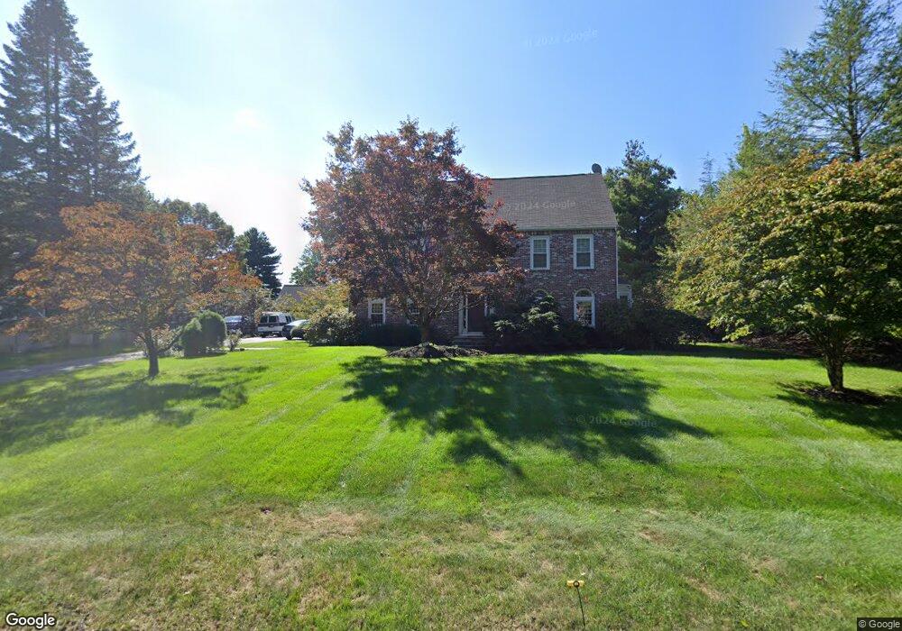
20 Bridle Path Westwood, MA 02090
Estimated Value: $1,707,000 - $2,025,000
4
Beds
4
Baths
3,741
Sq Ft
$495/Sq Ft
Est. Value
About This Home
This home is located at 20 Bridle Path, Westwood, MA 02090 and is currently estimated at $1,852,824, approximately $495 per square foot. 20 Bridle Path is a home located in Norfolk County with nearby schools including Westwood High School, St Catherine Of Siena School, and Xaverian Brothers High School.
Ownership History
Date
Name
Owned For
Owner Type
Purchase Details
Closed on
Nov 30, 2010
Sold by
Rasky Lawrence B and Rasky Carolyn
Bought by
Nassif Fayez G
Current Estimated Value
Home Financials for this Owner
Home Financials are based on the most recent Mortgage that was taken out on this home.
Original Mortgage
$625,000
Outstanding Balance
$413,555
Interest Rate
4.25%
Mortgage Type
Purchase Money Mortgage
Estimated Equity
$1,439,269
Purchase Details
Closed on
Aug 1, 1995
Sold by
Mccarthy Ronald C and Mccarthy Susan P
Bought by
Rasky Lawrence B and Rasky Carolyn
Purchase Details
Closed on
Dec 15, 1987
Sold by
Gurney Charles R
Bought by
Mccarthy Ronald C
Create a Home Valuation Report for This Property
The Home Valuation Report is an in-depth analysis detailing your home's value as well as a comparison with similar homes in the area
Home Values in the Area
Average Home Value in this Area
Purchase History
| Date | Buyer | Sale Price | Title Company |
|---|---|---|---|
| Nassif Fayez G | $925,000 | -- | |
| Rasky Lawrence B | $535,000 | -- | |
| Mccarthy Ronald C | $500,000 | -- |
Source: Public Records
Mortgage History
| Date | Status | Borrower | Loan Amount |
|---|---|---|---|
| Open | Nassif Fayez G | $625,000 | |
| Previous Owner | Mccarthy Ronald C | $200,000 | |
| Previous Owner | Mccarthy Ronald C | $445,000 |
Source: Public Records
Tax History Compared to Growth
Tax History
| Year | Tax Paid | Tax Assessment Tax Assessment Total Assessment is a certain percentage of the fair market value that is determined by local assessors to be the total taxable value of land and additions on the property. | Land | Improvement |
|---|---|---|---|---|
| 2025 | $18,990 | $1,482,400 | $546,000 | $936,400 |
| 2024 | $18,990 | $1,482,400 | $546,000 | $936,400 |
| 2023 | $16,545 | $1,157,000 | $452,900 | $704,100 |
| 2022 | $15,846 | $1,068,500 | $400,400 | $668,100 |
| 2021 | $15,866 | $1,073,450 | $381,300 | $692,150 |
| 2020 | $15,402 | $1,061,450 | $381,300 | $680,150 |
| 2019 | $14,809 | $1,010,850 | $363,150 | $647,700 |
| 2018 | $14,389 | $953,550 | $339,150 | $614,400 |
| 2017 | $13,941 | $956,850 | $339,150 | $617,700 |
| 2016 | $13,518 | $922,100 | $339,150 | $582,950 |
| 2015 | $12,706 | $833,700 | $339,150 | $494,550 |
Source: Public Records
Map
Nearby Homes
- 216 Clapboardtree St
- 86 Lakeshore Dr
- 20 Lakeshore Dr
- 49 Fisher St
- 35 Whitney Ave
- 300 Nahatan St
- 618 Nahatan St
- 17 Royal Ct
- 162 Mayfair Dr
- 131 Bay Colony Dr
- 37 Silver St
- 470 Nahatan St
- 147 Mill St
- 60 Warwick Dr
- 115 Lincoln St
- 36 Kingswood Rd
- 303 Oak St
- 60 Florence Ave Unit A
- 144 Fensview Dr
- 42 Myrtle St
- 26 Bridle Path
- 8 Bridle Path
- 14 Bridle Path
- 34 Bridle Path
- 19 Bridle Path
- 7 Bridle Path
- 41 Martingale Ln
- 33 Bridle Path
- 86 Clapboardtree St
- 40 Martingale Ln
- 15 Bridle Path
- 99 Clapboardtree St
- 42 Bridle Path
- 25 Bridle Path
- 41 Bridle Path
- 37 Martingale Ln
- 115 Clapboardtree St
- 36 Martingale Ln
- 131 Clapboardtree St
- 22 Winter St