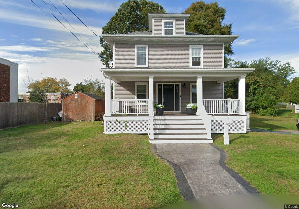
20 Brookfield Rd Riverside, RI 02915
Kent Heights NeighborhoodEstimated Value: $449,000 - $503,000
3
Beds
2
Baths
1,746
Sq Ft
$278/Sq Ft
Est. Value
About This Home
This home is located at 20 Brookfield Rd, Riverside, RI 02915 and is currently estimated at $484,526, approximately $277 per square foot. 20 Brookfield Rd is a home located in Providence County with nearby schools including East Providence High School, St Mary Academy-Bay View, and The Gordon School.
Ownership History
Date
Name
Owned For
Owner Type
Purchase Details
Closed on
Nov 3, 2003
Sold by
Barbato Barbara Est and Barbato
Bought by
Mello Peter and Mello Jacqueline
Current Estimated Value
Home Financials for this Owner
Home Financials are based on the most recent Mortgage that was taken out on this home.
Original Mortgage
$210,000
Outstanding Balance
$96,921
Interest Rate
6.05%
Mortgage Type
Purchase Money Mortgage
Estimated Equity
$387,605
Create a Home Valuation Report for This Property
The Home Valuation Report is an in-depth analysis detailing your home's value as well as a comparison with similar homes in the area
Home Values in the Area
Average Home Value in this Area
Purchase History
| Date | Buyer | Sale Price | Title Company |
|---|---|---|---|
| Mello Peter | $210,000 | -- | |
| Mello Peter | $210,000 | -- |
Source: Public Records
Mortgage History
| Date | Status | Borrower | Loan Amount |
|---|---|---|---|
| Open | Mello Peter | $30,000 | |
| Open | Mello Peter | $50,000 | |
| Open | Mello Peter | $210,000 | |
| Closed | Mello Peter | $210,000 |
Source: Public Records
Tax History
| Year | Tax Paid | Tax Assessment Tax Assessment Total Assessment is a certain percentage of the fair market value that is determined by local assessors to be the total taxable value of land and additions on the property. | Land | Improvement |
|---|---|---|---|---|
| 2025 | $5,938 | $454,300 | $162,100 | $292,200 |
| 2024 | $5,402 | $352,400 | $135,100 | $217,300 |
| 2023 | $5,201 | $352,400 | $135,100 | $217,300 |
| 2022 | $4,403 | $201,400 | $43,600 | $157,800 |
| 2021 | $4,382 | $203,800 | $43,100 | $160,700 |
| 2020 | $4,196 | $203,800 | $43,100 | $160,700 |
| 2019 | $4,080 | $203,800 | $43,100 | $160,700 |
| 2018 | $3,510 | $153,400 | $33,400 | $120,000 |
| 2017 | $3,432 | $153,400 | $33,400 | $120,000 |
| 2016 | $3,415 | $153,400 | $33,400 | $120,000 |
| 2015 | $3,479 | $151,600 | $30,900 | $120,700 |
| 2014 | $3,479 | $151,600 | $30,900 | $120,700 |
Source: Public Records
Map
Nearby Homes
- 2941 Pawtucket Ave
- 14 Waterview Ave Unit 16
- 53 Wampanoag Trail
- 50 Kettle Point Ave Unit 50
- 34 Commack Rd
- 6 Fuller Ave
- 106 Wannamoisett Rd
- 25 Bullocks Point Ave Unit 5C
- 33 Bullocks Point Ave Unit 5C
- 43 Bullocks Point Ave Unit 4A
- 29 Ide Ave
- 74 Brookhaven Dr
- 151 Willett Ave Unit 2
- 151 Dover Ave
- 25 Arnold St
- 26 Callender Ave
- 158 S Rose St
- 191 S Spruce St
- 28 Jefferson Ave
- 103 Burnside Ave
- 26 Brookfield Rd
- 19 Brookfield Rd
- 15 Brookfield Rd
- 35 Brookfield Rd
- 36 Brookfield Rd Unit 38
- 13 Brookfield Rd
- 40 Brookfield Rd
- 45 Brookfield Rd
- 3062 Pawtucket Ave
- 50 Brookfield Rd
- 3040-3048 Pawtucket Ave
- 53 Brookfield Rd
- 35 Merritt Rd
- 41 Merritt Rd
- 29 Merritt Rd
- 47 Merritt Rd
- 3051 Pawtucket Ave
- 23 Merritt Rd
- 3051 Pawtucket Ave
- 19 Merritt Rd
Your Personal Tour Guide
Ask me questions while you tour the home.