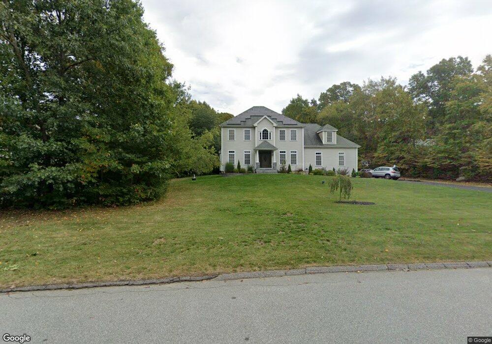
20 Brookstone Dr Colchester, CT 06415
Estimated Value: $709,602 - $888,000
3
Beds
3
Baths
3,492
Sq Ft
$224/Sq Ft
Est. Value
About This Home
This home is located at 20 Brookstone Dr, Colchester, CT 06415 and is currently estimated at $780,651, approximately $223 per square foot. 20 Brookstone Dr is a home located in New London County with nearby schools including Colchester Elementary School, Jack Jackter Intermediate School, and William J. Johnston Middle School.
Ownership History
Date
Name
Owned For
Owner Type
Purchase Details
Closed on
Oct 1, 2010
Sold by
James Marino Jr Comt L
Bought by
Patel Manisha and Patel Jignesh
Current Estimated Value
Home Financials for this Owner
Home Financials are based on the most recent Mortgage that was taken out on this home.
Original Mortgage
$280,000
Outstanding Balance
$169,196
Interest Rate
2.75%
Mortgage Type
Adjustable Rate Mortgage/ARM
Estimated Equity
$611,455
Create a Home Valuation Report for This Property
The Home Valuation Report is an in-depth analysis detailing your home's value as well as a comparison with similar homes in the area
Home Values in the Area
Average Home Value in this Area
Purchase History
| Date | Buyer | Sale Price | Title Company |
|---|---|---|---|
| Patel Manisha | $420,000 | -- |
Source: Public Records
Mortgage History
| Date | Status | Borrower | Loan Amount |
|---|---|---|---|
| Open | Patel Manisha | $280,000 |
Source: Public Records
Tax History
| Year | Tax Paid | Tax Assessment Tax Assessment Total Assessment is a certain percentage of the fair market value that is determined by local assessors to be the total taxable value of land and additions on the property. | Land | Improvement |
|---|---|---|---|---|
| 2025 | $11,352 | $379,400 | $58,800 | $320,600 |
| 2024 | $10,877 | $379,400 | $58,800 | $320,600 |
| 2023 | $10,246 | $376,400 | $58,800 | $317,600 |
| 2022 | $10,193 | $376,400 | $58,800 | $317,600 |
| 2021 | $10,125 | $308,300 | $58,300 | $250,000 |
| 2020 | $10,125 | $308,300 | $58,300 | $250,000 |
| 2019 | $10,125 | $308,300 | $58,300 | $250,000 |
| 2018 | $9,400 | $291,200 | $58,300 | $232,900 |
| 2017 | $9,426 | $291,200 | $58,300 | $232,900 |
| 2016 | $9,091 | $294,100 | $75,100 | $219,000 |
| 2015 | $9,047 | $294,100 | $75,100 | $219,000 |
| 2014 | $8,991 | $294,100 | $75,100 | $219,000 |
Source: Public Records
Map
Nearby Homes
- 6 Taylor Rd
- 8 Taylor Rd
- 10 Taylor Rd
- 1 Taylor Rd
- 3 Taylor Rd
- Lot #2 Taylor Rd
- 7 Taylor Rd
- 9 Taylor Rd
- 63 Taylor Rd
- 86 Hi Lea Farm Rd
- 23 Olmstead Rd
- 145 Lakeview Dr
- 0 Prospect Hill Rd
- 18 Quail Rd
- 6 Westchester Hills Unit G
- 7 Westchester Hills Unit D
- 11 Lookout Dr
- 124 James St
- 190 Waterhole Rd
- 538 Old Hartford Rd
- 24 Brookstone Dr
- 12 Brookstone Dr
- 12 Brookstone Dr(lot 2)
- lot 24 Brookstone Dr
- 24 Brookstone Dr(lot 4)
- 25 Brookstone Dr
- 13 Brookstone Dr
- 32 Brookstone Dr
- 14 Brookstone Dr
- 8 Brookstone Dr
- 32 Brookstone Dr (Lot 5)
- 9 Brookstone Dr
- 27 Brookstone Dr
- 10 Brookstone Dr
- LOT 3 Brookstone Dr
- lot 2 Brookstone Dr
- LOT 21 Brookstone Dr
- Lot 9 Brookstone Dr
- 40 Brookstone Dr
- 15 Brookstone Dr
Your Personal Tour Guide
Ask me questions while you tour the home.