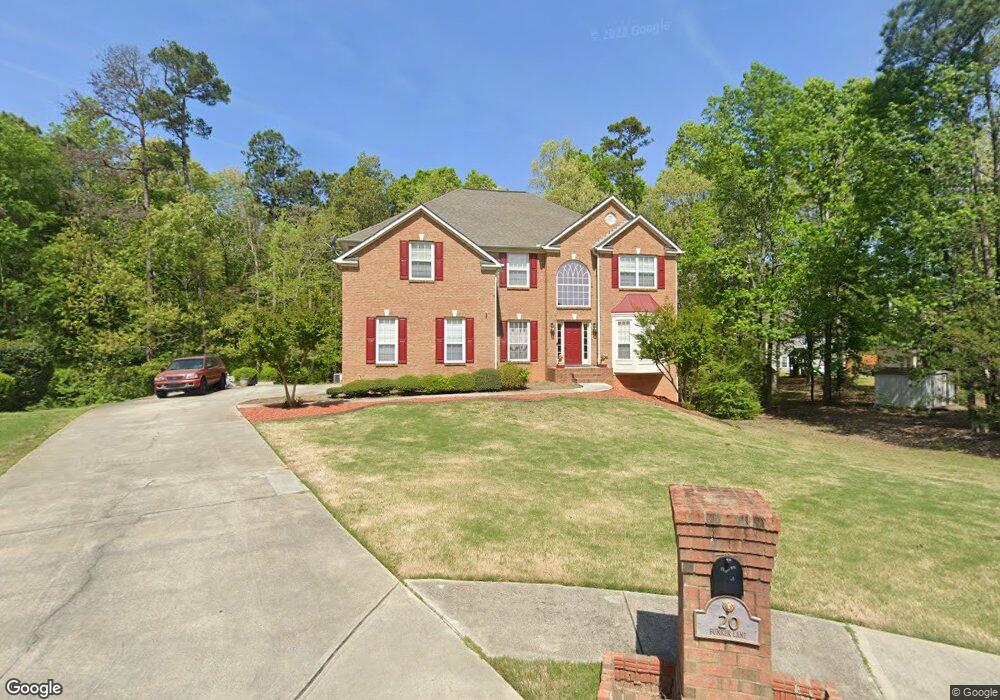
20 Bunker Ln Covington, GA 30014
Estimated Value: $356,363 - $412,000
--
Bed
2
Baths
3,083
Sq Ft
$127/Sq Ft
Est. Value
About This Home
This home is located at 20 Bunker Ln, Covington, GA 30014 and is currently estimated at $391,841, approximately $127 per square foot. 20 Bunker Ln is a home located in Newton County with nearby schools including East Newton Elementary School, Cousins Middle School, and Eastside High School.
Ownership History
Date
Name
Owned For
Owner Type
Purchase Details
Closed on
Jun 14, 2006
Sold by
Nooks Mark P
Bought by
Nooks Mark P and Nooks Catina D
Current Estimated Value
Purchase Details
Closed on
Dec 29, 2003
Sold by
The Ryland Grp Inc
Bought by
Nooks Mark P
Home Financials for this Owner
Home Financials are based on the most recent Mortgage that was taken out on this home.
Original Mortgage
$209,400
Interest Rate
4.63%
Mortgage Type
New Conventional
Create a Home Valuation Report for This Property
The Home Valuation Report is an in-depth analysis detailing your home's value as well as a comparison with similar homes in the area
Home Values in the Area
Average Home Value in this Area
Purchase History
| Date | Buyer | Sale Price | Title Company |
|---|---|---|---|
| Nooks Mark P | -- | -- | |
| Nooks Mark P | $261,800 | -- |
Source: Public Records
Mortgage History
| Date | Status | Borrower | Loan Amount |
|---|---|---|---|
| Previous Owner | Nooks Mark P | $209,400 |
Source: Public Records
Tax History Compared to Growth
Tax History
| Year | Tax Paid | Tax Assessment Tax Assessment Total Assessment is a certain percentage of the fair market value that is determined by local assessors to be the total taxable value of land and additions on the property. | Land | Improvement |
|---|---|---|---|---|
| 2024 | $3,566 | $142,040 | $22,400 | $119,640 |
| 2023 | $3,831 | $142,640 | $13,200 | $129,440 |
| 2022 | $3,194 | $119,160 | $13,200 | $105,960 |
| 2021 | $3,583 | $119,880 | $13,200 | $106,680 |
| 2020 | $3,577 | $109,320 | $13,200 | $96,120 |
| 2019 | $3,607 | $108,600 | $13,200 | $95,400 |
| 2018 | $3,414 | $102,320 | $13,200 | $89,120 |
| 2017 | $2,807 | $84,640 | $13,200 | $71,440 |
| 2016 | $2,380 | $72,200 | $10,000 | $62,200 |
| 2015 | $2,245 | $67,440 | $10,000 | $57,440 |
| 2014 | $2,043 | $61,720 | $0 | $0 |
Source: Public Records
Map
Nearby Homes
- 8 Jackson Rd
- 130 S Links Dr
- 10184 Malcolm Dr
- 75 Woodfield Rd
- 10155 Malcolm Dr
- 10110 Malcolm Ct
- 13262 Tolstoy Dr
- 72 Woodfield Rd
- 8193 Monticello St
- 7703 Fawn Cir
- 7762 Fawn Cir
- 345 River Walk Farm Unit LOT 5
- 330 River Walk Farm
- 210 Kestrel Cir
- 323 River Walk Farm
- 338 River Walk Farm
- 344 River Walk Farm
- 240 Kestrel Cir
- 10717 Georgia 36
- 9176 Carr Cir SW
- 255 Fairway Trail
- 30 Bunker Ln
- 265 Fairway Trail
- 35 Bunker Ln
- 15 Bunker Ln
- 25 Bunker Ln
- 230 Fairway Trail
- 240 Fairway Trail
- 225 Fairway Trail
- 220 Fairway Trail
- 45 Hummingbird Ln
- 250 Fairway Trail
- 210 Fairway Trail
- 200 Fairway Trl
- 200 Fairway Trl Unit 87
- 260 Fairway Trail
- 215 Fairway Trail
- 50 Hummingbird Ln
- 190 Fairway Trail
- 0 Covington Bypass and Hwy 36 Unit 7426222