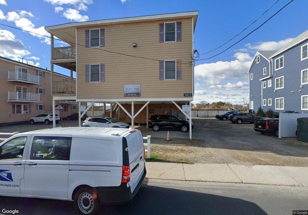
20 Cable Ave Unit 14 Salisbury, MA 01952
Estimated Value: $354,000 - $487,000
2
Beds
1
Bath
909
Sq Ft
$459/Sq Ft
Est. Value
About This Home
This home is located at 20 Cable Ave Unit 14, Salisbury, MA 01952 and is currently estimated at $417,681, approximately $459 per square foot. 20 Cable Ave Unit 14 is a home located in Essex County with nearby schools including Triton Regional High School.
Ownership History
Date
Name
Owned For
Owner Type
Purchase Details
Closed on
Jun 29, 2020
Sold by
Sweeney Jerilynn A
Bought by
Desilva Joanna L
Current Estimated Value
Home Financials for this Owner
Home Financials are based on the most recent Mortgage that was taken out on this home.
Original Mortgage
$194,925
Outstanding Balance
$171,636
Interest Rate
3.2%
Mortgage Type
New Conventional
Estimated Equity
$246,045
Purchase Details
Closed on
Aug 1, 2005
Sold by
Giso Rlty Llc
Bought by
Sweeney Jerilynn A
Create a Home Valuation Report for This Property
The Home Valuation Report is an in-depth analysis detailing your home's value as well as a comparison with similar homes in the area
Home Values in the Area
Average Home Value in this Area
Purchase History
| Date | Buyer | Sale Price | Title Company |
|---|---|---|---|
| Desilva Joanna L | $259,900 | None Available | |
| Desilva Joanna L | $259,900 | None Available | |
| Sweeney Jerilynn A | $250,000 | -- |
Source: Public Records
Mortgage History
| Date | Status | Borrower | Loan Amount |
|---|---|---|---|
| Open | Desilva Joanna L | $194,925 | |
| Closed | Desilva Joanna L | $194,925 |
Source: Public Records
Tax History
| Year | Tax Paid | Tax Assessment Tax Assessment Total Assessment is a certain percentage of the fair market value that is determined by local assessors to be the total taxable value of land and additions on the property. | Land | Improvement |
|---|---|---|---|---|
| 2025 | $3,455 | $342,800 | $0 | $342,800 |
| 2024 | $3,215 | $307,700 | $0 | $307,700 |
| 2023 | $3,255 | $291,500 | $0 | $291,500 |
| 2022 | $3,135 | $272,100 | $0 | $272,100 |
| 2021 | $2,881 | $247,800 | $0 | $247,800 |
| 2020 | $2,655 | $231,700 | $0 | $231,700 |
| 2019 | $2,655 | $218,600 | $0 | $218,600 |
| 2018 | $2,127 | $177,100 | $0 | $177,100 |
| 2017 | $2,097 | $172,500 | $0 | $172,500 |
| 2016 | $2,013 | $172,500 | $0 | $172,500 |
| 2015 | $1,859 | $158,200 | $0 | $158,200 |
Source: Public Records
Map
Nearby Homes
- 20 Cable Ave Unit 5
- 16 N End Blvd Unit 8
- 16 N End Blvd Unit 3
- 16 N End Blvd Unit 7
- 16 N End Blvd Unit 12
- 16 N End Blvd Unit 5
- 16 N End Blvd Unit 9
- 103 Railroad Ave
- 114 Railroad Ave
- 78 N End Blvd Unit 1
- 98 Central Ave
- 170 Beach Rd Unit 52
- 2 Old County Rd Unit 13
- 2 Old County Rd Unit 10
- 2 Old County Rd Unit 15
- 135 Beach Rd Unit B114
- 127 Beach Rd
- 34 Dock Ln
- 10 Meadowview Ln Unit B
- 100 Forest Rd
- 20 Cable Ave Unit 17
- 20 Cable Ave Unit 16
- 20 Cable Ave Unit 15
- 20 Cable Ave Unit 12
- 20 Cable Ave Unit 10
- 20 Cable Ave Unit 9
- 20 Cable Ave Unit 7
- 20 Cable Ave Unit 6
- 20 Cable Ave Unit 4
- 20 Cable Ave Unit 3
- 20 Cable Ave Unit 2
- 20 Cable Ave Unit 1
- 20 Cable Ave Unit 14,20
- 20 Cable Ave Unit 13,20
- 20 Cable Ave Unit 16,26
- 16 Cable Ave
- 27 Railroad Ave
- 24 Cable Ave Unit 16
- 25 Cable Ave
- 30 Cable Ave (Winter) Unit B
Your Personal Tour Guide
Ask me questions while you tour the home.