Estimated Value: $1,017,766 - $1,174,000
4
Beds
3
Baths
2,158
Sq Ft
$500/Sq Ft
Est. Value
About This Home
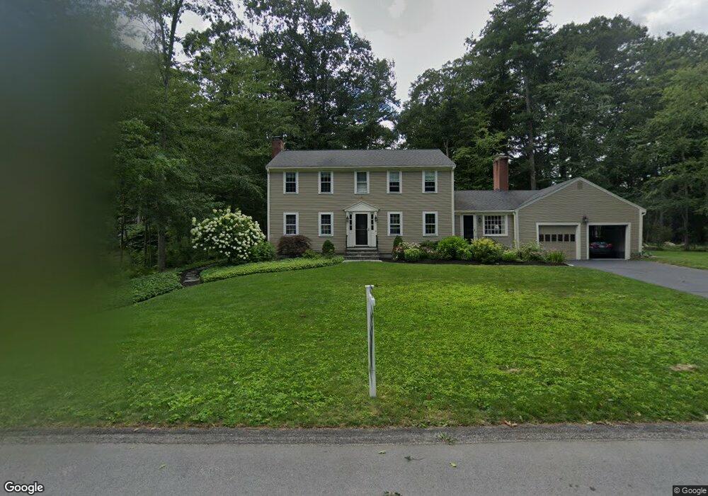
This home is located at 20 Captain Browns Ln, Acton, MA 01720 and is currently estimated at $1,078,442, approximately $499 per square foot. 20 Captain Browns Ln is a home located in Middlesex County with nearby schools including Acton-Boxborough Regional High School.
Ownership History
Date
Name
Owned For
Owner Type
Purchase Details
Closed on
Jun 27, 2001
Sold by
Austin Theodore M and Austin Martha F
Bought by
Zawada John C and Zawada Lynne H
Current Estimated Value
Home Financials for this Owner
Home Financials are based on the most recent Mortgage that was taken out on this home.
Original Mortgage
$392,000
Interest Rate
7.14%
Mortgage Type
Purchase Money Mortgage
Purchase Details
Closed on
Jul 16, 1998
Sold by
Reynholds Bernard N
Bought by
Austin Theodore M and Austin Martha F
Home Financials for this Owner
Home Financials are based on the most recent Mortgage that was taken out on this home.
Original Mortgage
$150,000
Interest Rate
6.98%
Mortgage Type
Purchase Money Mortgage
Create a Home Valuation Report for This Property
The Home Valuation Report is an in-depth analysis detailing your home's value as well as a comparison with similar homes in the area
Home Values in the Area
Average Home Value in this Area
Purchase History
| Date | Buyer | Sale Price | Title Company |
|---|---|---|---|
| Zawada John C | $527,000 | -- | |
| Austin Theodore M | $385,000 | -- | |
| Austin Theodore M | $385,000 | -- |
Source: Public Records
Mortgage History
| Date | Status | Borrower | Loan Amount |
|---|---|---|---|
| Open | Austin Theodore M | $346,000 | |
| Closed | Austin Theodore M | $392,000 | |
| Previous Owner | Austin Theodore M | $150,000 |
Source: Public Records
Tax History Compared to Growth
Tax History
| Year | Tax Paid | Tax Assessment Tax Assessment Total Assessment is a certain percentage of the fair market value that is determined by local assessors to be the total taxable value of land and additions on the property. | Land | Improvement |
|---|---|---|---|---|
| 2025 | $16,294 | $950,100 | $368,200 | $581,900 |
| 2024 | $13,059 | $783,400 | $368,200 | $415,200 |
| 2023 | $13,246 | $754,300 | $334,700 | $419,600 |
| 2022 | $12,545 | $645,000 | $290,800 | $354,200 |
| 2021 | $12,233 | $604,700 | $269,100 | $335,600 |
| 2020 | $11,544 | $600,000 | $269,100 | $330,900 |
| 2019 | $11,169 | $576,600 | $269,100 | $307,500 |
| 2018 | $10,988 | $567,000 | $269,100 | $297,900 |
| 2017 | $10,716 | $562,200 | $269,100 | $293,100 |
| 2016 | $10,532 | $547,700 | $269,100 | $278,600 |
| 2015 | $10,156 | $533,100 | $269,100 | $264,000 |
| 2014 | $10,003 | $514,300 | $269,100 | $245,200 |
Source: Public Records
Map
Nearby Homes
- 285 Central St Unit 285
- 9 Elm St Unit 1
- 5 Elm St Unit 1
- 31 Mohawk Dr
- 89 Windsor Ave
- 4,7,8 Crestwood Ln
- 4 Huron Rd
- 169 Main St
- 92 Willow St Unit 3
- 92 Willow St Unit 2
- 90 Willow St Unit 1
- 23 John Swift Rd
- 19 Railroad St Unit C2
- 129 Main St Unit 129
- 129 Main St
- 131 Main St
- 5 Oakwood Rd
- 68 Macintosh Ln
- 8 Laurel Ct
- 86 School St
- 20 Captain Brown's Ln
- 11 Captain Forbush Ln
- 9 Captain Forbush Ln
- 21 Captain Browns Ln
- 13 Captain Forbush Ln
- 23 Captain Browns Ln
- 24 Captain Browns Ln
- 16 Captain Brown's Ln
- 19 Captain Browns Ln
- 16 Captain Browns Ln
- 12 Captain Forbush Ln
- 25 Captain Browns Ln
- 14 Captain Forbush Ln
- 7 Captain Forbush Ln
- 15 Captain Forbush Ln
- 26 Captain Browns Ln
- 10 Captain Forbush Ln
- 27 Captain Brown's Ln
- 17 Captain Browns Ln
- 27 Captain Browns Ln