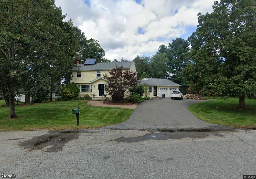
20 Carty Cir North Andover, MA 01845
Estimated Value: $747,000 - $925,000
3
Beds
3
Baths
1,900
Sq Ft
$455/Sq Ft
Est. Value
About This Home
This home is located at 20 Carty Cir, North Andover, MA 01845 and is currently estimated at $864,696, approximately $455 per square foot. 20 Carty Cir is a home located in Essex County with nearby schools including Franklin Elementary School, North Andover Middle School, and North Andover High School.
Ownership History
Date
Name
Owned For
Owner Type
Purchase Details
Closed on
Jul 12, 2013
Sold by
Bradburn David and Bradburn Gabriela
Bought by
Kelly Marie Robert and Kelly Marie
Current Estimated Value
Purchase Details
Closed on
Jan 31, 2000
Sold by
Fung Stanley L and Fung Shirley
Bought by
Bradburn David and Bradburn Gabriela
Purchase Details
Closed on
Jul 24, 1996
Sold by
Gorham George V
Bought by
Fung Stanley L
Create a Home Valuation Report for This Property
The Home Valuation Report is an in-depth analysis detailing your home's value as well as a comparison with similar homes in the area
Home Values in the Area
Average Home Value in this Area
Purchase History
| Date | Buyer | Sale Price | Title Company |
|---|---|---|---|
| Kelly Marie Robert | $539,900 | -- | |
| Bradburn David | $316,000 | -- | |
| Fung Stanley L | $238,000 | -- |
Source: Public Records
Mortgage History
| Date | Status | Borrower | Loan Amount |
|---|---|---|---|
| Previous Owner | Fung Stanley L | $495,000 | |
| Previous Owner | Fung Stanley L | $300,700 | |
| Previous Owner | Fung Stanley L | $57,000 |
Source: Public Records
Tax History Compared to Growth
Tax History
| Year | Tax Paid | Tax Assessment Tax Assessment Total Assessment is a certain percentage of the fair market value that is determined by local assessors to be the total taxable value of land and additions on the property. | Land | Improvement |
|---|---|---|---|---|
| 2025 | $9,022 | $801,200 | $381,600 | $419,600 |
| 2024 | $8,545 | $770,500 | $361,500 | $409,000 |
| 2023 | $8,023 | $655,500 | $305,300 | $350,200 |
| 2022 | $7,812 | $577,400 | $277,200 | $300,200 |
| 2021 | $7,510 | $530,000 | $251,100 | $278,900 |
| 2020 | $7,282 | $530,000 | $251,100 | $278,900 |
| 2019 | $7,107 | $530,000 | $251,100 | $278,900 |
| 2018 | $7,701 | $530,000 | $251,100 | $278,900 |
| 2017 | $6,259 | $438,300 | $207,900 | $230,400 |
| 2016 | $5,956 | $417,400 | $206,600 | $210,800 |
| 2015 | $6,029 | $419,000 | $199,400 | $219,600 |
Source: Public Records
Map
Nearby Homes
- 74 Hewitt Ave
- 51 Village Green Dr
- 13 Kingston St Unit 94
- 2 Kingston St Unit 2
- 58 Berkeley Rd
- 44 Kingston St Unit 44
- 97 Cotuit St Unit 1
- 174 Chestnut St Unit 14
- 156 Chestnut St Unit 15
- 86 Kingston St Unit 86
- 180 Chickering Rd Unit 204C
- 180 Chickering Rd Unit 107C
- 190 Chickering Rd Unit 204D
- 190 Chickering Rd Unit 201D
- 90 Farrwood Ave Unit 1
- 170 Haverhill St Unit 138
- 170 Haverhill St Unit 129
- 40 Fernview Ave Unit 11
- 52 Fernview Ave Unit 7
- 75 Edgelawn Ave Unit 2