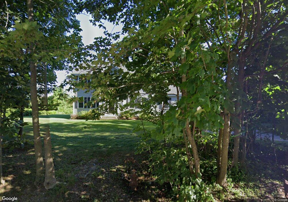
20 Central Tree Rd Rutland, MA 01543
Estimated Value: $634,167 - $681,000
3
Beds
3
Baths
2,248
Sq Ft
$292/Sq Ft
Est. Value
About This Home
This home is located at 20 Central Tree Rd, Rutland, MA 01543 and is currently estimated at $655,792, approximately $291 per square foot. 20 Central Tree Rd is a home with nearby schools including Wachusett Regional High School.
Ownership History
Date
Name
Owned For
Owner Type
Purchase Details
Closed on
Jan 30, 2014
Sold by
Pleasantdale Estates L
Bought by
Jean Michael R and Jean Colleen E
Current Estimated Value
Home Financials for this Owner
Home Financials are based on the most recent Mortgage that was taken out on this home.
Original Mortgage
$301,750
Outstanding Balance
$229,172
Interest Rate
4.47%
Mortgage Type
New Conventional
Estimated Equity
$426,620
Create a Home Valuation Report for This Property
The Home Valuation Report is an in-depth analysis detailing your home's value as well as a comparison with similar homes in the area
Home Values in the Area
Average Home Value in this Area
Purchase History
| Date | Buyer | Sale Price | Title Company |
|---|---|---|---|
| Jean Michael R | $322,242 | -- |
Source: Public Records
Mortgage History
| Date | Status | Borrower | Loan Amount |
|---|---|---|---|
| Open | Jean Michael R | $301,750 |
Source: Public Records
Tax History Compared to Growth
Tax History
| Year | Tax Paid | Tax Assessment Tax Assessment Total Assessment is a certain percentage of the fair market value that is determined by local assessors to be the total taxable value of land and additions on the property. | Land | Improvement |
|---|---|---|---|---|
| 2025 | $7,517 | $527,900 | $104,300 | $423,600 |
| 2024 | $7,328 | $494,100 | $93,800 | $400,300 |
| 2023 | $6,680 | $486,900 | $88,500 | $398,400 |
| 2022 | $6,243 | $395,400 | $75,200 | $320,200 |
| 2021 | $6,059 | $362,800 | $75,200 | $287,600 |
| 2020 | $6,130 | $348,100 | $70,800 | $277,300 |
| 2019 | $6,070 | $339,300 | $65,100 | $274,200 |
| 2018 | $5,785 | $319,100 | $65,100 | $254,000 |
| 2017 | $5,846 | $319,100 | $65,100 | $254,000 |
| 2016 | $5,439 | $313,100 | $66,400 | $246,700 |
| 2015 | $5,362 | $303,800 | $66,400 | $237,400 |
| 2014 | $5,198 | $303,800 | $66,400 | $237,400 |
Source: Public Records
Map
Nearby Homes
- 10 Beechwood Dr
- 21 Highland Park Rd
- 27 Lewis St
- 11 Lewis St
- 21 Lewis St
- 12 Lewis St
- 6 Lewis St
- 85 Maple Ave Unit A
- 7 Prescott St
- 25 Watson Ln
- 28 Forest Hill Dr
- 2 Forest Hill Dr
- 32 Pommogussett Rd Unit 1
- 132 Fidelity Dr Unit 61
- 10 Fidelity Dr Unit 5
- 2226 Main St
- 55 Pommogussett Rd
- 10 Soucy Dr
- 176 Maple Ave Unit 1-38
- 176 Maple Ave Unit 3-25
- 24 Central Tree Rd
- 3 Central Tree Rd
- 15 Central Tree Rd
- 17 Central Tree Rd
- 13 Central Tree Rd
- 9 William Cir
- 19 Central Tree Rd
- 16 Central Tree Rd
- 8 Central Tree Rd
- 14 Central Tree Rd
- 12 Central Tree Rd
- 10 Central Tree Rd
- 12 Central Tree Rd
- 22 Central Tree Rd Unit 5
- 22 Central Tree Rd Unit 4
- 22 Central Tree Rd Unit 1
- 22 Central Tree Rd
- 22 Central Tree Rd Unit 3
- 9 Sycamore Dr
- 11 Sycamore Dr