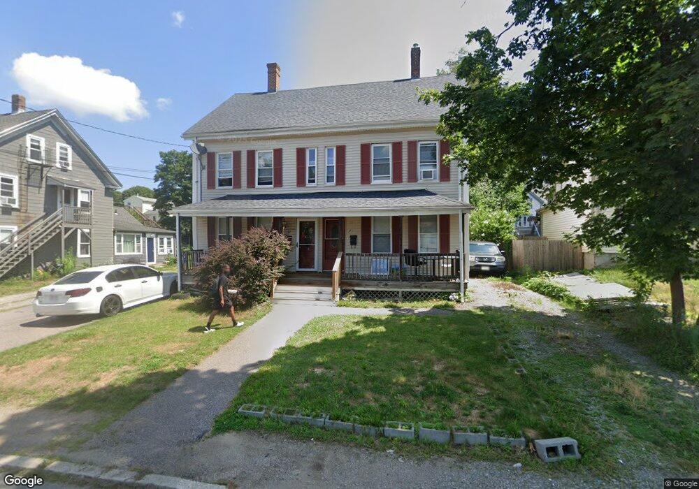
20 Chestnut St Unit 1 Stoughton, MA 02072
Estimated Value: $643,082 - $790,000
3
Beds
1
Bath
1,300
Sq Ft
$560/Sq Ft
Est. Value
About This Home
This home is located at 20 Chestnut St Unit 1, Stoughton, MA 02072 and is currently estimated at $728,521, approximately $560 per square foot. 20 Chestnut St Unit 1 is a home located in Norfolk County with nearby schools including Joseph R Dawe Jr Elementary School, O'Donnell Middle School, and Stoughton High School.
Ownership History
Date
Name
Owned For
Owner Type
Purchase Details
Closed on
Dec 5, 2013
Sold by
Peterson Edward F and Peterson Suzanne M
Bought by
Myers Latoya A
Current Estimated Value
Home Financials for this Owner
Home Financials are based on the most recent Mortgage that was taken out on this home.
Original Mortgage
$333,841
Outstanding Balance
$249,129
Interest Rate
4.17%
Mortgage Type
FHA
Estimated Equity
$479,392
Create a Home Valuation Report for This Property
The Home Valuation Report is an in-depth analysis detailing your home's value as well as a comparison with similar homes in the area
Home Values in the Area
Average Home Value in this Area
Purchase History
| Date | Buyer | Sale Price | Title Company |
|---|---|---|---|
| Myers Latoya A | $340,000 | -- | |
| Myers Latoya A | $340,000 | -- | |
| Myers Latoya A | $340,000 | -- |
Source: Public Records
Mortgage History
| Date | Status | Borrower | Loan Amount |
|---|---|---|---|
| Open | Myers Latoya A | $333,841 | |
| Closed | Myers Latoya A | $333,841 | |
| Previous Owner | Myers Latoya A | $254,500 | |
| Previous Owner | Myers Latoya A | $110,000 |
Source: Public Records
Tax History Compared to Growth
Tax History
| Year | Tax Paid | Tax Assessment Tax Assessment Total Assessment is a certain percentage of the fair market value that is determined by local assessors to be the total taxable value of land and additions on the property. | Land | Improvement |
|---|---|---|---|---|
| 2025 | $6,371 | $514,600 | $206,300 | $308,300 |
| 2024 | $6,318 | $496,300 | $188,000 | $308,300 |
| 2023 | $6,545 | $483,000 | $174,700 | $308,300 |
| 2022 | $6,510 | $451,800 | $159,700 | $292,100 |
| 2021 | $6,333 | $419,400 | $144,700 | $274,700 |
| 2020 | $6,170 | $414,400 | $139,700 | $274,700 |
| 2019 | $6,141 | $400,300 | $139,700 | $260,600 |
| 2018 | $5,831 | $393,700 | $133,100 | $260,600 |
| 2017 | $5,545 | $382,700 | $126,400 | $256,300 |
| 2016 | $4,874 | $325,600 | $116,500 | $209,100 |
| 2015 | $4,825 | $318,900 | $109,800 | $209,100 |
| 2014 | $4,072 | $258,700 | $99,800 | $158,900 |
Source: Public Records
Map
Nearby Homes
- 6 Grove St
- 58 Union St Unit 15
- 11 Monk St
- 15 Jones Terrace Unit 2
- 17 Jones Terrace Unit 4
- 310 Lincoln St
- 36 Pleasant Dr Unit 42
- 18 Britton St
- 5-9 Morton Square
- 15-17 Morton Square
- 26 Faxon St Unit 2
- 702 Central St
- 62 Kinsley St
- 68 Crescent Ave
- 79 Kinsley St
- 73 Crescent Ave
- 959 Washington St
- 136 Bramblebush Rd
- 59 Summer Ave
- 121 Bassick Cir
- 20 Chestnut St
- 20/22 Chestnut St
- 22 Chestnut St Unit 2
- 22 Chestnut St
- 12 Chestnut St
- 158 Seaver St
- 166 Seaver St
- 174 Seaver St
- 155 Pleasant St
- 148 Seaver St
- 171 Pleasant St
- 163 Pleasant St
- 180 Seaver St
- 15 Chestnut St
- 17 Prospect St
- 161 Seaver St
- 7 Chestnut St
- 142 Seaver St
- 15 Prospect St
- 21 Prospect St