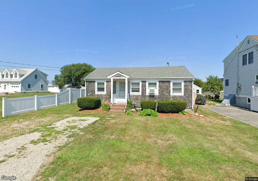
20 Chickatawbut Ave Marshfield, MA 02050
Ocean Bluff-Brant Rock NeighborhoodEstimated Value: $470,000 - $622,000
2
Beds
1
Bath
480
Sq Ft
$1,102/Sq Ft
Est. Value
About This Home
This home is located at 20 Chickatawbut Ave, Marshfield, MA 02050 and is currently estimated at $529,156, approximately $1,102 per square foot. 20 Chickatawbut Ave is a home located in Plymouth County with nearby schools including Governor Edward Winslow School, Furnace Brook Middle School, and Marshfield High School.
Ownership History
Date
Name
Owned For
Owner Type
Purchase Details
Closed on
Dec 20, 2023
Sold by
Spellman Karen A
Bought by
Karen A Spellman 2023 Ret and Spellman
Current Estimated Value
Purchase Details
Closed on
Feb 15, 1994
Sold by
Friars Minor
Bought by
Spellman Kevin A and Spellman Karen A
Home Financials for this Owner
Home Financials are based on the most recent Mortgage that was taken out on this home.
Original Mortgage
$35,200
Interest Rate
7.08%
Mortgage Type
Purchase Money Mortgage
Create a Home Valuation Report for This Property
The Home Valuation Report is an in-depth analysis detailing your home's value as well as a comparison with similar homes in the area
Home Values in the Area
Average Home Value in this Area
Purchase History
| Date | Buyer | Sale Price | Title Company |
|---|---|---|---|
| Karen A Spellman 2023 Ret | -- | None Available | |
| Karen A Spellman 2023 Ret | -- | None Available | |
| Spellman Kevin A | $44,000 | -- |
Source: Public Records
Mortgage History
| Date | Status | Borrower | Loan Amount |
|---|---|---|---|
| Previous Owner | Spellman Kevin A | $35,200 |
Source: Public Records
Tax History Compared to Growth
Tax History
| Year | Tax Paid | Tax Assessment Tax Assessment Total Assessment is a certain percentage of the fair market value that is determined by local assessors to be the total taxable value of land and additions on the property. | Land | Improvement |
|---|---|---|---|---|
| 2025 | $4,668 | $471,500 | $378,100 | $93,400 |
| 2024 | $4,587 | $441,500 | $358,200 | $83,300 |
| 2023 | $4,029 | $385,800 | $310,500 | $75,300 |
| 2022 | $4,029 | $311,100 | $248,800 | $62,300 |
| 2021 | $4,047 | $306,800 | $248,800 | $58,000 |
| 2020 | $4,078 | $305,900 | $248,800 | $57,100 |
| 2019 | $4,023 | $300,700 | $248,800 | $51,900 |
| 2018 | $3,470 | $259,500 | $209,000 | $50,500 |
| 2017 | $3,481 | $253,700 | $209,000 | $44,700 |
| 2016 | $3,469 | $249,900 | $209,000 | $40,900 |
| 2015 | $3,144 | $236,600 | $199,000 | $37,600 |
| 2014 | $3,358 | $252,700 | $209,000 | $43,700 |
Source: Public Records
Map
Nearby Homes
- 16 Chickatawbut Ave
- 10 Chickatawbut Ave
- 15 Saginaw Ave
- 19 Saginaw Ave
- 21 Chickatawbut Ave
- 25 Saginaw Ave
- 23 Saginaw Ave
- 15 Saginaw Ave -Winter Rental
- 32 Chickatawbut Ave
- 11 Chickatawbut Ave
- 11 Chickatawbut Ave Unit 11
- MOB-11-9 Saginaw Ave
- M08 11-9 Saginaw Ave
- 27 Chickatawbut Ave
- 11 Saginaw Ave
- 527 Ocean St
- 31 Saginaw Ave
- 36 Chickatawbut Ave
- 20 Lowell Ave
- 5 Saginaw Ave