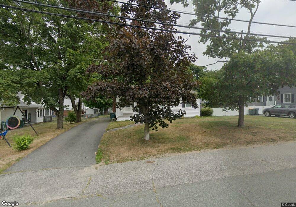
20 Clark St Abington, MA 02351
Estimated Value: $391,000 - $555,000
3
Beds
1
Bath
1,008
Sq Ft
$469/Sq Ft
Est. Value
About This Home
This home is located at 20 Clark St, Abington, MA 02351 and is currently estimated at $472,790, approximately $469 per square foot. 20 Clark St is a home located in Plymouth County with nearby schools including Beaver Brook Elementary School, Abington Middle School, and Woodsdale School.
Ownership History
Date
Name
Owned For
Owner Type
Purchase Details
Closed on
Aug 1, 2000
Sold by
Thomas Eva L
Bought by
Richardson Thomas J and Hayes Kerrie A
Current Estimated Value
Purchase Details
Closed on
Sep 23, 1993
Sold by
Connors Susan R and Beaton Cathleen
Bought by
Thomas Eva L
Purchase Details
Closed on
Jul 15, 1988
Sold by
Rockett Josephine
Bought by
Connors Susan R
Create a Home Valuation Report for This Property
The Home Valuation Report is an in-depth analysis detailing your home's value as well as a comparison with similar homes in the area
Home Values in the Area
Average Home Value in this Area
Purchase History
| Date | Buyer | Sale Price | Title Company |
|---|---|---|---|
| Richardson Thomas J | $175,000 | -- | |
| Thomas Eva L | $105,000 | -- | |
| Connors Susan R | $132,000 | -- |
Source: Public Records
Mortgage History
| Date | Status | Borrower | Loan Amount |
|---|---|---|---|
| Open | Connors Susan R | $172,000 | |
| Closed | Connors Susan R | $45,000 | |
| Closed | Connors Susan R | $30,000 |
Source: Public Records
Tax History
| Year | Tax Paid | Tax Assessment Tax Assessment Total Assessment is a certain percentage of the fair market value that is determined by local assessors to be the total taxable value of land and additions on the property. | Land | Improvement |
|---|---|---|---|---|
| 2025 | $5,152 | $394,500 | $211,600 | $182,900 |
| 2024 | $4,852 | $362,600 | $192,400 | $170,200 |
| 2023 | $4,917 | $346,000 | $167,300 | $178,700 |
| 2022 | $4,956 | $325,600 | $146,400 | $179,200 |
| 2021 | $4,619 | $280,300 | $132,800 | $147,500 |
| 2020 | $4,799 | $282,300 | $139,400 | $142,900 |
| 2019 | $4,325 | $248,700 | $132,800 | $115,900 |
| 2018 | $4,375 | $245,500 | $132,800 | $112,700 |
| 2017 | $4,090 | $222,900 | $132,800 | $90,100 |
| 2016 | $3,591 | $200,300 | $126,400 | $73,900 |
| 2015 | $3,310 | $194,700 | $126,400 | $68,300 |
Source: Public Records
Map
Nearby Homes
- 1065 Bedford St
- 1077 Bedford St
- 338 Adams St
- 1353 Washington St
- 0 Bedford St
- 120 Glen St
- 35 Adams St
- 337 Randolph St
- 73 Monroe St
- 353 Plymouth St
- 27 Fir Rd
- 40 Fir Rd Unit 386
- 20 Birch St
- 17 Birch St Unit 135
- 189 Sheri Ln
- 451 Lincoln St
- 14 Jamieson St
- 46 Carey St
- 22 Kingswood Dr Unit 6F
- 9 Chestnut Cir
- 997 Bedford St
- 997 Bedford St Unit 3
- 28 Clark St
- 23 Clark St Unit 23
- 981 Bedford St
- 21 Clark St
- 27 Clark St Unit 27
- 25 Clark St Unit 25
- 84 Hamilton St
- 76 Hamilton St
- 90 Hamilton St
- 100 Pizzingz
- 100 Pizza & Wings
- 1023 Bedford St
- 982 Bedford St
- 62 Hamilton St
- 1012 Bedford St
- 96 Hamilton St
- 1035 Bedford St Unit 101
- 1035 Bedford St Unit 104