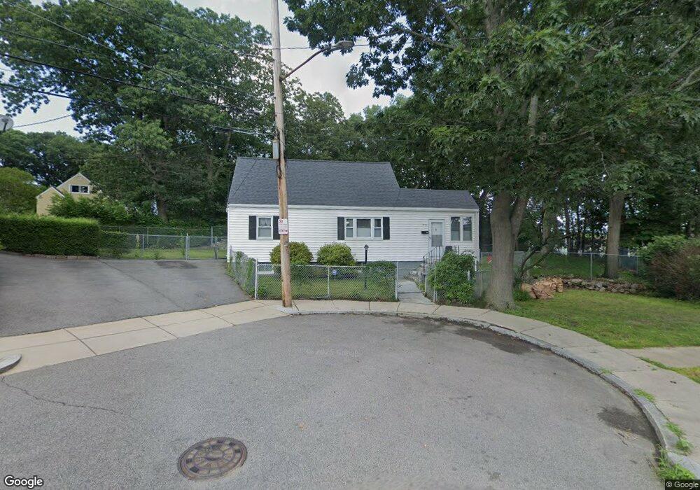
20 Constitution Rd Mattapan, MA 02126
Southern Mattapan NeighborhoodEstimated Value: $521,377 - $628,000
3
Beds
2
Baths
1,122
Sq Ft
$524/Sq Ft
Est. Value
About This Home
This home is located at 20 Constitution Rd, Mattapan, MA 02126 and is currently estimated at $587,844, approximately $523 per square foot. 20 Constitution Rd is a home located in Suffolk County with nearby schools including KIPP Academy Boston Charter School and Berea Sda Academy.
Ownership History
Date
Name
Owned For
Owner Type
Purchase Details
Closed on
Aug 2, 1993
Sold by
Wright Joseph E and Wright Dorothy L
Bought by
Mustafa Khalid and Mustafa Lunita
Current Estimated Value
Home Financials for this Owner
Home Financials are based on the most recent Mortgage that was taken out on this home.
Original Mortgage
$65,250
Interest Rate
7.32%
Mortgage Type
Purchase Money Mortgage
Create a Home Valuation Report for This Property
The Home Valuation Report is an in-depth analysis detailing your home's value as well as a comparison with similar homes in the area
Home Values in the Area
Average Home Value in this Area
Purchase History
| Date | Buyer | Sale Price | Title Company |
|---|---|---|---|
| Mustafa Khalid | $87,000 | -- |
Source: Public Records
Mortgage History
| Date | Status | Borrower | Loan Amount |
|---|---|---|---|
| Closed | Mustafa Khalid | $65,250 | |
| Previous Owner | Mustafa Khalid | $17,344 | |
| Previous Owner | Mustafa Khalid | $8,500 | |
| Closed | Mustafa Khalid | $17,400 |
Source: Public Records
Tax History
| Year | Tax Paid | Tax Assessment Tax Assessment Total Assessment is a certain percentage of the fair market value that is determined by local assessors to be the total taxable value of land and additions on the property. | Land | Improvement |
|---|---|---|---|---|
| 2025 | $4,578 | $395,300 | $152,600 | $242,700 |
| 2024 | $4,779 | $438,400 | $154,300 | $284,100 |
| 2023 | $4,484 | $417,500 | $146,900 | $270,600 |
| 2022 | $4,285 | $393,800 | $138,600 | $255,200 |
| 2021 | $4,086 | $382,900 | $138,600 | $244,300 |
| 2020 | $3,580 | $339,000 | $137,700 | $201,300 |
| 2019 | $3,339 | $316,800 | $103,500 | $213,300 |
| 2018 | $3,103 | $296,100 | $103,500 | $192,600 |
| 2017 | $3,104 | $293,100 | $103,500 | $189,600 |
| 2016 | $2,804 | $254,900 | $103,500 | $151,400 |
| 2015 | $2,453 | $202,600 | $96,300 | $106,300 |
| 2014 | $2,380 | $189,200 | $96,300 | $92,900 |
Source: Public Records
Map
Nearby Homes
- 8 Violet St
- 8 Faunce Rd Unit A
- 4 Crossman St Unit 4
- 11 French St
- 165-167 Delhi St
- 157 Delhi St
- 44 Allen Cir
- 567B Norfolk St
- 95 Woodhaven St
- 853 Cummins Hwy
- 35 Standard St
- 10 Brockton St
- 80 Blue Hills Pkwy
- 58 Mattapan St
- 18 Fairfax Rd
- 84 Blue Hills Pkwy
- 116 Almont St
- 20 Monterey Ave
- 23 Maryknoll St
- 770 Cummins Hwy Unit 1
- 16 Constitution Rd
- 9 Jamestown Terrace
- 5 Jamestown Terrace
- 23 Dania St
- 19 Dania St
- 10 Linvale Terrace
- 27 Dania St
- 6 Linvale Terrace
- 14 Linvale Terrace
- 6 Viking Terrace
- 34 Gladeside Ave
- 2 Viking Terrace
- 38 Gladeside Ave
- 10 Jamestown Terrace
- 40 Gladeside Ave
- 15 Dania St
- 6 Jamestown Terrace
- 8 Constitution Rd
- 18 Linvale Terrace
- 18 Linvale Terrace Unit 2
Your Personal Tour Guide
Ask me questions while you tour the home.