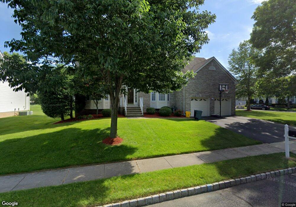
20 Cortland Dr East Brunswick, NJ 08816
Estimated Value: $776,826 - $1,182,000
--
Bed
--
Bath
2,970
Sq Ft
$355/Sq Ft
Est. Value
About This Home
This home is located at 20 Cortland Dr, East Brunswick, NJ 08816 and is currently estimated at $1,052,957, approximately $354 per square foot. 20 Cortland Dr is a home located in Middlesex County with nearby schools including Lawrence Brook Elementary School, Warnsdorfer Elementary School, and Churchill Junior High School.
Ownership History
Date
Name
Owned For
Owner Type
Purchase Details
Closed on
Oct 26, 2001
Sold by
M And M At Apple Ridge Llc
Bought by
Gopu Praveen and Gundu Neelima
Current Estimated Value
Home Financials for this Owner
Home Financials are based on the most recent Mortgage that was taken out on this home.
Original Mortgage
$350,000
Outstanding Balance
$136,595
Interest Rate
6.7%
Mortgage Type
Purchase Money Mortgage
Estimated Equity
$916,362
Create a Home Valuation Report for This Property
The Home Valuation Report is an in-depth analysis detailing your home's value as well as a comparison with similar homes in the area
Home Values in the Area
Average Home Value in this Area
Purchase History
| Date | Buyer | Sale Price | Title Company |
|---|---|---|---|
| Gopu Praveen | $475,483 | -- |
Source: Public Records
Mortgage History
| Date | Status | Borrower | Loan Amount |
|---|---|---|---|
| Open | Gopu Praveen | $350,000 |
Source: Public Records
Tax History Compared to Growth
Tax History
| Year | Tax Paid | Tax Assessment Tax Assessment Total Assessment is a certain percentage of the fair market value that is determined by local assessors to be the total taxable value of land and additions on the property. | Land | Improvement |
|---|---|---|---|---|
| 2025 | $21,009 | $175,000 | $46,900 | $128,100 |
| 2024 | $20,435 | $175,000 | $46,900 | $128,100 |
| 2023 | $20,435 | $175,000 | $46,900 | $128,100 |
| 2022 | $20,361 | $175,000 | $46,900 | $128,100 |
| 2021 | $19,447 | $175,000 | $46,900 | $128,100 |
| 2020 | $19,752 | $175,000 | $46,900 | $128,100 |
| 2019 | $19,548 | $175,000 | $46,900 | $128,100 |
| 2018 | $19,196 | $175,000 | $46,900 | $128,100 |
| 2017 | $18,884 | $175,000 | $46,900 | $128,100 |
| 2016 | $18,492 | $175,000 | $46,900 | $128,100 |
| 2015 | $18,029 | $175,000 | $46,900 | $128,100 |
| 2014 | $17,240 | $171,000 | $46,900 | $124,100 |
Source: Public Records
Map
Nearby Homes
- 15 Cortland Dr
- 82 Milltown Rd
- 45 Cortland Dr
- 28 Elm St
- 18 Milltown Rd
- 4 Clayton Ct
- 77 Wilcox Ave
- 7 Wedgewood Ct
- 5 Lois Ave
- 212 Old Bridge Turnpike
- 15 Parker St
- 402 Cranbury Rd Unit 8
- 20 Cleveland Ave
- 13 Garwood St
- 19 Cleveland Ave
- 28 Johnson Place
- 166 Joseph St
- 22 Roosevelt St
- 149 Prigmore St
- 86 Hillside Ave
- 18 Cortland Dr
- 21 Cortland Dr
- 9 Braeburn Place
- 14 Braeburn Place
- 23 Cortland Dr
- 16 Cortland Dr
- 12 Braeburn Place
- 10 Braeburn Place
- 25 Cortland Dr
- 7 Braeburn Place
- 14 Cortland Dr
- 19 Winesap Dr
- 17 Winesap Dr
- 8 Braeburn Place
- 15 Winesap Dr
- 27 Cortland Dr
- 5 Braeburn Place
- 10 Cortland Dr
- 6 Braeburn Place
- 18 Winesap Dr