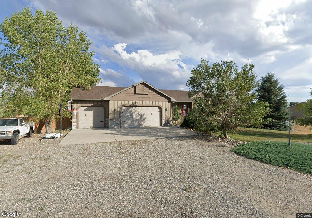
20 Dale Ln Laurel, MT 59044
Estimated Value: $486,000 - $619,156
5
Beds
3
Baths
3,090
Sq Ft
$184/Sq Ft
Est. Value
About This Home
This home is located at 20 Dale Ln, Laurel, MT 59044 and is currently estimated at $568,789, approximately $184 per square foot. 20 Dale Ln is a home located in Carbon County with nearby schools including Fred W. Graff School, West School, and Laurel Middle School.
Ownership History
Date
Name
Owned For
Owner Type
Purchase Details
Closed on
Jul 8, 2015
Sold by
Temple Jon J and Temple Jeannette
Bought by
Meadows Jeramie W and Meadows Anna J
Current Estimated Value
Home Financials for this Owner
Home Financials are based on the most recent Mortgage that was taken out on this home.
Original Mortgage
$292,500
Outstanding Balance
$227,835
Interest Rate
3.83%
Mortgage Type
New Conventional
Estimated Equity
$340,954
Create a Home Valuation Report for This Property
The Home Valuation Report is an in-depth analysis detailing your home's value as well as a comparison with similar homes in the area
Purchase History
We collect this data history from publicly available records. To have your information removed, we recommend requesting removal directly through your county’s website.
| Date | Buyer | Sale Price | Title Company |
|---|---|---|---|
| Meadows Jeramie W | $365,625 | Stewart Title |
Source: Public Records
Mortgage History
We collect this data history from publicly available records. To have your information removed, we recommend requesting removal directly through your county’s website.
| Date | Status | Borrower | Loan Amount |
|---|---|---|---|
| Open | Meadows Jeramie W | $292,500 |
Source: Public Records
Tax History
| Year | Tax Paid | Tax Assessment Tax Assessment Total Assessment is a certain percentage of the fair market value that is determined by local assessors to be the total taxable value of land and additions on the property. | Land | Improvement |
|---|---|---|---|---|
| 2025 | $2,431 | $568,700 | $0 | $0 |
| 2024 | $2,658 | $414,000 | $0 | $0 |
| 2023 | $2,490 | $414,000 | $0 | $0 |
| 2022 | $2,135 | $354,700 | $0 | $0 |
| 2021 | $2,208 | $354,700 | $0 | $0 |
| 2020 | $2,169 | $347,000 | $0 | $0 |
| 2019 | $2,170 | $347,000 | $0 | $0 |
| 2018 | $2,148 | $323,500 | $0 | $0 |
| 2017 | $2,128 | $323,500 | $0 | $0 |
| 2016 | $1,714 | $259,700 | $0 | $0 |
| 2015 | $1,659 | $259,700 | $0 | $0 |
| 2014 | $1,591 | $134,302 | $0 | $0 |
Source: Public Records
Map
Nearby Homes
- 46 Beartooth View Dr
- 4320 Moser Dome Rd
- 751 Clarks River Rd
- 2275 Shay Rd
- Lot 16 Clarks Point Dr
- 29 Spruce Dr
- 51 Wildflower Cir
- TBD S Park City Rd Rd
- 10 Cc Ln
- 9 & 10 & 11 Cc Ln
- 55 Mangum Ln
- 4 Morgan Dr
- TBD Wold Rd
- 244 S Park City Rd
- 4 Pinto Place
- 29 Sagebrush Downs
- 00 Rodeo Dr
- 10 Sagebrush Downs
- 208 West Ave
- 410 Maple Ave
Your Personal Tour Guide
Ask me questions while you tour the home.