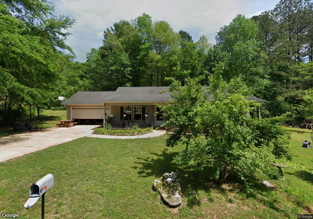
20 Deason St Griffin, GA 30223
Spalding County NeighborhoodEstimated Value: $199,000 - $224,000
3
Beds
2
Baths
1,316
Sq Ft
$161/Sq Ft
Est. Value
About This Home
This home is located at 20 Deason St, Griffin, GA 30223 and is currently estimated at $211,665, approximately $160 per square foot. 20 Deason St is a home located in Spalding County with nearby schools including Cowan Road Elementary School, Cowan Road Middle School, and Griffin High School.
Ownership History
Date
Name
Owned For
Owner Type
Purchase Details
Closed on
Feb 12, 2002
Sold by
Lavigne Barbara D
Bought by
Harmon Patricia H
Current Estimated Value
Home Financials for this Owner
Home Financials are based on the most recent Mortgage that was taken out on this home.
Original Mortgage
$73,000
Outstanding Balance
$30,398
Interest Rate
7.16%
Mortgage Type
New Conventional
Estimated Equity
$181,267
Create a Home Valuation Report for This Property
The Home Valuation Report is an in-depth analysis detailing your home's value as well as a comparison with similar homes in the area
Home Values in the Area
Average Home Value in this Area
Purchase History
| Date | Buyer | Sale Price | Title Company |
|---|---|---|---|
| Harmon Patricia H | -- | -- |
Source: Public Records
Mortgage History
| Date | Status | Borrower | Loan Amount |
|---|---|---|---|
| Open | Harmon Patricia H | $73,000 |
Source: Public Records
Tax History Compared to Growth
Tax History
| Year | Tax Paid | Tax Assessment Tax Assessment Total Assessment is a certain percentage of the fair market value that is determined by local assessors to be the total taxable value of land and additions on the property. | Land | Improvement |
|---|---|---|---|---|
| 2024 | $2,103 | $58,794 | $6,240 | $52,554 |
| 2023 | $2,103 | $58,794 | $6,240 | $52,554 |
| 2022 | $1,078 | $48,955 | $4,800 | $44,155 |
| 2021 | $900 | $39,872 | $4,800 | $35,072 |
| 2020 | $905 | $39,872 | $4,800 | $35,072 |
| 2019 | $923 | $39,872 | $4,800 | $35,072 |
| 2018 | $1,056 | $36,684 | $4,800 | $31,884 |
| 2017 | $1,028 | $36,684 | $4,800 | $31,884 |
| 2016 | $1,046 | $36,684 | $4,800 | $31,884 |
| 2015 | $1,080 | $36,684 | $4,800 | $31,884 |
| 2014 | $1,100 | $36,684 | $4,800 | $31,884 |
Source: Public Records
Map
Nearby Homes
- 265 Steele Rd
- 1115 Burgundy Dr
- 475 Edwards Rd
- 1972 Pinecrest Dr Unit 4
- 1156 Burgundy Dr
- 1019 Oakridge Dr
- 1949 Bonnie Ridge Dr
- 204 Vineyard Ridge Dr
- 3701 Fayetteville Rd
- 1022 Serene Lake Dr
- 1317 Cheatham Rd
- 110 Janie Ln
- 220 Beasley Rd
- 813 Vineyard Rd
- 105 Janie Ln
- 4920 Fayetteville Rd
- 4940 Fayetteville Rd
- 4946 Fayetteville Rd
- 313 Sammy Cir
- 1100 Stiles Crossing
- 35 Vickery Dr
- 37 Vickery Dr
- 33 Deason St
- 8 Vickery Dr
- 38 Deason St
- 39 Vickery Dr
- 10 Vickery Dr
- 1507 Vineyard Rd
- 1521 Vineyard Rd
- 1501 Vineyard Rd
- 1483 Vineyard Rd
- 1497 Vineyard Rd
- 1527 Vineyard Rd
- 0 Vickery Dr Unit 7072310
- 45 Deason St
- 1551 Vineyard Rd
- 1526 Vineyard Rd
- 36 Vickery Dr
- 1512 Vineyard Rd
- 1504 Vineyard Rd