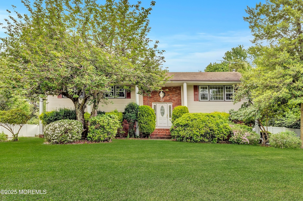
20 Devon Rd Middletown, NJ 07748
New Monmouth NeighborhoodEstimated payment $5,493/month
Highlights
- In Ground Pool
- Deck
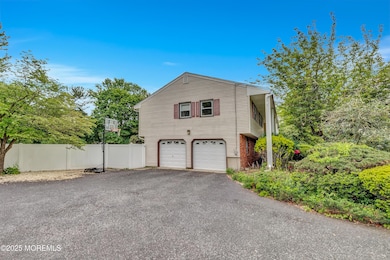
- 2 Car Attached Garage
- Middletown Village Elementary School Rated A-
- No HOA
- Shed
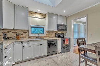
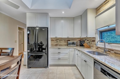
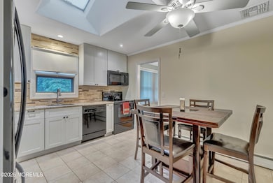
About This Home
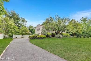
Tucked away on a quiet street in one of Middletown's most sought-after neighborhoods, this spacious bi-level single-family home offers the perfect blend of comfort, privacy, and outdoor living.
Featuring 3 bedrooms and 3 full bathrooms, this home sits on a generously sized lot that backs to serene woods, offering a peaceful, secluded setting. The expansive backyard is an entertainer's dream — complete with an in-ground pool, perfect for summer gatherings or relaxing weekends at home.
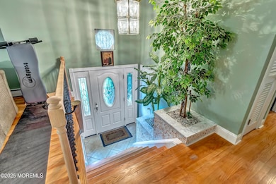
Inside, the versatile bi-level layout offers space and flexibility. Whether you're hosting family and friends or simply enjoying quiet evenings, this home provides the ideal backdrop. Convenient access to top-rated schools, shopping, dining, and transportation.
Home Details
Home Type
- Single Family
Est. Annual Taxes
- $12,545
Year Built
- Built in 1963
Lot Details
- 0.73 Acre Lot
- Lot Dimensions are 125 x 255
- Fenced
Parking
- 2 Car Attached Garage
- Garage Door Opener
Home Design
- Shingle Roof
Interior Spaces
- 2,454 Sq Ft Home
- 1-Story Property
Kitchen
- Stove
- Microwave
- Disposal
Bedrooms and Bathrooms
- 3 Bedrooms
- 3 Full Bathrooms
Laundry
- Dryer
- Washer
Outdoor Features
- In Ground Pool
- Deck
- Shed
Schools
- Middletown Village Elementary School
- Thompson Middle School
- Middle North High School
Utilities
- Zoned Heating and Cooling System
- Natural Gas Water Heater
Community Details
- No Home Owners Association
- Twinbrooks Subdivision
Listing and Financial Details
- Assessor Parcel Number 32-00821-0000-00009
Map
Home Values in the Area
Average Home Value in this Area
Tax History
| Year | Tax Paid | Tax Assessment Tax Assessment Total Assessment is a certain percentage of the fair market value that is determined by local assessors to be the total taxable value of land and additions on the property. | Land | Improvement |
|---|---|---|---|---|
| 2025 | $12,545 | $884,500 | $527,000 | $357,500 |
| 2024 | $11,038 | $762,600 | $411,600 | $351,000 |
| 2023 | $11,038 | $635,100 | $335,500 | $299,600 |
| 2022 | $10,074 | $596,200 | $306,800 | $289,400 |
| 2021 | $10,074 | $523,100 | $275,200 | $247,900 |
| 2020 | $11,028 | $515,800 | $273,500 | $242,300 |
| 2019 | $10,997 | $520,700 | $273,500 | $247,200 |
| 2018 | $11,327 | $522,700 | $273,500 | $249,200 |
| 2017 | $11,013 | $518,500 | $273,500 | $245,000 |
| 2016 | $10,634 | $499,000 | $263,500 | $235,500 |
| 2015 | $10,616 | $497,000 | $263,500 | $233,500 |
| 2014 | $10,439 | $476,900 | $263,500 | $213,400 |
Property History
| Date | Event | Price | List to Sale | Price per Sq Ft |
|---|---|---|---|---|
| 12/12/2025 12/12/25 | Pending | -- | -- | -- |
| 10/16/2025 10/16/25 | For Sale | $849,000 | 0.0% | $346 / Sq Ft |
| 10/02/2025 10/02/25 | Pending | -- | -- | -- |
| 09/17/2025 09/17/25 | For Sale | $849,000 | -- | $346 / Sq Ft |
Purchase History
| Date | Type | Sale Price | Title Company |
|---|---|---|---|
| Deed | $465,000 | -- |
Mortgage History
| Date | Status | Loan Amount | Loan Type |
|---|---|---|---|
| Open | $365,000 | Purchase Money Mortgage |
Source: MOREMLS (Monmouth Ocean Regional REALTORS®)
MLS Number: 22528247
APN: 32-00821-0000-00009
Disclaimer: Certain information contained herein is derived from information provided by parties other than Homes.com. All information provided is deemed reliable, but is not guaranteed to be accurate and should be independently verified.
![]() IDX information is provided exclusively for personal, non-commercial use, and may not be used for any purpose other than to identify prospective properties consumers may be interested in purchasing.
IDX information is provided exclusively for personal, non-commercial use, and may not be used for any purpose other than to identify prospective properties consumers may be interested in purchasing.
Information is deemed reliable but not guaranteed.
- 35 Woodland Dr
- 0 Hamiltonian Dr Unit 22514980
- 164 Heights Terrace
- 7 Meehan Ct
- 6 Waller Dr
- 10 Waller Dr
- 16 Waller Dr
- 22 Waller Dr
- 22 Edmund Way
- 89 Augustus Dr
- 6 Augustus Dr
- 76 Edmund Way
- 211 April Way Unit 211
- 8 Church St
- 17 Winding Brook Way
- 152 Sleepy Hollow Rd
- 33 Swartzel Dr
- 74 Fish Hawk Dr
- 24 Princeton St
- 152 Chapel Hill Rd
