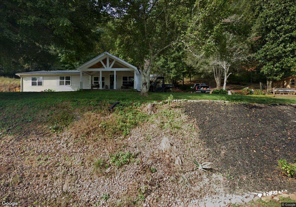
20 Dills Dr Dahlonega, GA 30533
Estimated Value: $277,000 - $363,000
--
Bed
2
Baths
1,593
Sq Ft
$202/Sq Ft
Est. Value
About This Home
This home is located at 20 Dills Dr, Dahlonega, GA 30533 and is currently estimated at $321,569, approximately $201 per square foot. 20 Dills Dr is a home located in Lumpkin County with nearby schools including Lumpkin County High School.
Ownership History
Date
Name
Owned For
Owner Type
Purchase Details
Closed on
Oct 28, 2021
Sold by
Mincey Dwayne W
Bought by
Mincey William D and Mincey Rebecca A
Current Estimated Value
Purchase Details
Closed on
Feb 6, 2009
Sold by
Mincey Dwayne W
Bought by
Mincey William D
Home Financials for this Owner
Home Financials are based on the most recent Mortgage that was taken out on this home.
Original Mortgage
$160,000
Interest Rate
5.07%
Mortgage Type
New Conventional
Purchase Details
Closed on
Oct 5, 2006
Sold by
Not Provided
Bought by
Mincey William D
Home Financials for this Owner
Home Financials are based on the most recent Mortgage that was taken out on this home.
Original Mortgage
$76,000
Interest Rate
6.45%
Mortgage Type
New Conventional
Purchase Details
Closed on
Dec 23, 1997
Sold by
Dills J H
Bought by
Dills Dills J and Dills Adell
Create a Home Valuation Report for This Property
The Home Valuation Report is an in-depth analysis detailing your home's value as well as a comparison with similar homes in the area
Home Values in the Area
Average Home Value in this Area
Purchase History
| Date | Buyer | Sale Price | Title Company |
|---|---|---|---|
| Mincey William D | -- | -- | |
| Mincey William D | -- | -- | |
| Mincey William D | $95,000 | -- | |
| Dills Dills J | -- | -- |
Source: Public Records
Mortgage History
| Date | Status | Borrower | Loan Amount |
|---|---|---|---|
| Previous Owner | Mincey William D | $160,000 | |
| Previous Owner | Mincey William D | $76,000 |
Source: Public Records
Tax History Compared to Growth
Tax History
| Year | Tax Paid | Tax Assessment Tax Assessment Total Assessment is a certain percentage of the fair market value that is determined by local assessors to be the total taxable value of land and additions on the property. | Land | Improvement |
|---|---|---|---|---|
| 2024 | $2,088 | $91,491 | $23,772 | $67,719 |
| 2023 | $1,536 | $84,850 | $21,611 | $63,239 |
| 2022 | $1,822 | $75,578 | $18,009 | $57,569 |
| 2021 | $1,659 | $66,819 | $18,009 | $48,810 |
| 2020 | $1,655 | $64,752 | $17,257 | $47,495 |
| 2019 | $1,671 | $64,752 | $17,257 | $47,495 |
| 2018 | $1,645 | $59,973 | $17,257 | $42,716 |
| 2017 | $1,675 | $59,907 | $17,257 | $42,650 |
| 2016 | $1,582 | $54,894 | $17,257 | $37,637 |
| 2015 | $1,415 | $54,894 | $17,257 | $37,637 |
| 2014 | $1,415 | $55,658 | $17,257 | $38,400 |
| 2013 | -- | $56,738 | $17,257 | $39,481 |
Source: Public Records
Map
Nearby Homes
- 4039 Highway 19 N
- 00 LOT C Cavender Creek Rd
- 00 Cavender Creek Rd
- 34 Great Works Dr
- 1036 Wards Creek Dr
- 2589 Morrison Moore Pkwy E
- 13 Hallmark Place
- 85 Summit Canyon Rd Unit H102
- 0 Ridley Rd Unit 7672007
- 0 Ridley Rd Unit 10632021
- 1323 Cavender Creek Rd
- 238 Grand View St
- 65 Golden Autumn Dr
- 122 Tritt Rd
- 149 Highland Rd S
- 77 Old River Rd
- 1437 Porter Springs Rd
- 46 Deer Acres Dr
- 165 Porter Springs Rd
- 372 Porter Springs Rd
- 572 Miller Calhoun Rd
- 746 Miller Calhoun Rd
- 521 Miller Calhoun Rd
- 286 Miller Calhoun Rd
- 850 Miller Calhoun Rd Unit 3
- 0 Miller Calhoun Rd Unit LOT 4 3284685
- 0 Miller Calhoun Rd Unit LOT 2 3284570
- 0 Miller Calhoun Rd Unit LOT 3 3284644
- 00 Miller Calhoun Rd
- 0 Miller Calhoun Rd Unit 10247764
- 0 Miller Calhoun Rd Unit 10078983
- 0 Miller Calhoun Rd Unit 10059684
- 0 Miller Calhoun Rd Unit 7066234
- 0 Miller Calhoun Rd Unit 7047820
- 0 Miller Calhoun Rd Unit 3 7476608
- 0 Miller Calhoun Rd Unit 3 8054628
- 99 Sandy Springs Rd
- 215 Sandy Springs Rd
- 4404 U S 19
- 4404 Highway 19 N