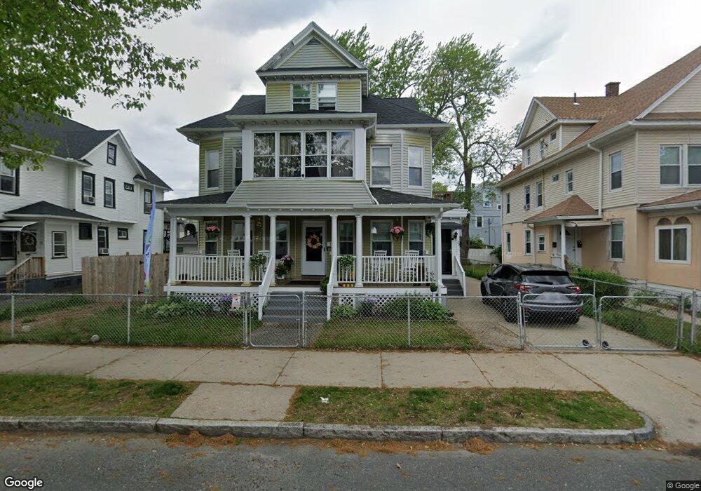
20 Dunmoreland St Unit 22 Springfield, MA 01109
Upper Hill NeighborhoodEstimated Value: $349,901 - $420,000
8
Beds
3
Baths
3,488
Sq Ft
$108/Sq Ft
Est. Value
About This Home
This home is located at 20 Dunmoreland St Unit 22, Springfield, MA 01109 and is currently estimated at $376,475, approximately $107 per square foot. 20 Dunmoreland St Unit 22 is a home located in Hampden County with nearby schools including Mary M. Walsh Elementary School, M Marcus Kiley Middle, and Springfield High School of Science and Technology.
Ownership History
Date
Name
Owned For
Owner Type
Purchase Details
Closed on
May 21, 2002
Sold by
Davis Sharon R
Bought by
Neighborhood Hsng Svcs
Current Estimated Value
Purchase Details
Closed on
Sep 3, 1997
Sold by
Est Stirling Vincent H and Johnson Henriquez
Bought by
Davis Sharon R
Home Financials for this Owner
Home Financials are based on the most recent Mortgage that was taken out on this home.
Original Mortgage
$61,750
Interest Rate
7.36%
Mortgage Type
Purchase Money Mortgage
Create a Home Valuation Report for This Property
The Home Valuation Report is an in-depth analysis detailing your home's value as well as a comparison with similar homes in the area
Home Values in the Area
Average Home Value in this Area
Purchase History
| Date | Buyer | Sale Price | Title Company |
|---|---|---|---|
| Neighborhood Hsng Svcs | $63,000 | -- | |
| Davis Sharon R | $65,000 | -- |
Source: Public Records
Mortgage History
| Date | Status | Borrower | Loan Amount |
|---|---|---|---|
| Previous Owner | Davis Sharon R | $61,750 | |
| Closed | Davis Sharon R | $2,300 |
Source: Public Records
Tax History Compared to Growth
Tax History
| Year | Tax Paid | Tax Assessment Tax Assessment Total Assessment is a certain percentage of the fair market value that is determined by local assessors to be the total taxable value of land and additions on the property. | Land | Improvement |
|---|---|---|---|---|
| 2025 | $4,488 | $286,200 | $31,100 | $255,100 |
| 2024 | $4,302 | $267,900 | $31,100 | $236,800 |
| 2023 | $3,852 | $225,900 | $28,300 | $197,600 |
| 2022 | $3,399 | $180,600 | $26,400 | $154,200 |
| 2021 | $3,185 | $168,500 | $18,700 | $149,800 |
| 2020 | $3,193 | $163,500 | $18,700 | $144,800 |
| 2019 | $3,025 | $153,700 | $16,000 | $137,700 |
| 2018 | $2,932 | $149,000 | $16,000 | $133,000 |
| 2017 | $3,014 | $153,300 | $15,000 | $138,300 |
| 2016 | $2,615 | $133,000 | $15,000 | $118,000 |
| 2015 | $2,508 | $127,500 | $15,000 | $112,500 |
Source: Public Records
Map
Nearby Homes
- 88 Dunmoreland St
- 19 Westford Ave
- 21 Westford Cir
- 124-126 Westford Cir
- 140 Northampton Ave
- 179 Albemarle St
- 162 Northampton Ave
- 62-64 Bristol St
- 135-137 Suffolk St
- 290 Quincy St
- 65 Montrose St
- 43 Colonial Ave
- 52-56 Andrew St
- 58 Willard Ave
- 111 Marlborough St
- 129 Eastern Ave
- 158 Norfolk St
- 81 Hayden Ave
- 15 Kenyon St
- 67 Carlisle St
- 20-22 Dunmoreland St
- 16 Dunmoreland St Unit 18
- 26 Dunmoreland St Unit 28
- 19 Dunmoreland St
- 21 Massachusetts Ave
- 21 Massachusetts Ave Unit 1
- 15 Massachusetts Ave
- 32 Dunmoreland St Unit 34
- 25 Massachusetts Ave
- 21 Dunmoreland St
- 15 Dunmoreland St
- 25 Dunmoreland St
- 17 Dunmoreland St
- 31 Massachusetts Ave Unit 33
- 31 Massachusetts Ave Unit 3
- 38 Dunmoreland St Unit 40
- 187 Wilbraham Rd
- 183 Wilbraham Rd
- 33 Dunmoreland St
- 5 Massachusetts Ave Unit 1