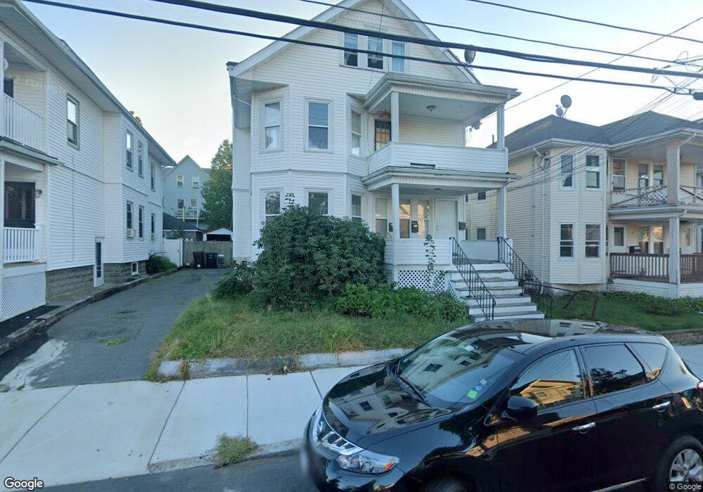
20 Dunster Rd Everett, MA 02149
Glendale NeighborhoodEstimated Value: $778,000 - $1,074,000
8
Beds
3
Baths
3,597
Sq Ft
$264/Sq Ft
Est. Value
About This Home
This home is located at 20 Dunster Rd, Everett, MA 02149 and is currently estimated at $948,667, approximately $263 per square foot. 20 Dunster Rd is a home located in Middlesex County with nearby schools including Everett High School.
Ownership History
Date
Name
Owned For
Owner Type
Purchase Details
Closed on
Aug 6, 2013
Sold by
Moreno Daisey and Alas Dimas
Bought by
Moreno Daisey and Alas Dimas
Current Estimated Value
Purchase Details
Closed on
Feb 27, 2009
Sold by
Accredited Home Lender
Bought by
20 Dunster Road Rt and Digirolamo Ralph
Purchase Details
Closed on
Jul 31, 2008
Sold by
Gutierrez Christian N
Bought by
Accredited Home Lender
Purchase Details
Closed on
Mar 1, 2006
Sold by
Powers Kenneth J and Piccolo Maryann
Bought by
Gutierrez Christian N
Home Financials for this Owner
Home Financials are based on the most recent Mortgage that was taken out on this home.
Original Mortgage
$468,000
Interest Rate
6.16%
Mortgage Type
Purchase Money Mortgage
Create a Home Valuation Report for This Property
The Home Valuation Report is an in-depth analysis detailing your home's value as well as a comparison with similar homes in the area
Home Values in the Area
Average Home Value in this Area
Purchase History
| Date | Buyer | Sale Price | Title Company |
|---|---|---|---|
| Moreno Daisey | -- | -- | |
| 20 Dunster Road Rt | $270,000 | -- | |
| Accredited Home Lender | $387,000 | -- | |
| Gutierrez Christian N | $585,000 | -- |
Source: Public Records
Mortgage History
| Date | Status | Borrower | Loan Amount |
|---|---|---|---|
| Previous Owner | Gutierrez Christian N | $468,000 |
Source: Public Records
Tax History
| Year | Tax Paid | Tax Assessment Tax Assessment Total Assessment is a certain percentage of the fair market value that is determined by local assessors to be the total taxable value of land and additions on the property. | Land | Improvement |
|---|---|---|---|---|
| 2025 | $10,801 | $948,300 | $251,900 | $696,400 |
| 2024 | $9,889 | $862,900 | $220,800 | $642,100 |
| 2023 | $9,736 | $826,500 | $211,200 | $615,300 |
| 2022 | $7,965 | $768,800 | $201,600 | $567,200 |
| 2021 | $7,193 | $728,800 | $180,400 | $548,400 |
| 2020 | $7,328 | $688,700 | $180,400 | $508,300 |
| 2019 | $7,757 | $626,600 | $171,800 | $454,800 |
| 2018 | $7,297 | $529,500 | $149,700 | $379,800 |
| 2017 | $7,100 | $491,700 | $134,400 | $357,300 |
| 2016 | $6,331 | $438,100 | $120,000 | $318,100 |
| 2015 | $5,970 | $408,600 | $108,200 | $300,400 |
Source: Public Records
Map
Nearby Homes
- 859 Broadway Unit 15
- 881 Broadway Unit 44
- 881 Broadway Unit 28
- 5 Mason St
- 53 Sycamore St
- 528 Ferry St
- 17 Jones St Unit 2
- 102 Suffolk St
- 51 Adams Ave
- 39 Broadway Unit 305
- 19 Mills St
- 112 Hadley St
- 44 Walnut St
- 211 Elm St
- 21 Central Ave Unit 10
- 21 Staples Ave Unit 26
- 15 Staples Ave Unit 45
- 15 Staples Ave Unit 31
- 272-274 Cross St Unit 4
- 272-274 Cross St Unit 3
- 20 Dunster Rd
- 20 Dunster Rd Unit 2
- 20 Dunster Rd Unit 3
- 20 Dunster Rd Unit 1
- 18 Dunster Rd
- 24 Dunster Rd
- 24 Dunster Rd Unit 1
- 28 Dunster Rd
- 16 Dunster Rd
- 21-23 Kenwood Rd
- 23 Kenwood Rd
- 21 Kenwood Rd
- 25 Kenwood Rd
- 25 Kenwood Rd Unit 2
- 25 Kenwood Rd Unit 1
- 19 Kenwood Rd
- 17 Kenwood Rd
- 13 Kenwood Rd
- 13 Kenwood Rd Unit 1
- 34 Dunster Rd
Your Personal Tour Guide
Ask me questions while you tour the home.