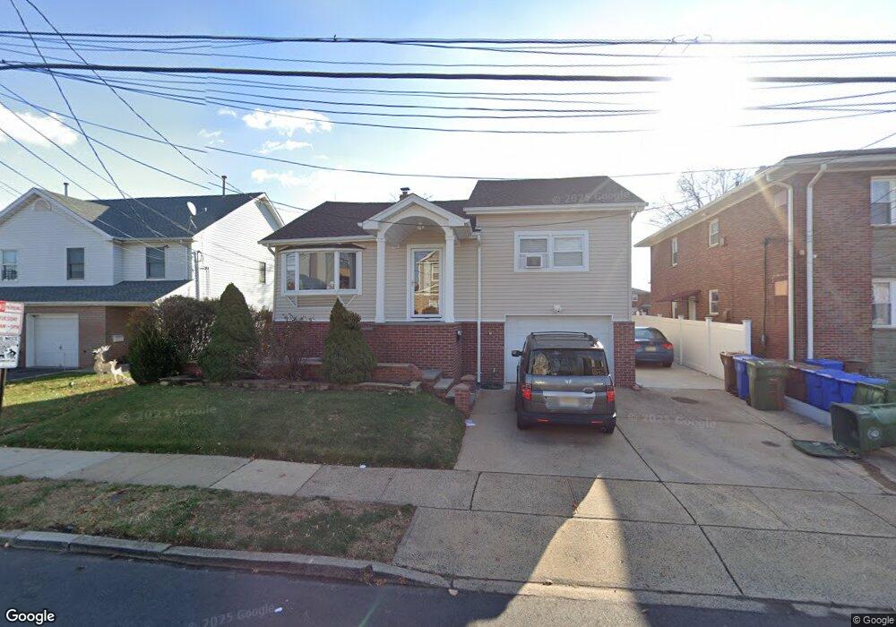
20 E 10th St Linden, NJ 07036
Estimated Value: $434,449 - $498,000
Studio
--
Bath
640
Sq Ft
$744/Sq Ft
Est. Value
About This Home
This home is located at 20 E 10th St, Linden, NJ 07036 and is currently estimated at $476,112, approximately $743 per square foot. 20 E 10th St is a home located in Union County with nearby schools including School No. 2, Myles J. McManus Middle School, and Linden High School.
Ownership History
Date
Name
Owned For
Owner Type
Purchase Details
Closed on
Jun 23, 2005
Sold by
Marin Luis J
Bought by
Saldarriaga Pedro and Moore Maria
Current Estimated Value
Home Financials for this Owner
Home Financials are based on the most recent Mortgage that was taken out on this home.
Original Mortgage
$276,750
Outstanding Balance
$144,201
Interest Rate
5.73%
Mortgage Type
New Conventional
Estimated Equity
$331,911
Purchase Details
Closed on
Mar 21, 2005
Sold by
Ruvolo Kathleen A
Bought by
Marin Luis J and Dariva Lucia
Home Financials for this Owner
Home Financials are based on the most recent Mortgage that was taken out on this home.
Original Mortgage
$200,000
Interest Rate
6.75%
Mortgage Type
Adjustable Rate Mortgage/ARM
Create a Home Valuation Report for This Property
The Home Valuation Report is an in-depth analysis detailing your home's value as well as a comparison with similar homes in the area
Home Values in the Area
Average Home Value in this Area
Purchase History
| Date | Buyer | Sale Price | Title Company |
|---|---|---|---|
| Saldarriaga Pedro | $307,500 | -- | |
| Marin Luis J | $250,000 | -- |
Source: Public Records
Mortgage History
| Date | Status | Borrower | Loan Amount |
|---|---|---|---|
| Open | Saldarriaga Pedro | $276,750 | |
| Previous Owner | Marin Luis J | $200,000 |
Source: Public Records
Tax History
| Year | Tax Paid | Tax Assessment Tax Assessment Total Assessment is a certain percentage of the fair market value that is determined by local assessors to be the total taxable value of land and additions on the property. | Land | Improvement |
|---|---|---|---|---|
| 2025 | $8,171 | $116,200 | $46,000 | $70,200 |
| 2024 | $7,992 | $116,200 | $46,000 | $70,200 |
| 2023 | $7,992 | $116,200 | $46,000 | $70,200 |
| 2022 | $8,034 | $116,200 | $46,000 | $70,200 |
| 2021 | $8,075 | $116,200 | $46,000 | $70,200 |
| 2020 | $8,032 | $116,200 | $46,000 | $70,200 |
| 2019 | $8,005 | $116,200 | $46,000 | $70,200 |
| 2018 | $8,003 | $116,200 | $46,000 | $70,200 |
| 2017 | $7,830 | $116,200 | $46,000 | $70,200 |
| 2016 | $7,583 | $116,200 | $46,000 | $70,200 |
| 2015 | $7,294 | $116,200 | $46,000 | $70,200 |
| 2014 | $7,152 | $116,200 | $46,000 | $70,200 |
Source: Public Records
Map
Nearby Homes
- 11 W 12th St
- 111 E 10th St
- 112 E 12th St
- 46 W 12th St
- 119 E 13th St
- 135 Liberty St
- 317 Mitchell Ave
- 1713 S Wood Ave Unit 2
- 300 Kennedy Dr
- 116 W 17th St Unit 2
- 108 W 18th St
- 12 Belmont Place
- 1930 S Wood Ave
- 212 W Morris Ave
- 226 Pennsylvania Railroad Ave
- 120 S Stiles St
- 10 N Wood Ave Unit 406
- 10 N Wood Ave Unit 717
- 111 Todd Place
- 208 E Price St
- 12 E 10th St Unit R 1
- 12 E 10th St Unit 16
- 26 E 10th St
- 12-16 E 10th St
- 21 E 11th St
- 13 E 11th St
- 34 W 10th St
- 27 E 11th St
- 34 E 10th St
- 31 E 11th St
- 36 E 10th St
- 36 E 10th St Unit 1
- 19 E 10th St
- 21 E 10th St
- 15 E 10th St
- 33 E 11th St
- 25 E 10th St
- 25 E 10th St Unit C
- 25 E 10th St Unit D
- 25 E 10th St Unit A
Your Personal Tour Guide
Ask me questions while you tour the home.