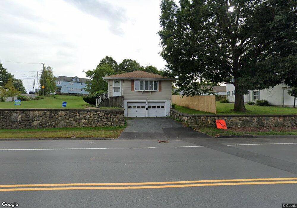
20 E Mountain St Worcester, MA 01606
Burncoat NeighborhoodEstimated Value: $392,148 - $433,000
3
Beds
2
Baths
1,092
Sq Ft
$381/Sq Ft
Est. Value
About This Home
This home is located at 20 E Mountain St, Worcester, MA 01606 and is currently estimated at $415,787, approximately $380 per square foot. 20 E Mountain St is a home located in Worcester County with nearby schools including Belmont Street Community School, Jacob Hiatt Magnet School, and Chandler Magnet.
Ownership History
Date
Name
Owned For
Owner Type
Purchase Details
Closed on
Jul 24, 2019
Sold by
Pignataro Anthony S and Pignataro Maria C
Bought by
Pignataro Skylar and Pignataro Tiana
Current Estimated Value
Purchase Details
Closed on
Sep 13, 2011
Sold by
Pignataro Nina A
Bought by
Pignataro Nina A and Pignataro Francis
Create a Home Valuation Report for This Property
The Home Valuation Report is an in-depth analysis detailing your home's value as well as a comparison with similar homes in the area
Home Values in the Area
Average Home Value in this Area
Purchase History
| Date | Buyer | Sale Price | Title Company |
|---|---|---|---|
| Pignataro Skylar | -- | -- | |
| Pignataro Nina A | -- | -- |
Source: Public Records
Tax History
| Year | Tax Paid | Tax Assessment Tax Assessment Total Assessment is a certain percentage of the fair market value that is determined by local assessors to be the total taxable value of land and additions on the property. | Land | Improvement |
|---|---|---|---|---|
| 2025 | $4,818 | $365,300 | $118,800 | $246,500 |
| 2024 | $4,719 | $343,200 | $118,800 | $224,400 |
| 2023 | $4,559 | $317,900 | $103,300 | $214,600 |
| 2022 | $4,037 | $265,400 | $82,700 | $182,700 |
| 2021 | $3,868 | $237,600 | $66,100 | $171,500 |
| 2020 | $3,718 | $218,700 | $66,100 | $152,600 |
| 2019 | $3,494 | $194,100 | $59,600 | $134,500 |
| 2018 | $3,394 | $179,500 | $59,600 | $119,900 |
| 2017 | $3,446 | $179,300 | $59,600 | $119,700 |
| 2016 | $3,357 | $162,900 | $44,000 | $118,900 |
| 2015 | $3,269 | $162,900 | $44,000 | $118,900 |
| 2014 | $3,183 | $162,900 | $44,000 | $118,900 |
Source: Public Records
Map
Nearby Homes
- 53 Collins St
- 10 Beale St
- 12 Beale St
- 39 Mountainshire Dr
- 30 Danielles Way
- 31 Danielles Way
- 22 Danielles Way
- 26 Danielles Way
- 69 Santoro Rd
- 1110 W Boylston St Unit A
- 71 Hillside Village Dr
- 66 Eunice Ave
- 331 Burncoat St
- 156 Hillside Village Dr
- 13 Fatima Ln
- 323 Burncoat St
- 48 Whispering Pine Cir Unit 48
- 30 Osgood Ave
- 169 Whitmarsh Ave
- 58 Osceola Ave
- 18 E Mountain St
- 18 E Mountain St Unit 1
- 18 E Mountain St Unit 1R
- 57 Collins St
- 539 Burncoat St
- 537 Burncoat St
- 60 Collins St
- 51 Collins St
- 535 Burncoat St
- I-130 11 Gibbs Unit 130
- 533 Burncoat St
- 52 Collins St
- 49 Collins St
- 49 Collins St Unit 49
- 531 Burncoat St
- 7 Vendora Rd
- 45 Collins St
- 34 E Mountain St
- 529 Burncoat St
- 44 Collins St
Your Personal Tour Guide
Ask me questions while you tour the home.