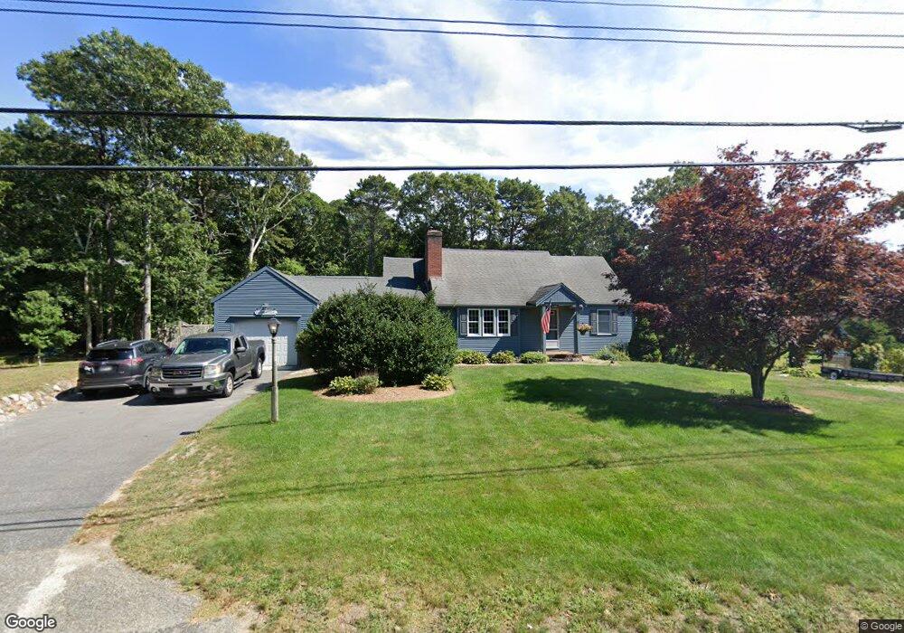
20 Eileen St Yarmouth Port, MA 02675
Yarmouth Port NeighborhoodEstimated Value: $728,900 - $830,000
3
Beds
3
Baths
1,768
Sq Ft
$438/Sq Ft
Est. Value
About This Home
This home is located at 20 Eileen St, Yarmouth Port, MA 02675 and is currently estimated at $775,225, approximately $438 per square foot. 20 Eileen St is a home located in Barnstable County with nearby schools including Dennis-Yarmouth Regional High School and St. Pius X. School.
Ownership History
Date
Name
Owned For
Owner Type
Purchase Details
Closed on
Sep 16, 2016
Sold by
Harkenrider Donald J and Harkenrider Nina C
Bought by
Harkenrider Ft
Current Estimated Value
Create a Home Valuation Report for This Property
The Home Valuation Report is an in-depth analysis detailing your home's value as well as a comparison with similar homes in the area
Home Values in the Area
Average Home Value in this Area
Purchase History
| Date | Buyer | Sale Price | Title Company |
|---|---|---|---|
| Harkenrider Ft | -- | -- |
Source: Public Records
Tax History Compared to Growth
Tax History
| Year | Tax Paid | Tax Assessment Tax Assessment Total Assessment is a certain percentage of the fair market value that is determined by local assessors to be the total taxable value of land and additions on the property. | Land | Improvement |
|---|---|---|---|---|
| 2025 | $4,706 | $664,700 | $169,700 | $495,000 |
| 2024 | $4,371 | $592,300 | $147,600 | $444,700 |
| 2023 | $4,384 | $540,600 | $134,100 | $406,500 |
| 2022 | $4,005 | $436,300 | $128,000 | $308,300 |
| 2021 | $3,927 | $410,800 | $128,000 | $282,800 |
| 2020 | $3,849 | $384,900 | $135,400 | $249,500 |
| 2019 | $3,590 | $355,400 | $135,400 | $220,000 |
| 2018 | $3,425 | $332,800 | $112,800 | $220,000 |
| 2017 | $3,335 | $332,800 | $112,800 | $220,000 |
| 2016 | $3,223 | $322,900 | $103,800 | $219,100 |
| 2015 | $3,061 | $304,900 | $99,300 | $205,600 |
Source: Public Records
Map
Nearby Homes
- 44 Stratford Ln
- 86 Pompano Rd
- 43 Canterbury Rd
- 34 Kates Path
- 34 Kates Path Unit 34
- 64 Kates Path
- 17 Kates Path Unit A
- 6 Nimble Hill Dr
- 228 Kates Path
- 25 Oak Glen Village Unit 25
- 25 Oak Glen
- 1 Barnacle Rd
- 50 John Hall Cartway
- 50 John Hall Cartway Unit 50
- 42 John Hall Cartway Unit 42
- 7 Forest Gate Unit 7
- 2 Pine Grove
- 111 Merchant Ave
- 30 W Woods Cir Unit 30
- 30 W Woods