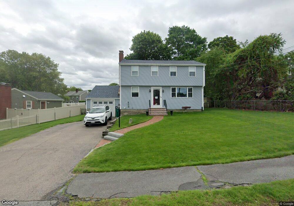
20 Eisenhower Rd Norwood, MA 02062
North Norwood NeighborhoodEstimated Value: $739,000 - $819,000
4
Beds
2
Baths
1,568
Sq Ft
$494/Sq Ft
Est. Value
About This Home
This home is located at 20 Eisenhower Rd, Norwood, MA 02062 and is currently estimated at $774,504, approximately $493 per square foot. 20 Eisenhower Rd is a home located in Norfolk County with nearby schools including Norwood High School, St Catherine Of Siena School, and Norwood Montessori School.
Ownership History
Date
Name
Owned For
Owner Type
Purchase Details
Closed on
Jul 21, 2006
Sold by
Shea James F and Shea Mary E
Bought by
Yoke Gregory J C and Yoke Jacqueline M
Current Estimated Value
Purchase Details
Closed on
Aug 25, 1989
Sold by
Whalen Joanne M
Bought by
Shea James F
Create a Home Valuation Report for This Property
The Home Valuation Report is an in-depth analysis detailing your home's value as well as a comparison with similar homes in the area
Home Values in the Area
Average Home Value in this Area
Purchase History
| Date | Buyer | Sale Price | Title Company |
|---|---|---|---|
| Yoke Gregory J C | $462,000 | -- | |
| Shea James F | $207,500 | -- |
Source: Public Records
Mortgage History
| Date | Status | Borrower | Loan Amount |
|---|---|---|---|
| Open | Shea James F | $297,000 | |
| Closed | Shea James F | $297,000 |
Source: Public Records
Tax History Compared to Growth
Tax History
| Year | Tax Paid | Tax Assessment Tax Assessment Total Assessment is a certain percentage of the fair market value that is determined by local assessors to be the total taxable value of land and additions on the property. | Land | Improvement |
|---|---|---|---|---|
| 2025 | $67 | $634,700 | $310,800 | $323,900 |
| 2024 | $6,469 | $617,900 | $310,800 | $307,100 |
| 2023 | $5,761 | $558,200 | $260,900 | $297,300 |
| 2022 | $5,385 | $500,900 | $237,200 | $263,700 |
| 2021 | $5,244 | $462,400 | $228,500 | $233,900 |
| 2020 | $5,186 | $465,100 | $224,400 | $240,700 |
| 2019 | $4,642 | $426,300 | $215,700 | $210,600 |
| 2018 | $4,781 | $431,100 | $214,700 | $216,400 |
| 2017 | $4,807 | $431,100 | $214,700 | $216,400 |
| 2016 | $4,563 | $410,300 | $214,700 | $195,600 |
| 2015 | $4,634 | $404,000 | $203,700 | $200,300 |
| 2014 | $4,369 | $377,300 | $190,700 | $186,600 |
Source: Public Records
Map
Nearby Homes
- 365 Washington St Unit 4
- 68-70 Adams St
- 301 Neponset St Unit 17
- 301 Neponset St Unit 25
- 42 Myrtle St
- 85 Casey St
- 25 Bird Rd
- 49 Railroad Ave
- 1 Lenox St Unit 312
- 1 Lenox St Unit 115
- 253 Nahatan St Unit 11
- 232-234 Nahatan St
- 227 Prospect St
- 232 Rock St
- 470 Nahatan St
- 135 Cottage St Unit 2
- 66 Crestwood Cir
- 21 Walpole St
- 17 Royal Ct
- 11 Beacon Park Rd
- 22 Eisenhower Rd
- 18 Eisenhower Rd
- 21 Eisenhower Rd
- 17 Eisenhower Rd
- 25 Eisenhower Rd
- 24 Eisenhower Rd
- 14 Eisenhower Rd
- 104 Fales Ave
- 105 Fales Ave
- 13 Eisenhower Rd
- 27 Saint Catherines Rd
- 28 Eisenhower Rd
- 12 Eisenhower Rd
- 23 Saint Catherines Rd
- 153 Hill St
- 101 Fales Ave
- 100 Fales Ave
- 159 Hill St
- 145 Hill St
- 165 Hill St