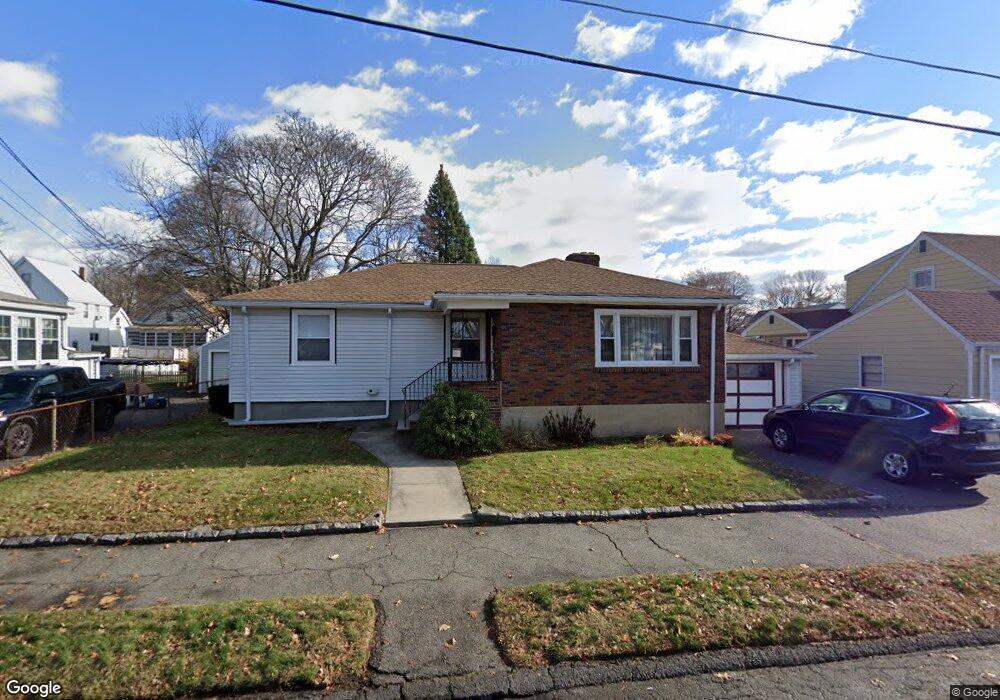
20 Farrell Rd Lynn, MA 01905
Lower Boston Street NeighborhoodEstimated Value: $609,000 - $682,000
3
Beds
2
Baths
1,906
Sq Ft
$338/Sq Ft
Est. Value
About This Home
This home is located at 20 Farrell Rd, Lynn, MA 01905 and is currently estimated at $643,621, approximately $337 per square foot. 20 Farrell Rd is a home located in Essex County with nearby schools including Lincoln-Thomson Elementary School, William R. Fallon School, and Breed Middle School.
Ownership History
Date
Name
Owned For
Owner Type
Purchase Details
Closed on
Dec 13, 2007
Sold by
Camusi J Karen and Nazzaro Marie E
Bought by
Donoghue John P
Current Estimated Value
Home Financials for this Owner
Home Financials are based on the most recent Mortgage that was taken out on this home.
Original Mortgage
$145,000
Interest Rate
6.3%
Mortgage Type
Purchase Money Mortgage
Create a Home Valuation Report for This Property
The Home Valuation Report is an in-depth analysis detailing your home's value as well as a comparison with similar homes in the area
Home Values in the Area
Average Home Value in this Area
Purchase History
| Date | Buyer | Sale Price | Title Company |
|---|---|---|---|
| Donoghue John P | $290,000 | -- |
Source: Public Records
Mortgage History
| Date | Status | Borrower | Loan Amount |
|---|---|---|---|
| Open | Donoghue John P | $142,000 | |
| Closed | Donoghue John P | $145,000 | |
| Closed | Donoghue John P | $25,000 | |
| Closed | Donoghue John P | $145,000 |
Source: Public Records
Tax History
| Year | Tax Paid | Tax Assessment Tax Assessment Total Assessment is a certain percentage of the fair market value that is determined by local assessors to be the total taxable value of land and additions on the property. | Land | Improvement |
|---|---|---|---|---|
| 2025 | $6,580 | $635,100 | $226,900 | $408,200 |
| 2024 | $6,015 | $571,200 | $199,300 | $371,900 |
| 2023 | $5,994 | $537,600 | $205,900 | $331,700 |
| 2022 | $5,419 | $436,000 | $152,400 | $283,600 |
| 2021 | $5,219 | $400,500 | $140,200 | $260,300 |
| 2020 | $5,191 | $387,400 | $134,900 | $252,500 |
| 2019 | $5,161 | $360,900 | $127,000 | $233,900 |
| 2018 | $5,243 | $346,100 | $140,200 | $205,900 |
| 2017 | $4,845 | $310,600 | $116,500 | $194,100 |
| 2016 | $4,647 | $287,200 | $109,100 | $178,100 |
| 2015 | $4,474 | $267,100 | $108,200 | $158,900 |
Source: Public Records
Map
Nearby Homes
- 70 Farrell Rd
- 268 Walnut St
- 28 Wyman St
- 32 Birch Brook Landing Unit 25
- 32 Birch Brook Landing Unit 22
- 32 Birch Brook Rd Unit 13
- 32 Birch Brook Rd Unit 27
- 32 Birch Brook Rd Unit 26
- 32 Birch Brook Rd Unit 16
- 32 Birch Brook Rd Unit 1
- 32 Birch Brook Rd Unit 15
- 32 Birch Brook Rd Unit 14
- 32 Birch Brook Rd Unit 28
- 73 Waterhill St
- 79 Laurel St
- 93 Robinson St
- 50-50A Kirtland St
- 447 Boston St
- 37 Sargents Ct
- 20 Murray St
- 26 Farrell Rd
- 12 Farrell Rd
- 108 Gardiner St
- 104 Gardiner St
- 30 Farrell Rd
- 8 Farrell Rd
- 114 Gardiner St
- 5 Purdon Ave
- 100 Gardiner St
- 118 Gardiner St
- 86 Holyoke St
- 34 Farrell Rd
- 9 Purdon Ave
- 122 Gardiner St
- 76 Holyoke St
- 96 Gardiner St
- 90 Holyoke St
- 72 Holyoke St
- 126-128 Gardiner St
- 126 Gardiner St Unit 128
Your Personal Tour Guide
Ask me questions while you tour the home.