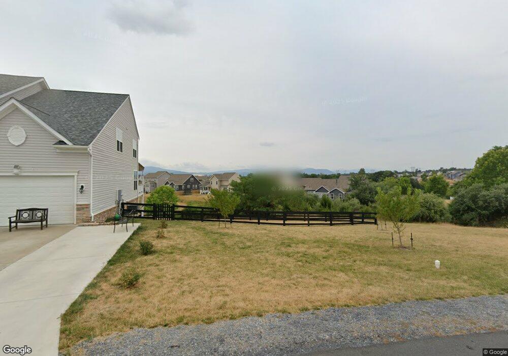
20 Fore Ct Front Royal, VA 22630
Estimated Value: $611,000 - $755,000
3
Beds
2
Baths
3,716
Sq Ft
$177/Sq Ft
Est. Value
About This Home
This home is located at 20 Fore Ct, Front Royal, VA 22630 and is currently estimated at $658,718, approximately $177 per square foot. 20 Fore Ct is a home located in Warren County with nearby schools including Leslie Fox Keyser Elementary School and Warren County High School.
Ownership History
Date
Name
Owned For
Owner Type
Purchase Details
Closed on
Jun 21, 2021
Sold by
Fleet Alan
Bought by
Hyers and Hyers John
Current Estimated Value
Purchase Details
Closed on
Nov 2, 2018
Sold by
D R Horton Inc
Bought by
Hyers John V and Hyers Davina C
Home Financials for this Owner
Home Financials are based on the most recent Mortgage that was taken out on this home.
Original Mortgage
$393,500
Interest Rate
4.6%
Mortgage Type
VA
Create a Home Valuation Report for This Property
The Home Valuation Report is an in-depth analysis detailing your home's value as well as a comparison with similar homes in the area
Home Values in the Area
Average Home Value in this Area
Purchase History
| Date | Buyer | Sale Price | Title Company |
|---|---|---|---|
| Hyers | -- | None Available | |
| Hyers John V | $393,500 | Fidelity National Title Insu |
Source: Public Records
Mortgage History
| Date | Status | Borrower | Loan Amount |
|---|---|---|---|
| Previous Owner | Hyers John V | $393,500 |
Source: Public Records
Tax History
| Year | Tax Paid | Tax Assessment Tax Assessment Total Assessment is a certain percentage of the fair market value that is determined by local assessors to be the total taxable value of land and additions on the property. | Land | Improvement |
|---|---|---|---|---|
| 2025 | $3,189 | $665,700 | $74,000 | $591,700 |
| 2024 | $3,080 | $581,200 | $92,000 | $489,200 |
| 2023 | $2,848 | $581,200 | $92,000 | $489,200 |
| 2022 | $2,904 | $443,300 | $80,000 | $363,300 |
| 2021 | $1,410 | $443,300 | $80,000 | $363,300 |
| 2020 | $2,820 | $430,500 | $80,000 | $350,500 |
| 2019 | $2,820 | $430,500 | $80,000 | $350,500 |
| 2018 | $330 | $50,000 | $50,000 | $0 |
| 2017 | $325 | $50,000 | $50,000 | $0 |
| 2016 | $310 | $50,000 | $50,000 | $0 |
| 2015 | -- | $50,000 | $50,000 | $0 |
| 2014 | -- | $45,000 | $45,000 | $0 |
Source: Public Records
Map
Nearby Homes
- 87 Albatross Ct
- 47 Hickory Shaft Ct
- 11 Driver Square
- 171 Hospitality Dr
- 0 Hospitality Unit VAWR2013410
- 49 Oldt Dr
- 8+/- Acres Winchester Rd
- 92 Oak Hill Ct
- 167 Cedar Park Ct
- Lot 3 Springwood Ln
- 386 Ashby Station Rd
- 43 Little Sorrel Dr
- 76 Katie Ln
- 0 Pin Oak Rd Unit VAWR2006146
- Lot 19 River Bluff Dr
- 529 Cherrywood Rd
- 0 River Ridge Dr Unit VAWR2012826
- 0 River Ridge Dr Unit VAWR2011208
- 2723 Fairground Rd
- 3684 Rockland Rd
- 20 Fairway Ct
- 0 Fore Ct Unit WR10062832
- 0 Fore Ct Unit WR10062816
- 0 Fore Ct Unit WR10062797
- 0 Fore Ct Unit 1001002377
- 0 Fore Ct Unit 1001002359
- 0 Fore Ct Unit 1001002343
- 40 Fore Ct
- 17 Fore Ct
- 42 Fore Ct
- 15 Albatross Ct
- 19 Flagstick Ct
- 37 Fore Ct
- 44 Fore Ct
- 33 Albatross Ct
- 41 Fore Ct
- 10 Bogey Ct
- 51 Albatross Ct
- 28 Bogey Ct
- 37 Putter Ct
Your Personal Tour Guide
Ask me questions while you tour the home.