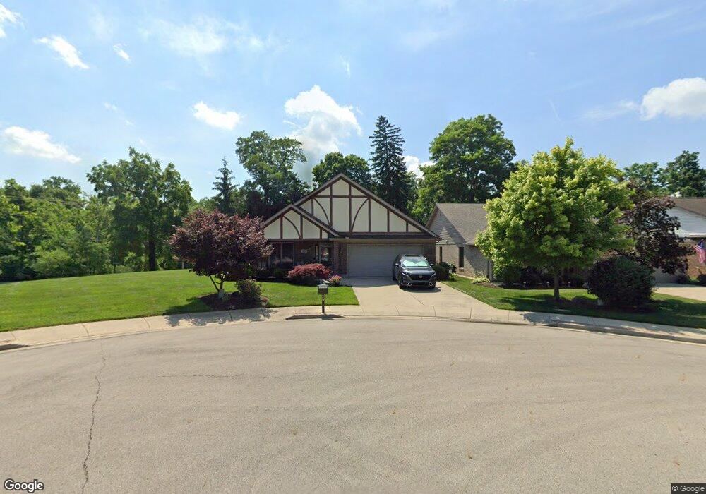
20 Frances Ln Vandalia, OH 45377
Estimated Value: $291,000 - $344,000
3
Beds
2
Baths
1,845
Sq Ft
$172/Sq Ft
Est. Value
About This Home
This home is located at 20 Frances Ln, Vandalia, OH 45377 and is currently estimated at $317,562, approximately $172 per square foot. 20 Frances Ln is a home located in Montgomery County with nearby schools including Helke Elementary School, Morton Middle School, and Butler High School.
Ownership History
Date
Name
Owned For
Owner Type
Purchase Details
Closed on
Aug 12, 2010
Sold by
Waters Linda M
Bought by
Rode Sharon Lee
Current Estimated Value
Purchase Details
Closed on
Jan 10, 2006
Sold by
Vogel Shirley A
Bought by
Vogel Shirley A and Shirley A Vogel Living Trust
Purchase Details
Closed on
Feb 23, 2005
Sold by
Juniper Development Group Ltd
Bought by
Vogel Shirley A
Create a Home Valuation Report for This Property
The Home Valuation Report is an in-depth analysis detailing your home's value as well as a comparison with similar homes in the area
Home Values in the Area
Average Home Value in this Area
Purchase History
| Date | Buyer | Sale Price | Title Company |
|---|---|---|---|
| Rode Sharon Lee | $170,000 | Attorney | |
| Vogel Shirley A | -- | None Available | |
| Vogel Shirley A | $47,500 | Chicago Title Insurance Co |
Source: Public Records
Tax History Compared to Growth
Tax History
| Year | Tax Paid | Tax Assessment Tax Assessment Total Assessment is a certain percentage of the fair market value that is determined by local assessors to be the total taxable value of land and additions on the property. | Land | Improvement |
|---|---|---|---|---|
| 2024 | $4,575 | $96,950 | $18,900 | $78,050 |
| 2023 | $4,575 | $96,950 | $18,900 | $78,050 |
| 2022 | $4,066 | $71,820 | $14,000 | $57,820 |
| 2021 | $4,069 | $71,820 | $14,000 | $57,820 |
| 2020 | $4,060 | $71,820 | $14,000 | $57,820 |
| 2019 | $3,928 | $55,970 | $12,600 | $43,370 |
| 2018 | $3,936 | $55,970 | $12,600 | $43,370 |
| 2017 | $3,885 | $55,970 | $12,600 | $43,370 |
| 2016 | $3,842 | $54,400 | $14,000 | $40,400 |
| 2015 | $3,794 | $54,400 | $14,000 | $40,400 |
| 2014 | $3,794 | $54,400 | $14,000 | $40,400 |
| 2012 | -- | $49,860 | $16,800 | $33,060 |
Source: Public Records
Map
Nearby Homes
- 246 Crest Hill Ave
- 1052 Forest Crest Place
- 612 Bennert Dr
- 416 Attica St
- 461 Poplar Grove Dr
- 1441 S Dixie Dr
- 416 Bent Twig Dr
- 469 Farrell Rd
- 696 W Alkaline Springs Rd
- 108 Tionda Dr S
- 485 Pilot Point Unit 1-301
- 521 Rader Dr
- 1054 Wilhelmina Dr
- 32 Gabriel St
- 545 Koch Ave
- 465 Pilot Point Unit 1-302
- 1515 Ash Ridge Ct
- 626 W National Rd
- 475 Pilot Point Unit 1-300
- 552 Tionda Dr N